All collections

Every collection on Reveal.World, grouped by the language it is written in.

India. Delhi: Old City

India. Delhi: Old City

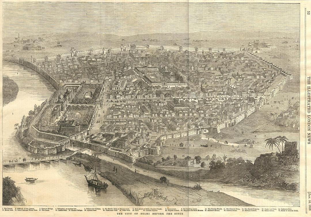
Old Delhi (in Hindustani: Purani Dilli) is a district in the central district of Delhi, India. Delhi was founded as a walled city and officially named Shahjahanabad in 1648, when Shah Jahan decided to move the Mughal capital from Agra. The construction of the city was completed in 1648, and it remained the capital of Mughal India until its fall in 1857, when the British Empire gained dominance over the Indian subcontinent. The old city is the epicenter of the kind of hell that a large Indian city can seem like — chaos, crowds, filth, stench, shabby modern brick-concrete shacks mixed with beautiful dilapidated old havelis and temples — the full set of specific Indian urban impressions. But it is precisely in this area that the main attractions of Delhi are located — the Red Fort, the citadel of the capital of the Empire of the Great Mughals and a national symbol of the country, and Jama Masjid — the largest and most famous mosque in all of India. This district serves as the symbolic heart of metropolitan Delhi and is known for its bazaars, street food, shops, and Islamic architecture, the most outstanding example of which is Jama Masjid, towering in the center of the old city. Only a few havelis have been preserved and maintained. Delhi was founded as a walled city and officially named Shahjahanabad in 1648, when Shah Jahan decided to move the Mughal capital from Agra. The construction of the city was completed in 1648, and it remained the capital of Mughal India until its fall in 1857, when the British Empire gained dominance over the Indian subcontinent.
India: Delhi: Qutb Minar Complex (Qutb Minar) and its Monuments

India: Delhi: Qutb Minar Complex (Qutb Minar) and its Monuments

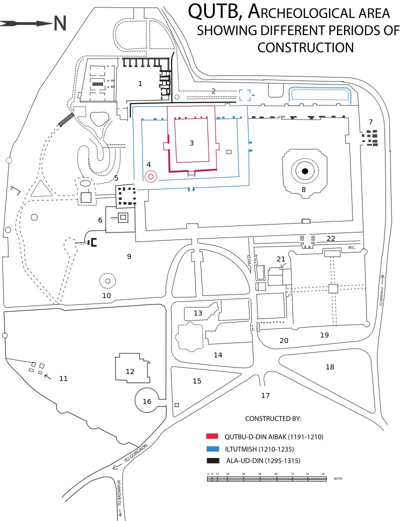
In 1192, during the reign of Ghyath al-Din Muhammad (1163–1203), construction began in Delhi on a mosque named "Quwwat al-Islam" ("The Might of Islam"). The mosque is enormous in size: 250 by 150 meters, with a total area (including auxiliary buildings) of 4 hectares. The building of the now-ruined mosque resembles the columned mosques of Syria and Andalusia. However, this similarity arose by chance: the craftsmen did not master the technique of laying arches and vaults from wedge-shaped bricks. They constructed flat ceilings supported by corbels and columns. These columns were taken from 27 destroyed Hindu temples and decorated with carved figures. Typically, a column in an Indian mosque has a square base, but then the craftsman shapes it into a round or faceted section and then returns to the square form. The red sandstone used by Indian craftsmen is easy to work with, so the carving usually covers all surfaces made from this stone. Only the facade wall and fragments of the prayer hall with columns have survived. But even in its ruined state, the mosque vividly recalls the times when it was the most outstanding structure of Muslim India. Its facade wall is among the finest examples of mosque decoration — its forms are executed with noble simplicity and elegance. Ornamental carving, done with great skill, covers the entire surface of the facade from top to bottom. In this carving, the combination of stripes of traditional Indian floral ornamentation with inscriptions in Arabic calligraphy is very interesting, creating a contrasting yet harmonious decorative effect. Besides the usual purpose of calling people to prayer, the minaret of Quwwat al-Islam was used as a victory tower to demonstrate the power of Islam, as well as a watchtower to oversee the surroundings for the city's protection. Among historians, there is also an opinion that the minaret was named after the first Turkish sultan Qutb-ud-din Aibak, or, according to another hypothesis, after the saint from Baghdad Khwaja Qutb-ud-din Bakhtiyar Kaki, who migrated to India and was highly respected by Akbar. Qutb-ud-din Aibak (1206–1219) built the unusual minaret Qutb Minar from red sandstone. It appears that the minaret is composed of numerous conical sections, which are linked like rings by openwork balconies supported by stalactite brackets. Later, a mausoleum of Sultan Shams-ud-din Iltutmish was added to the mosque. The Quwwat al-Islam mosque complex also includes the world-famous Iron Pillar, dating back to the early centuries AD. It is one of the most mysterious monuments of Indian culture. The Alai Minar minaret was started by Alauddin Khilji, who intended to make it twice as tall as the Qutb Minar. However, construction was halted when the structure reached 24.5 meters, and only one tier was built after Alauddin's death. The first tier of the building has survived to this day. The Quwwat al-Islam mosque became something like a "museum of trophies" of Indian architecture, taken by Muslim conquerors from ancient Indian temples. Here one can see, for example, columns with relief decorations taken from some destroyed Hindu structures. At the same time, it creates the impression that the champions of Islam who led the mosque's construction were not at all embarrassed by the fact that characteristic Hindu motifs appeared in a Muslim temple, which sharply contradicted the main principles of Muslim religious art, known to forbid depicting humans and animals, especially in buildings of a cult nature.
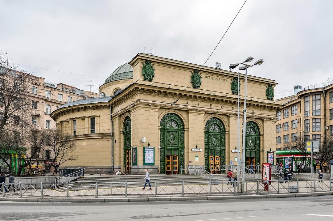
Petersburg: Metro, History, and Interesting Facts

Petersburg: Metro, History, and Interesting Facts

The idea of creating an urban underground railway — a metro — in the northern capital of the Russian Empire, Saint Petersburg, has a long history dating back to the 19th century. As early as 1820, engineer Torgovanov appealed through Count Miloradovich to Alexander I with a project to build a tunnel under the Neva River. The proposal received the resolution: "Issue Torgovanov 200 rubles from the office and oblige him by signature not to engage in projects henceforth, but to practice the trades appropriate to him." Similar ideas were also unsuccessfully proposed by the famous self-taught inventor Kulibin. Due to circumstances, the projects of the famous "father of tunnel construction," the English engineer of French origin Marc Isambard Brunel, also remained unrealized in Saint Petersburg at that time. In 1889, the Board of the Baltic Railway put forward the first project for an intracity line between the Baltic and Finland stations. This marked the beginning of numerous proposals and developments — a kind of forerunners of the Saint Petersburg metro — which were submitted almost annually from the late 1890s by various organizations and private individuals. In most early projects, the urban railway was primarily intended to connect all the stations with a single line and to relieve traffic on Nevsky Prospect — the main thoroughfare of the Russian capital. However, the struggle of various often conflicting interests during the discussion of all these projects in numerous agencies, and the need for large financial expenditures to implement them, proved to be insurmountable obstacles to the realization of the Saint Petersburg metro idea at that time. The return to this idea occurred only in the 1930s, in a completely different historical era. The same fate befell the first metro projects in Moscow at the beginning of the century. Construction of the Saint Petersburg metro began only in 1941, but during the war, metro construction forces were redirected to building warehouses and railway branches in besieged Leningrad. Metro construction resumed only in 1947. Eight years later, the first section of the metro from "Ploshchad Vosstaniya" to "Avtovo" was opened, and now the Saint Petersburg metro has 5 lines and 72 stations. On average, stations of the Saint Petersburg metro are located at a depth of 57 meters underground, with the deepest being "Admiralteyskaya" at 86 meters. This is due to the city being built on shifting water-saturated soils, and for a long time, there were no technologies that allowed construction in such conditions. Therefore, stations were laid at depths where dense sedimentary rock — Cambrian clay — lies. It resists moisture excellently, which is why it is used for building foundations on land with a high groundwater level, and is also added to masonry and plaster mixes. In the early years, workers used jackhammers and shovels manually, like in mines. Only in 1949 did Leningrad builders get their first tunneling shield: it bites into the rock with a rotating cutter, after which the rock is removed onto a conveyor and taken out of the tunnel. However, to get the shield and workers underground, a shaft or "vertical well" must first be built. To do this, it is necessary to freeze the "quick sands" — sands saturated with groundwater. Neither machines nor people can work with them. This is done as follows: boreholes are drilled around the perimeter of the shaft down to the Cambrian clays, plastic pipes are inserted, and water with salts is poured in. Then surface installations circulate this cold water in a loop, like a freezer, and within two months the soil freezes. Excavators and jackhammers cut the soil by one meter. After that, a reinforced concrete ring is assembled around the shaft perimeter, and the gap between it and the soil is filled with compacting and waterproofing solutions. Then the process repeats: soil excavation, ring installation, and injection. Only when the required depth is reached is the shield assembled in a special room or "chamber," which will start tunneling. Among all Russian metros, only the Saint Petersburg metro has closed stations. For example, "Gostiny Dvor" or "Petrogradskaya." Their halls are separated from the tracks by walls with doors that open only after the train arrives. Because of this design, they are often called "horizontal elevators." The reason for the appearance of closed stations is more prosaic — they were cheaper to build due to simpler technology. The construction did not require complex reassembly of the tunneling shield, and the tunnels hidden from view did not need expensive finishing. In practice, however, all the savings were "eaten up" by maintenance: the electric motors of the doors, which open and close hundreds of times a day, consume a lot of electricity, and they also need repairs and salaries for repair workers. This has been the case since 1961, when the first closed station, "Park Pobedy," was built. Moreover, "horizontal elevators" have very low throughput capacity. Nikita Khrushchev, the main fighter against Stalin's cult of personality, came to power in the year of the "father of nations'" death — 1953, while the first section of the Leningrad metro was launched in 1955. After the change of leaders, the architects of the "Avtovo" station managed to adjust the project to the new reality. Thus, instead of the inscription "Glory to Great Stalin" on the ceiling of the ticket hall, another appeared — "To the valiant defenders of Leningrad, who defended the hero city in battles." According to legend, another station of the first metro section — "Narvskaya" — was supposed to be called "Stalinskaya." However, metro history experts say that this name does not appear on any drawings. The names "Ploshchad Stachek" or "Narvskie Vorota" were used, without mentioning Stalin. Originally, the main decoration of the station was a mosaic "Stalin on the Tribune," but as part of the fight against the cult of personality in 1961, the panel was removed. According to one version, it was covered with a marble false wall without removal. According to another, it was dismantled and taken away. In any case, today it is unknown whether the mosaic has survived. The platform hall of "Narvskaya" is decorated with 48 relief images of people of various professions. There is an opinion that in the relief "Glory to Labor!" in the center, Stalin was also supposed to stand, but instead, a man with a flag appeared. Perhaps this is why the surrounding crowd looks at the ordinary worker with special enthusiasm. In 1974, a washout occurred on the section between the "Lesnaya" and "Ploshchad Muzhestva" stations — an exploratory borehole was drilled into the lower tunnel, and water flooded in. Workers barely managed to close the shutter to save themselves. As a result, a kilometer of tunnels was flooded, and sinkholes appeared on the surface, causing buildings to crack. The accident repeated in 1994 when water with sand washed away metal and concrete. To avoid such surprises, the "Admiralteyskaya" station was decided to be built as deep as possible. It appeared on drawings back in the 1950s, but due to very complex soil, proximity to the Neva, and abundant historic buildings on the surface, its construction was very difficult. It was laid only in 1997, but until its opening in 2011, it was a "ghost station," which trains passed without stopping, and passengers saw only a dimly lit hall. Construction was prolonged also because building materials for the station were delivered by train at night or brought from the shaft located at the corner of Zagorodny Prospect and Gorokhovaya Street. Builders had to travel two kilometers back and forth along a service narrow-gauge railway. In the winter of 1994-1995, the situation on the "Lesnaya" — "Ploshchad Muzhestva" section worsened again. During the summer and autumn of 1995, thanks to constant work, the situation was still kept under control, but by December it sharply deteriorated. On December 1, the last trains passed through the section. After that, both tunnels were filled with pressurized tap water to prevent subsidence of the earth's surface in the area of Ploshchad Muzhestva and destruction of nearby buildings; hermetic seals were welded, and two concrete plugs were constructed on both sides, plus one in the approach tunnel. In this form, the section ceased to exist. Restoring the section took a long 9 years, hindered by lack of funding and empty promises from authorities at all levels. "Lenmetrogiprotrans" proposed a design solution to build bypass tunnels located several hundred meters away from the existing route and a couple of dozen meters higher. Eliminating the consequences of the "Washout" accident cost the city a lot of money and time, seriously affecting the pace of construction of new metro sections and ultimately contributing to the overall lag in the development of the northern capital's transport infrastructure, which is keenly felt to this day. On June 10, 1999, the outer concrete canopy of the vestibule of the "Sennaya Ploshchad" station collapsed. Seven people died in the tragedy. This is the only accident in the history of the Saint Petersburg metro that resulted in human casualties. Immediately after the accident, the canopies of vestibules of other stations built in those years were either reinforced or dismantled. Today, the Saint Petersburg metro is the second largest and busiest metro in Russia, the fourth in Europe (after Moscow, Paris, and London), and the nineteenth in the world. By length of operated lines, it ranks 41st in the world and 8th in Europe (after the metros of Moscow, London, Madrid, Paris, Berlin, Valencia, and Barcelona). Sources: https://metro.spb.ru/historymetro.html https://ru.wikipedia.org/wiki/Петербургский_метрополитен

Serbia: Fortresses and Castles, a Crossroads of Empires and Religions

Serbia: Fortresses and Castles, a Crossroads of Empires and Religions

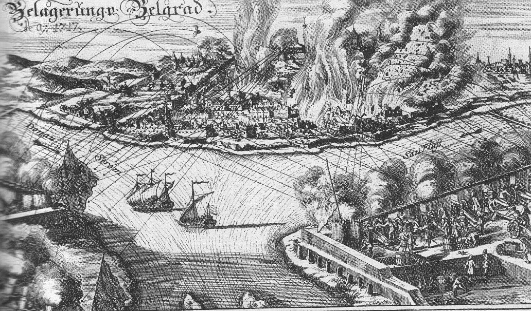
On the territory of modern Serbia lie the ruins of fortresses built in strategically important locations — near rivers, trade routes, and the borders of former empires. Constructed to protect cities, estates, or monasteries, they played a significant role in the military strategies of medieval rulers. Some of the fortresses served exclusively defensive purposes: here you can explore ancient military camps, arsenals, and barracks. Inside others, entire towns grew: houses, schools, and shops, as well as churches and mosques. The ruins of some of them have been preserved to this day. One of the oldest fortresses in Serbia is Stari Ras, listed as a UNESCO World Heritage site along with the nearby monasteries of Sopoćani and Đurđevi Stupovi, as well as the Church of the Holy Apostles Peter and Paul (Petrova Church). Serbian fortresses allow you to connect with the turbulent history of these lands and transport visitors back to the Middle Ages — a time when powerful rulers, brave knights lived here, and major battles took place.

World: Synagogues - Spiritual Centers of the Jewish World

World: Synagogues - Spiritual Centers of the Jewish World

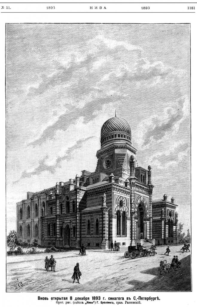
Defining the role of the synagogue in Jewish life, the president of the Federation of Jewish Communities of Russia, Alexander Boroda, noted: “The synagogue is not a temple. In Hebrew, it is called *beit knesset* — ‘house of assembly’ — a place where people can come not only for prayer. Many visit the synagogue simply to be there, to feel their connection to Judaism. Its architecture should not reflect any ideological messages: neither grandeur nor, conversely, asceticism, but the style of both the exterior and interior reflects the era and geographical location. The goal is to make the synagogue functional and cozy, like a home, to give people motivation to spend much more time there than is required for prayer.”

World: Hotels Where Great Films Were Shot and Where You Can Stay

World: Hotels Where Great Films Were Shot and Where You Can Stay

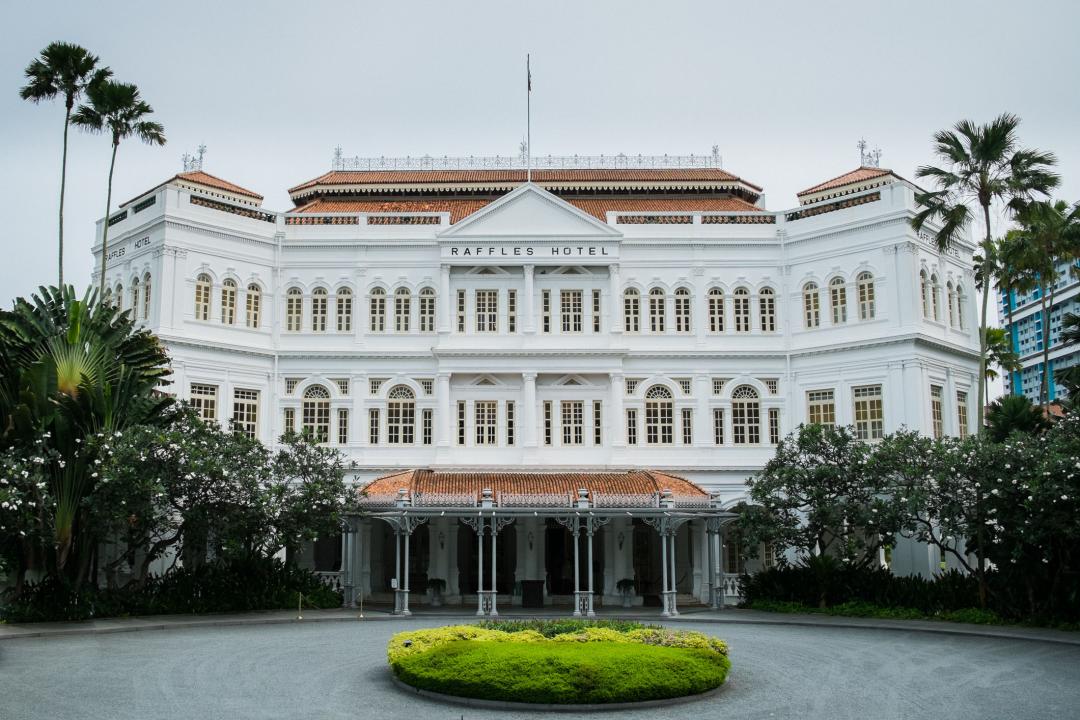
Each of us who has ever immersed ourselves in the world of thrilling cinema would love to visit the places where the gripping or romantic scenes featuring our favorite characters were filmed. Visit and enjoy an unforgettable stay at the famous hotels where unforgettable scenes from popular movies, familiar to many since childhood, were shot.

World: Hotels where great writers lived and great books were written, and where you can stay today

World: Hotels where great writers lived and great books were written, and where you can stay today

Traveling through countries, many do not realize that once famous writers walked these very streets. Saint Petersburg, London, Venice, Paris, Istanbul – in these and many other cities, renowned writers found their inspiration and stayed in hotels. These hotels have not only preserved the charm of the place but also attract visitors with the opportunity to connect with and get closer to any authors and books. Would you like to stay in Dostoevsky’s room and look out the window through which he watched passersby while working on his book? To go to Cuba to Hemingway’s favorite hotel? Or to rent a room in a cheap Moroccan hotel where Burroughs lived?
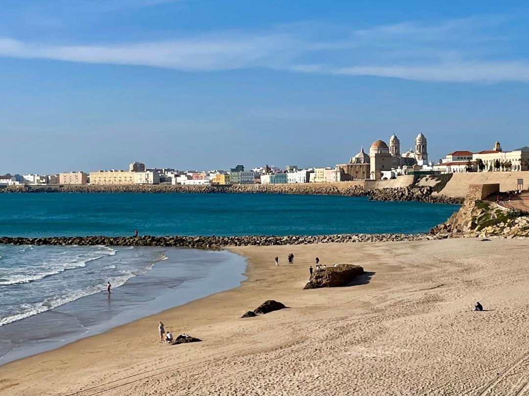
Hidden Gems of Cadiz

Hidden Gems of Cadiz

Explore some of the hidden gems of Cadiz, a town with many amazing sites if you know where to look!
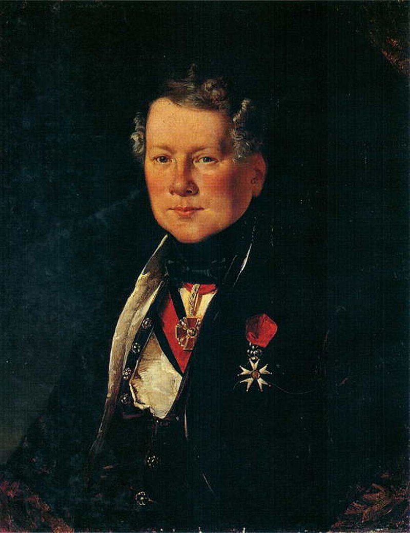
Great Architects: Auguste Montferrand

Great Architects: Auguste Montferrand

Henri Louis Auguste Ricard de Montferrand (born in French as Henri Louis Auguste Ricard de Montferrand), also known in Russia as August Augustovich Monferran and August (Augustin) Antonovich Monferran, was born on January 23, 1786, in Chaillot near Paris, and died on June 28, 1858, in Saint Petersburg. He was a French and Russian architect and engineer. He received his education at the Royal Special School of Architecture in Paris. He honed his professional skills in the workshops of architects Percier and Fontaine. From 1814 to 1816, he worked under the direction of the General Inspector of Paris for construction and architecture, Molino; he participated in the construction of the La Madeleine church in Paris (project by architect Vignon). During Emperor Alexander I’s stay in Paris in 1814, he presented him with an album of his projects and drawings and received an invitation to come to Russia, where he arrived in 1816. At that time, he was appointed court architect. From 1817 to 1826, he was head of the Drawing Committee for Building and Hydraulic Works, the main architectural authority at that time. Since 1826, he was a member of the Committee for the review of the project and works on the construction of the Cathedral of Christ the Savior in Moscow. Montferran’s work lies on the border of two architectural eras: being the leading architect of late classicism, he was one of the first to turn to eclecticism. He developed the project for the Empire-style building of the Manege (exercising hall, 1817) in Moscow, executed for Betancourt. From 1817 to 1822, he created an ensemble of administrative buildings, shopping rows, and a cathedral for the fair in Nizhny Novgorod; all buildings were designed in the traditions of classicism, except for the “Chinese Rows,” where Eastern motifs were used. Auguste Montferran (together with engineer Betancourt) built the Transfiguration Cathedral of the Old Fair in Nizhny Novgorod (1818–22). All of Montferran’s most significant projects were realized in Saint Petersburg. In his first building (the house of Lobanov-Rostovsky, 1817–20), Montferran showed himself as a talented urban planner, fitting the strict classical facades of the building into a complex development site shaped like a triangle. The first features of stylization “in Gothic style” and Eastern motifs appeared in 1823 in the project of pavilions for the Ekateringof Park near Petersburg (1820s; unfortunately, they have not survived). Later, elements of historical styles and free planning of volumes were skillfully applied by Montferran in projects of private houses (Demidov’s and Princess Gagarina’s on Bolshaya Morskaya Street). The perfectly proportioned and silhouetted Alexander Column completed the ensemble of Palace Square; the installation of the huge granite monolith of the column became possible thanks to calculations prepared by Montferran and unique technical devices for that time. Montferran’s most significant work is the St. Isaac’s Cathedral, where he applied the latest technologies, including the use of metal structures alongside traditional stone and brick masonry. While working on the project, Montferran relied on the best examples of the past: in 1842, he traveled through Western Europe to study the structures of dome buildings of the largest cathedrals. As a result, he created an original dome consisting of three shells, assembled entirely from cast-iron elements for the first time. Montferran was also a master of interior decoration, including work in the Winter Palace (decor of the Rotunda, Peter and Field Marshal’s ceremonial halls; he remodeled the layout and decoration of the private chambers of Empresses Maria Feodorovna and Alexandra Feodorovna). He was an honorary free associate of the St. Petersburg Academy of Arts, as well as an honorary member of the Academy of St. Luke in Rome, the Academy of Arts in Florence, and the Royal Institute of British Architects in London.

Treasures of Tarifa

Treasures of Tarifa

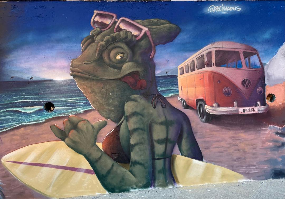
Define Tarifa? The southernmost point of continental Europe, the place where the Atlantic and the Mediterranean meet, and the primary kitesurfers’ destinations due to its famous winds. But Tarfifa is so much more than that! Wonder the narrow white-washed streets that hint at Morocco (the latter being clearly visible on the horizon), dive into its laid-back bohemian atmosphere, and check-out these spots to reveal the history, enjoy the views, and take fabulous Instagram pictures.

Walls that Speak: Estepona's Mural Magic

Walls that Speak: Estepona's Mural Magic

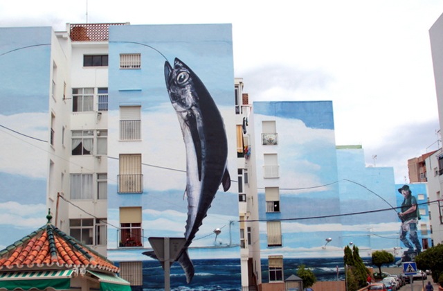
A diverse array of contributors, from renowned global artists to imaginative prison inmates, has embellished Estepona's outdoor art gallery with over 50 murals, transforming mundane concrete structures throughout the town. This collection will guide you through the most impressive ones in the town centre. Full collection can be found here: https://visitestepona.eu/wp-content/uploads/2019/12/Ruta-Murales-d%C3%ADptico-2019-web.pdf

Amazing Estepona

Amazing Estepona

Amazing spots and dazzling murals - sights worth checking when in Estepona.
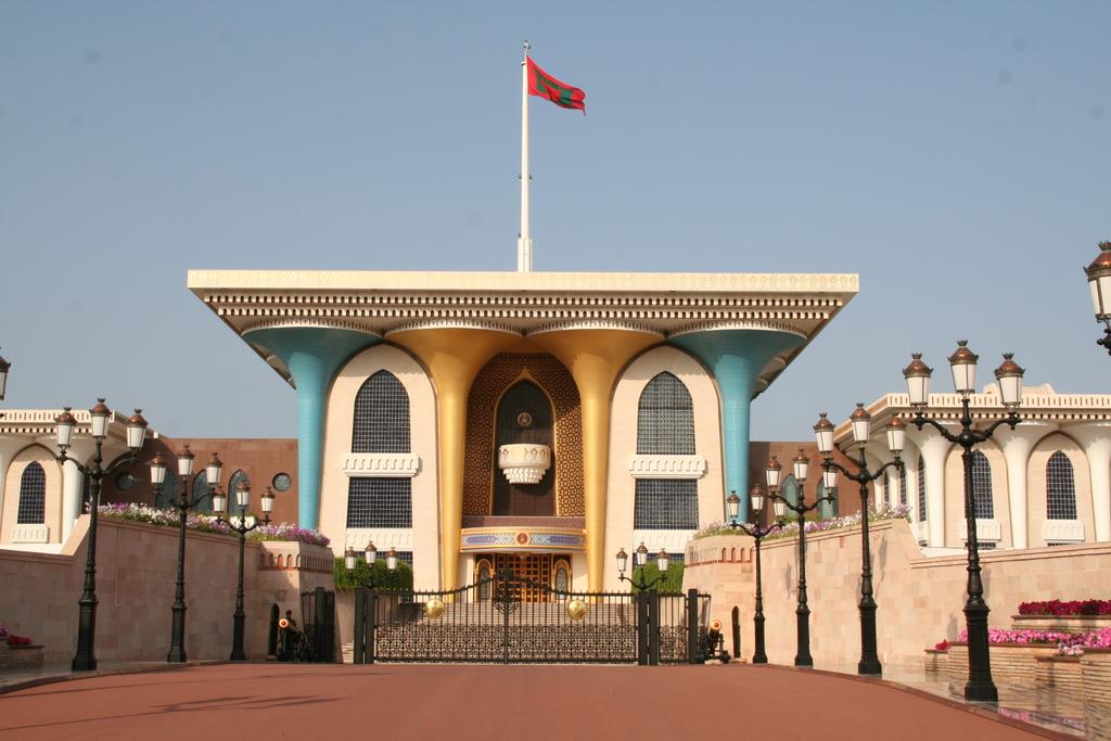
Oman: Mysteries, Stories, and Interesting Places

Oman: Mysteries, Stories, and Interesting Places

Oman is one of the most beautiful countries in the Persian Gulf. It is distinguished by very picturesque and diverse nature. Here you can see high mountains, roaring waterfalls, savannas, tropics, and even fjords. But Oman can amaze you not only with its amazing nature. In this extraordinary country, the originality of the Arab people has been preserved: it is the only country in the Middle East that has not succumbed to the influence of modern civilization and has maintained a high standard of living. People interested in the culture and customs of other peoples will find it very interesting here because the country has a huge historical and cultural heritage. However, young and energetic people craving entertainment, new emotions, and adventures may not like it very much, as there are only a few nightclubs in the country, and entertainment options are also scarce.
World: Lost Cities

World: Lost Cities

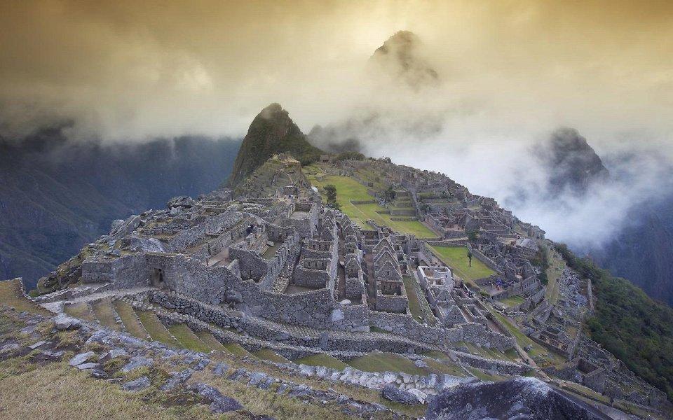
No one knows exactly how many lost cities exist on our planet. But those that archaeologists manage to discover invariably arouse great interest, both among specialist historians and ordinary enthusiasts of the unusual. They lure researchers, attract adventurers and tourists. Anyone can feel like Indiana Jones. Choose a lost city to your liking and go explore it. The most impressive lost but rediscovered cities are easily accessible. There is no need to hack your way through the jungle, hide from warlike natives, conquer mountain passes, or cross raging rivers as the brave pioneers once did.

Oman: The Land of Fortresses

Oman: The Land of Fortresses

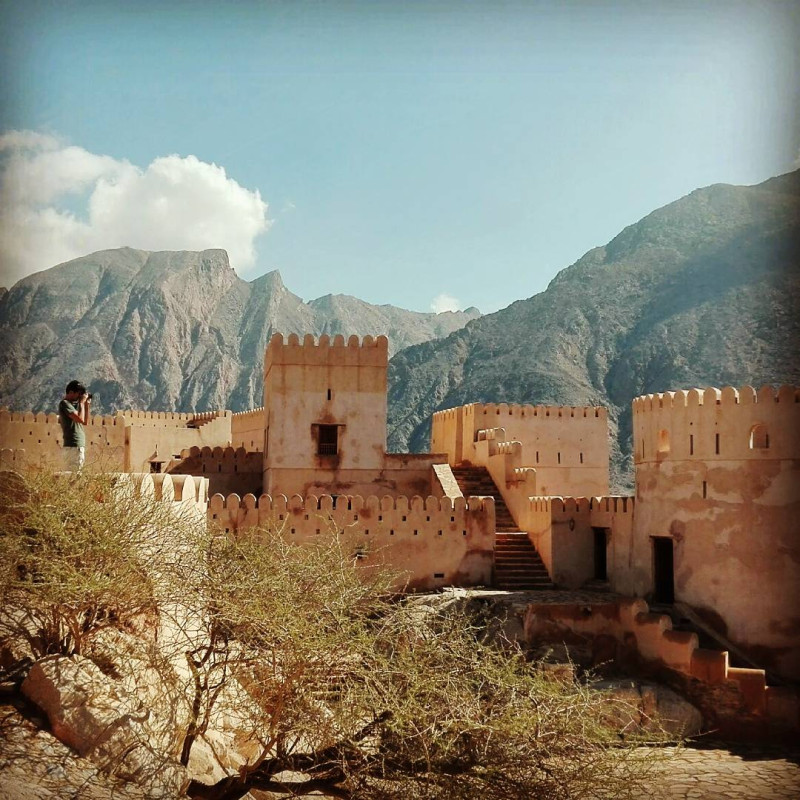
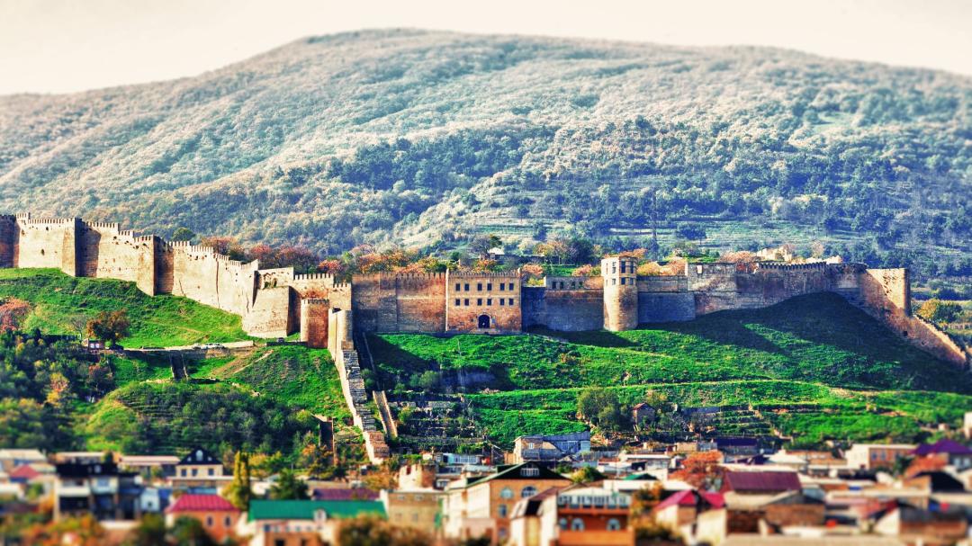
Forts and castles can be found here on the coast, in the mountains, and in the desert — practically in every region of the country. Some of them were built during the times when Oman was controlled by Portugal, others during the reign of the sultans. Each fortress has its own story, which in turn forms the history of the entire country. They rise above the land like guardians of time, carrying on their stone walls the stories of centuries. Like incredible witnesses of antiquity, they protected the mysterious intertwining of culture, trade, and defense, composing a mosaic picture of the richness of this beautiful country. At the center of this magical tale stands Nizwa Fortress, a guardian at the crossroads of time. Its stone towers and walls reaching to the sky seem indestructible, and every stone, every crack, carried the vibrations of past eras. Here, amidst the aroma of spices and the noise of bazaars, every stone told its own story. Surrounded by the endless desert, Nakhal Fort rose on a hill like an unbreakable castle amid a golden sea of sand dunes. Its dark walls held the secrets of wars and trade, and from its summit opened panoramic views of the beauty of the Omani landscape. Bahla Fort, the crown of architectural art, amazes with its grandeur. Preserved through time, this fortress was a stone witness to power and luxury, embodying the creative spirit of Omani builders. In the capital, Muscat, the majestic Mirani Fort, overlooking the endless waves of the Arabian Sea, became a symbol of maritime adventures and protection. Its walls told of ancient battles, the greatness of naval fleets, and how they met the winds and waves. All these fortresses, like wise guardians of the ages, speak of time, honor, and wealth. Their walls, imbued with the scent of history, keep the secrets of ancient civilizations, trade routes, and military strategies. Each stone tower is part of a story where people, merchants, and warriors met, building their lives on this land, defending and developing it. The forts of Oman are not just stone walls and towers. They are living witnesses of a great history, embodying the creativity and craftsmanship of Omani builders, the continuity of generations, and the unyielding will of this remarkable country to be the guardian of its heritage.
Rostov-on-Don: History and Interesting Places

Rostov-on-Don: History and Interesting Places

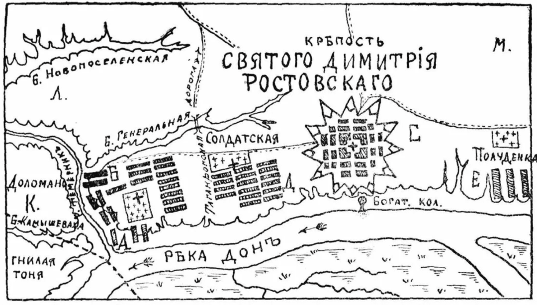
In its nearly three-hundred-year history, Rostov-on-Don has served as a customs post, a border fortress, and the criminal "Rostov Papa." The city of Rostov-on-Don officially received its status in 1807, but its history began half a century earlier. In 1749, by order of Empress Elizabeth Petrovna, the Temernitskaya customs post was established at the confluence of the Don and Temernik rivers — the first trading port in southern Russia. Its advantageous location allowed for the establishment of trade with countries bordering the Black, Aegean, and Mediterranean Seas. Subsequently, active trade contributed to the rapid development of Rostov-on-Don and its entire infrastructure. In 1761, the customs post was replaced by the fortress of Saint Dimitry of Rostov, built to defend against attacks by Turks and Crimean Tatars. However, the garrison here never had to defend itself. By the end of the 18th century, the Rostov fortress was dismantled as it was no longer needed. Nevertheless, several settlements had formed around its walls. At the beginning of the 19th century, all of these were united by a decree of Emperor Alexander I into Rostov-on-Don. In the 1830s, a customs office opened in the city, and in the 1870s it became a major railway hub thanks to the construction of a station. By the 20th century, the rapidly developing Rostov-on-Don had over a hundred industrial enterprises, thriving foreign trade, and a population exceeding 100,000 people. The city had such outstanding characteristics that it eventually became one of the strategic targets for Nazi Germany. During the Great Patriotic War, it became a battlefield several times and was occupied twice. It was here in 1941 that Soviet troops dealt the German invaders their first major defeat. After the war, Rostov-on-Don, almost reduced to ruins, was rebuilt. Today, it is one of Russia’s million-plus cities and holds the record for the largest population in the south of the country (over 1,100,000 people).
Petersburg: The Hunt for Owls in Architectural Decor

Petersburg: The Hunt for Owls in Architectural Decor

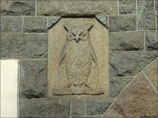
In the decorations of facades, entrances, and roofs of St. Petersburg houses, one can find a large number of owls. Owls are considered symbols of wisdom. They protect the home from evil and bring good luck to the residents, so it is not surprising that these birds appeared as decor on St. Petersburg houses alongside lions, flowers, and other representatives of the animal and plant world. Finding them is no easy task, so we invite you on an exciting owl-hunting walk.
Petersburg: Stories of Kamennoostrovsky Prospect

Petersburg: Stories of Kamennoostrovsky Prospect

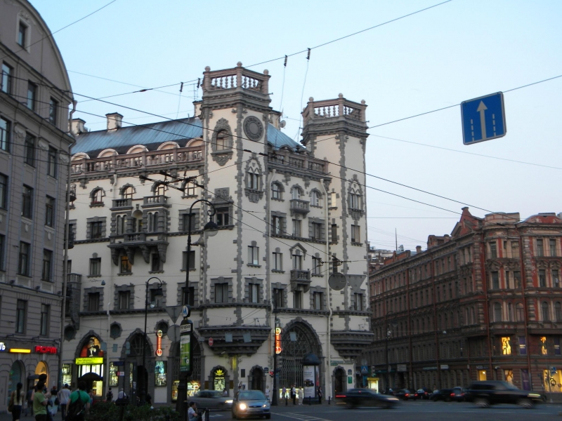
Kamennoostrovsky Prospect is rightfully called one of the most interesting and beautiful avenues of Saint Petersburg. It crosses the Petrograd side of the Northern capital, starting from the Trinity Bridge over the Neva and ending on Kamenny Island before the Ushakovsky Bridge. Its length is 3 kilometers and 400 meters, with a width of only 20 meters. The prospect was formed in several stages, beginning in 1712, when a road was laid from the Arsenal Yard built in the area of today's Mira Street to Trinity Square, which soon received the name Bolshaya Ruzheynaya (Great Armory Street). The "Road to Kamenny Island" was the name of the path from today's Lev Tolstoy Square to one of the Neva's branches – the Malaya Nevka. At the beginning of the 19th century, this section was named "Kamennoostrovsky Prospect." From the middle of the same century, it was extended to the Bolshaya Nevka. “Kamennoostrovsky Prospect is one of the lightest and most carefree streets of Petersburg. Don’t turn right or left: there’s nonsense there, a tramless wilderness. Trams on Kamennoostrovsky develop unheard-of speed. Kamennoostrovsky is a frivolous handsome man, starching his only two stone shirts, and the sea wind whistles in his tram head. He is a young and unemployed lad, carrying his houses under his arm like a poor dandy with his laundry’s airy package.” — wrote Osip Mandelstam in "Egyptian Stamp." In 1903, the prospect was finally extended through Alexandrovsky Park to the then newly built Trinity Bridge, and at the same time began to be developed in a modern European style, which attracted wealthy and well-known residents of the Northern capital. The entire route from the bridge to the Bolshaya Nevka became known as Kamennoostrovsky Prospect. The prospect began to be actively built up from the late 19th to the early 20th century, mainly with Art Nouveau buildings. These were rental houses and mansions. Park areas were improved. The best architects of the city took part in the construction. Kamennoostrovsky Prospect, connecting the city center with the islands, was often compared to one of the famous streets of Paris — the Champs-Élysées. Even today, the prospect offers a wonderful opportunity for a stroll and to get acquainted with its magnificent sights. After the revolution, it was called Red Dawn Street, then Kirovsky Prospect, until in 1991 historical justice prevailed. One of the oldest prospects of Saint Petersburg was restored to its original name, Kamennoostrovsky. https://peterburg.center/maps/kamennoostrovskiy-prospekt-v-sankt-peterburge.html
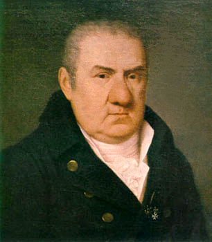
Great Architects: Giacomo Quarenghi

Great Architects: Giacomo Quarenghi

Giacomo Quarenghi was born in the village of Rota Fuori near the city of Bergamo in northern Italy, in Lombardy (Northern Italy), a region long renowned for skilled stonemasons and builders. In 1763, Quarenghi went to Rome, where he studied painting in the workshop of Anton Raphael Mengs, then with Stefano Pozzi, and architecture with Paolo Pozzi, befriending the future architect Vincenzo Brenna. In Rome, Quarenghi attended lectures on the theory of proportions by Antoine Derizet. Under the influence of the latter and Piranesi’s engravings, the young Quarenghi became fascinated with classical architecture. In Rome, Quarenghi became acquainted with Andrea Palladio’s treatise *The Four Books of Architecture*, an event that defined his entire subsequent creative biography. Influenced by the book, he began traveling across Europe to study architecture. He built a riding hall in Monaco and a dining hall in the house of the Archduchess of Modena in Vienna. Quarenghi traveled extensively throughout Northern and Southern Italy and was familiar with the works of another Palladian from Vicenza — Ottone Calderari. In Italy and later in Russia, Quarenghi often copied drawings by other neoclassical architects. In 1769, Quarenghi received a commission to remodel the interior of the medieval church of Santa Scholastica in the town of Subiaco near Rome. Construction took place from 1770 to 1773. The interior of this church “is one of the first and most valuable examples of neoclassicism… the only one in Lazio.” In 1771, Quarenghi visited Vicenza, home to Palladio’s main buildings, and met there with Ottavio Bertotti Scamozzi, a Palladio admirer who published a collection of authentic drawings of the great architect between 1776 and 1783. In Venice, Quarenghi befriended Tommaso Temanza, author of a biography of Palladio published in 1762. Quarenghi was dissatisfied with the tastes prevailing in contemporary Italian architecture (“survivals of Baroque splendor”), as he wrote in letters to Johann Friedrich Reiffenstein, an expert on Roman antiquities and friend of Winckelmann. In 1779, Quarenghi returned to Rome, where he met Friedrich Grimm. Baron Grimm came to Italy on behalf of Empress Catherine II to find architects for work in Russia. On Reiffenstein’s recommendation, who was also Catherine II’s “art agent” in Rome, Quarenghi signed a contract to work in Russia (initially for three years), where he worked for 37 years until his death. In October 1779, Quarenghi and his wife traveled via Venice and the Black Sea to Crimea, and from there to St. Petersburg. At 35 years old, unlike other Italians in Russia, he arrived in January 1780 with extensive experience as “architect to Her Majesty’s court.” On his way to Russia, Quarenghi brought with him the first two volumes of Palladio’s drawings, published in Venice by Bertotti Scamozzi. Before departure, the architect and his wife obtained a notarized document certifying the nobility of their family. The Quarenghi family has been known in Bergamo since the 12th century. At that time, noble lineage was especially important for employment in Russia. Under Emperor Paul I, who made himself Grand Master of the Order of Malta, the Catholic Quarenghi was also inducted as a knight of the order on July 19, 1800. The emperor offered him the position of the order’s architect (one of Quarenghi’s ancestors had already belonged to the Knights of St. John in the 16th century). The Russian State Archive in St. Petersburg holds the Quarenghi family coat of arms, drawn by the architect and certified by the Neapolitan ambassador. In 1799, the palace of Count Vorontsov, built by Rastrelli’s design, was assigned as the residence of the Order of Malta. Quarenghi designed and added the Maltese Chapel to the palace. During his first decade in Russia, he built the English Palace in Peterhof and a pavilion in Tsarskoye Selo. In St. Petersburg, Quarenghi constructed the buildings of the Hermitage Theatre, the Academy of Sciences, the Assignation Bank, and the Foreign College. He also fulfilled several commissions for high-ranking nobles, notably the summer palace of Count Bezborodko in St. Petersburg. Under Paul I, Quarenghi built the Alexander Palace in Tsarskoye Selo. At the same time, he designed the palace of Count Zavadovsky in Lyalichi. “The old man Quarenghi often walked on foot, and everyone knew him because he was remarkable for the huge bluish bulb that nature had stuck to his face instead of a nose” (Vigel). In the first decade of the 19th century, Quarenghi’s designs in St. Petersburg included the Horse Guards Riding Hall, the building of the Imperial Cabinet, the Mariinsky Hospital for the Poor, and the buildings of the Catherine Institute for Noble Maidens and the Smolny Institute for Noble Maidens. At the end of 1810, Quarenghi left St. Petersburg for Bergamo for the last time. He was given a ceremonial welcome in his hometown. But already in 1811, Quarenghi hurried back to Russia. Due to preparations for Napoleon’s campaign against Russia, Italians in Russian service were ordered to return to Italy; however, Quarenghi refused to comply and was sentenced to death in absentia with confiscation of property. Among the last works of the master was the construction of temporary wooden triumphal gates at the Narva Gate in honor of the victory over Napoleon. Quarenghi died on March 2, 1817, in St. Petersburg. He was buried in the Catholic section of the Volkovo Cemetery, where his grave was long considered lost. In the 1960s, the discovery of Quarenghi’s grave was announced, after which his remains were reburied in 1967 at the Lazarevskoe Cemetery of the Alexander Nevsky Lavra. Upon arriving in Petersburg, Quarenghi found himself in a complex situation. The Russian capital was architecturally a very contradictory whole. Traces of regular planning from the Petrine and Anna periods (a three-rayed city center system) coexisted with chaotic development and lavish Baroque-Rocaille facades of palaces built by Rastrelli in the mid-18th century. Behind the lavish facades and French-style cour d’honneur reigned complete chaos. Quarenghi managed to transfer the architecture of suburban Italian villas (*Villa suburbana*), developed by Palladio, into urban development. Despite arising difficulties, Quarenghi was able to filter his neoclassical, even purist, understanding of architecture through Baroque sensibilities. He boldly integrated his own buildings into the pre-existing Baroque-picturesque environment of the Russian capital. For example, Quarenghi masterfully fit the strictly symmetrical Palladian composition of the Assignation Bank building into the asymmetrical space between Sadovaya Street and the bend of the Catherine Canal (the semicircular open colonnades were later altered). Regarding planning tradition, Quarenghi, like Palladio, was a true Roman but capable, when necessary, of combining both compositional principles: symmetrical and asymmetrical, picturesque. Using the experience of English Palladians and architects of the French Academy of Architecture, Quarenghi managed to fuse the typical composition of an Italian villa, developed by Palladio, with the French hôtel particulier (urban mansion) featuring a triangular pediment and a cour d’honneur. Unlike Parisian academicians and English Palladians, Quarenghi succeeded in creating his own variant of neoclassical architecture, which became part of the St. Petersburg style of Catherine’s neoclassicism in the second half of the 18th century. Vicentine followers of Palladio adopted only certain facade composition techniques using order elements from their great teacher. The compositions of neoclassical Florentine facades are flat. Quarenghi, addressing antique models directly through Palladio, created “block-like” and spatial compositions. Externally, Quarenghi’s buildings in Petersburg are uniform, explained by the fact that in his projects the Bergamo architect strictly followed principles of neoclassical architecture that he himself formulated: - visual unity and compositional closure; - emphasis on the central portico with an external staircase, colonnade, and triangular pediment; - simplicity, conciseness, and clarity of proportions “according to Palladio” (in simple whole number ratios). Quarenghi’s contemporary, the Russian poet Derzhavin, somewhat ironically noted a feature of Russian neoclassical buildings, created first by Quarenghi — the portico with a triangular pediment in the center of the main facade, emphasizing that such buildings have a “temple-like appearance.” In his first building upon arriving in Russia — the English Palace in the southwestern part of Peterhof, the suburban mansion of Empress Catherine II — Quarenghi almost completely replicated Palladio’s composition of Villa Mocenigo on the Brenta River. At the center of the building is an eight-column portico with a triangular pediment and a wide staircase leading to it. Another characteristic device frequently repeated by Quarenghi is raising the colonnade on a high plinth or arched bel étage. Some buildings of the same scheme built by Quarenghi in Petersburg resemble works by English Palladians. Quarenghi used open extended colonnades, almost never found in Palladio’s projects, for example, in Count Bezborodko’s estate in Petersburg. Palladio more often included closed colonnades like loggias, rooted in traditional Italian rural canopies on posts. In France, semicircular galleries were used, for instance, in the inner courtyard of the Hôtel de Soubise in Paris, but there they were also closed. Nevertheless, Quarenghi called “transparent” colonnades “alla francese.” These eventually became typical for Russian estate architecture. The composition of the Hermitage Theatre for court performances is entirely original, with the prototype chosen as the ancient Greek *theatron* (not without the Empress’s involvement). Quarenghi had previously studied ancient theaters, and for the engraved 1787 edition dedicated to the Hermitage Theatre in Petersburg, he specially made a drawing of the Roman theater and a measured drawing of the Teatro Olimpico in Vicenza. Inside the theater, Quarenghi used Corinthian columns clad in artificial marble, niches with statues of Apollo and the nine Muses, and round medallions with profile portraits of famous poets and composers. Many operas, ballets, and dramatic performances were staged on the theater’s stage, including plays written by the Empress herself. According to Quarenghi, he built the Hermitage Theatre based on direct impressions from the ancient theater in Pompeii. The stage masks on the Corinthian capitals of the theater’s interior were made “following the examples seen in Rome and, mainly, those I found in the excavations of the Pompeii theater.” Quarenghi successfully developed the motif of a free-standing colonnade in the building of the Cabinet of the Anichkov Palace in St. Petersburg, quite unusually combining Ionic capitals with a Doric entablature. The composition of the Alexander Palace (for the future Emperor Alexander I) in Tsarskoye Selo has no direct prototypes, neither in antiquity nor in Palladio. Two risalits are “drawn together” by an extended double Corinthian colonnade facing the pond, through which the inner courtyard “shines through,” something between a Roman atrium and a French cour d’honneur. In other buildings, Quarenghi almost exactly copies Palladio’s Villa Rotonda (Almerico-Capra). Quarenghi’s work in Russia is unique; it does not repeat the works of other outstanding architects of Catherine’s neoclassicism: A. Rinaldi, J.-B. Vallin de la Mothe, C. Cameron, N. A. Lvov, M. Yu. Felten, nor is it similar to the works of Italian, French, and English Palladians. An important part of Quarenghi’s legacy is his graphic work. Quarenghi was an outstanding draftsman. He drew extensively from life: monuments of ancient Russian architecture, works by his colleagues, portraits, caricatures. His architectural, including project, graphics are distinguished by a lively, fluent manner. He loved to depict his buildings with pen and brush, watercolor and ink, in a landscape setting filled with light and inhabited by human figures. A special interest lies in comparing the styles of two outstanding architectural graphic artists: Giacomo Quarenghi and Charles Cameron.

Kronstadt - a fort fortress

Kronstadt - a fort fortress

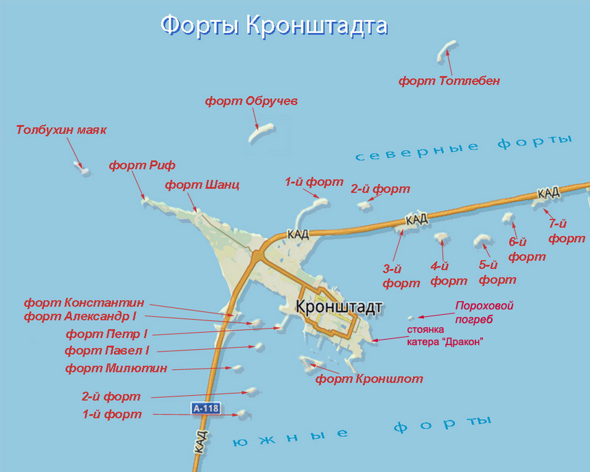
In Kronstadt, Peter I first implemented the idea of constructing a fort fortress consisting of a core and additional fortifications in front of it — forts. Russia fought for access to the sea, and to reliably block the way for Swedish ships to the lands of the Neva Bay and Petersburg, Peter decided to further strengthen the defense of the Kronstadt fortress. Thus, from 1704 until the beginning of the 20th century, a chain of fortresses — the Kronstadt forts — was built to protect Saint Petersburg from the sea, consisting of 21 fortifications, seventeen of which are located in the Gulf of Finland. The construction of the forts began on the southern side of Kotlin Island. Most of the forts were founded on artificially created islands. The first fort of Kronstadt was Kronshlot. This fortress was built in the shape of a decagon, with a width reaching 29 meters. In 1704-1705, Kronshlot played a leading role in repelling ships of the Swedish fleet. Today, Fort Kronshlot, along with Fort Peter I, are active facilities of the Saint Petersburg Naval Base, and access to their territory is strictly prohibited. Fort "Emperor Alexander I" is one of the most interesting forts of the Kronstadt fortress. Its appearance resembles the well-known French Fort Boyard, famous from television programs. In the southern Fort No. 3, also known as Milyutin, elevators for lifting shells have been preserved to this day. The history of Fort No. 4, better known as Zverev Fort, is shrouded in many legends and rumors. In summer, this densely overgrown island is hard to recognize as a military fortress, but upon closer inspection, many details of military actions preserved to this day can be seen. According to one version, in the 1970s, fuel and lubricants were disposed of in the casemates of this fort. This also explains why the fort is often called "Burnt," as it is impossible not to notice the distinctive smell in this place.

Great Architects: Antonio Rinaldi

Great Architects: Antonio Rinaldi

There is almost no information about Antonio Rinaldi's childhood. He was born in 1709 or 1710 in southern Italy, most likely in Naples. He studied under Luigi Vanvitelli, a representative of late Italian Baroque. Together with other students, Rinaldi participated in the construction of projects assigned to Vanvitelli. During his work in Italy, Rinaldi gained some recognition. In 1751, the architect was invited to serve in Russia. The contract was signed for seven years, and its terms included the Italian teaching Russian craftsmen. In 1754, Antonio Rinaldi became the architect of the "small court," meaning he entered the close circle of the Tsarevich Peter III. At the heir to the throne’s suggestion, the architect began his work in Oranienbaum. There he built Peter III’s palace, the Opera House, the ensemble of the Private Dacha with the Chinese Palace and the Slide Hill. While working in Oranienbaum, Rinaldi already called himself "architect of the Grand Duchess," thus gaining the trust of the future Catherine II. After Catherine II ascended the throne, Rinaldi became the leading architect of Saint Petersburg. One of his first works in Petersburg was the Church of St. Catherine on Nevsky Prospect, started by the architect Vallin de la Mothe, who had left Russia. In 1766, under Rinaldi’s direction, the reconstruction of the Prince Vladimir Cathedral began. Two years later, Rinaldi started building the Marble Palace, and two years after that—the new building of St. Isaac’s Cathedral. At the same time, the architect built a palace in Gatchina. Later, the building of Tuchkov Buyan was erected according to Rinaldi’s design. There is a theory that Rinaldi designed the Myatlev house on St. Isaac’s Square. According to Antonio Rinaldi’s project, the Bolshoi Theatre on Theatre Square was built, on the site of which the Conservatory building was later constructed. In the 1770s, the architect mainly worked in Tsarskoye Selo. There he created the Chinese Theatre and pavilion. Besides these buildings, Antonio Rinaldi designed the Chesme and Morea Rostral Columns, the Kagul Obelisk, and the Crimean Column. Antonio Rinaldi developed a project for the comprehensive design of roads leading from Saint Petersburg to Tsarskoye Selo and Peterhof. According to this plan, marble milestone posts were installed along the roads, some of which have survived to this day. On all buildings designed by Antonio Rinaldi, you can see his signature trademark—a crossed palm and laurel branch. A notable feature of his work is the use of materials rarely applied in building decoration. For example, during the construction of the Marble Palace, he used Russian marble quarried near Lake Ladoga. When building the palace in Gatchina, Pudozh limestone was used, giving the structure an original and memorable appearance. Antonio Rinaldi worked in Russia for more than 30 years. His active career was interrupted by an accident—the architect fell from the scaffolding of the Bolshoi Theatre building he was constructing. Due to the injury, he was unable to continue working. The architect was granted a lifelong pension; Rinaldi sold all his property in Petersburg and left for Rome in 1784. The pension was regularly paid to the architect through the Russian embassy. For the last 10 years, Antonio Rinaldi devoted himself to systematizing his projects and drawings. The architect died on February 10, 1794, in Rome.
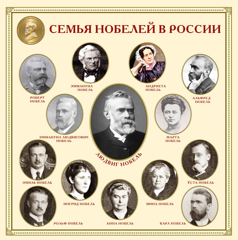
Great Businessmen and Inventors: The Nobel Family

Great Businessmen and Inventors: The Nobel Family

Emmanuel Nobel, inventor of underwater mines. A native of Uppsala, where he received higher education. Worked as an architect in Stockholm. After bankruptcy, he moved in 1832 to the Grand Duchy of Finland. From 1842 to 1859, he lived in Saint Petersburg, where he founded a mechanical factory. During the Crimean War of 1853–1856, he supplied weapons and mines to the Russian army. In 1859, he declared bankruptcy and moved to Sweden. Robert Emmanuelovich Nobel was born in Sweden and came to Saint Petersburg with his mother. From 1850, he worked at his father's factory. In 1859 (or 1861), he went to Finland, then returned to Russia and worked for many years at enterprises he founded together with his brothers. Alfred Bernhard Nobel (October 21, 1833, Stockholm – December 10, 1896, Sanremo, Italy), founder of the Nobel Prizes, son of Emmanuel Nobel. In Russia, he became acquainted with the works of N. N. Zinin and V. F. Petrushevsky on the chemical technology of nitroglycerin and its practical use. In 1863, he established production, and in 1867 obtained a patent in the United Kingdom for explosives collectively called "dynamites." In 1867, he patented the first mercury fulminate detonator cap in the United Kingdom. Organizer and co-owner of dynamite production enterprises, which were united into two trusts and operated in almost all Western European countries. Member of the Royal Society of London and the Swedish Academy of Sciences. Ludwig Nobel, entrepreneur, machine tool designer, member of the Russian Technical Society. Son of Emmanuel Nobel. He transformed the enterprises founded by his father in Saint Petersburg into a large engineering plant "Ludwig Nobel" (later the "Russian Diesel" plant). In 1876, together with his brothers Robert and Alfred, he founded an oil industrial enterprise in Baku (from 1879 — the Nobel Brothers Oil Production Partnership), which became the largest oil company in Russia. Nobel, Emmanuel Ludwigovich, son of Ludwig Nobel, headed the Nobel Brothers Partnership, the "Ludwig Nobel" company, and other enterprises from 1888 to 1917. He played an important role in Russia's entrepreneurial organizations. At the beginning of 1918, he moved to Sweden.
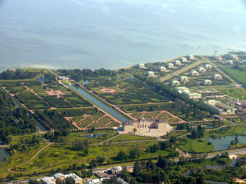
Imperial Parks: Strelna

Imperial Parks: Strelna

The Kikensky Pogost manuscript of 1500 also mentions the village of Strelna "on the Strelna River by the sea." In 1617, a peace treaty between Russia and Sweden was signed in the village of Stolbovo near Tikhvin, which ended the Russo-Swedish War of 1614–1617, and the village of Strelna, along with other territories, was transferred to Sweden. Victories in the Great Northern War (1700–1721) allowed Russia to acquire lands on the shores of the Baltic Sea, including the Strelna Manor, where Peter I often stayed during his trips from Saint Petersburg to Kronstadt.
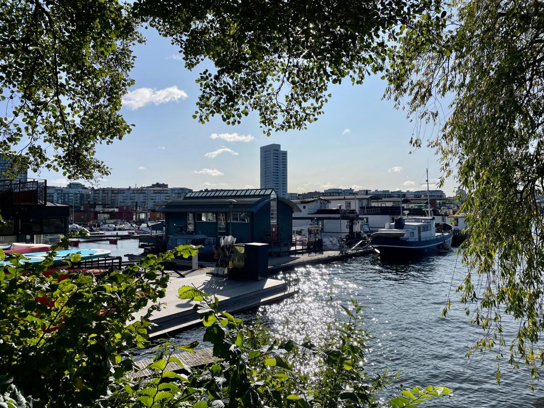
Waterside Chronicles: Boats, Horses, and Historic Intrigue at Karlbergs Strand

Waterside Chronicles: Boats, Horses, and Historic Intrigue at Karlbergs Strand

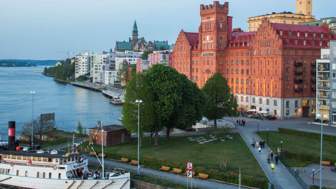
This is a beautiful walk along the water with lots to see. You can start at Karlberg Palace as we suggest, or at Pampas Marina if you want a shorter walk. Between Village on the Water and Augustendals 4H stops you can make a short detour to Solna’s Golden Gate which is well worth the climb. Otherwise, just keep following the waterfront, enjoy the views and listen to our stories. This walk is not circular, but you do not have to go all the way back - you can return by subway from Huvudsta (about 2,5 km from Karlberg Palace) or Solna Strand (about 4 km from Karlberg Palace).
Great Architects: Fyodor Ivanovich Lidval

Great Architects: Fyodor Ivanovich Lidval

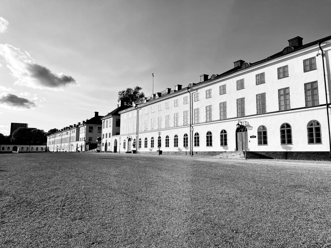
Baron Fyodor Ivanovich Lidval (Johan Fredrik Lidvall, Swedish: Johan Fredrik Lidvall; May 20 (June 1), 1870 — March 14, 1945) was a Russian-Swedish architect of Swedish citizenship and origin, an academician of the Imperial Academy of Arts. F. I. Lidval was born in Saint Petersburg. In 1882, he graduated from the primary school at the Evangelical Swedish Church of Saint Catherine, and then from the Second Petersburg Real School (in 1888). He studied for two years at the Baron Stieglitz School of Technical Drawing. During vacations, Fyodor Lidval, like his brothers, twice served in the Royal Life Guards Regiment in Stockholm. From 1890 to 1896, Fyodor Lidval was a student in the architectural department of the Higher Art School at the Imperial Academy of Arts, where from 1894 to 1896 he studied in the workshop of architect L. N. Benois. He graduated from the Higher Art School with the title of artist-architect. The most productive period of Lidval’s creativity is associated with Saint Petersburg. Since 1899, he became a member of the Petersburg Society of Architects. In 1907, a special commission for awarding prizes for the best facades awarded Lidval a silver medal for the facade of N. A. Meltzer’s house (corner of Bolshaya Konyushennaya Street and Volynsky Lane) and an honorary diploma for the facade of A. F. Zimmerman’s income house (corner of Kamennoostrovsky Prospect and Vologodskaya Street). More than 30 buildings and structures were built in Saint Petersburg according to his designs. Lidval’s works began to play a significant role in the architecture of Saint Petersburg in the 1900s. In the first stage of his creativity (1897–1907), he was a bright representative of the "Northern Modern" style; his pursuits during these years were close to the aspirations of Scandinavian and Finnish architects. In 1918, ruined by the revolution, F. I. Lidval left for Stockholm, where he had sent his family a year earlier. After moving to Sweden, F. I. Lidval worked at the company of the famous architect Albin Stark and designed 16 signature houses in Stockholm, as well as participated in the development of projects for another 7 buildings (mainly as an interior designer). His first independent project was two residential buildings on Tysta Gatan (No. 3 and No. 5, 1922), whose appearance combines motifs characteristic of Lidval’s Petersburg period and Swedish architecture in the Swedish Grace style, distinguished by modesty and restraint. Among other projects he realized in Stockholm are the Shell oil company building on Birger Jarlsgatan and a house at the corner of Torsgatan and Saint Eriksgatan. Also, in the early 1930s, F. I. Lidval designed several residential buildings in Stockholm in the functionalism style. He died in 1945 as a result of a cerebral hemorrhage. He is buried in Stockholm at the Djursholm Cemetery.

Estonia: Tallinn and Its Surroundings: Attractions

Estonia: Tallinn and Its Surroundings: Attractions

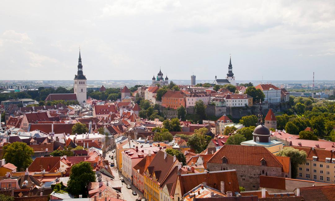
The main attractions of Tallinn are connected to its centuries-old history. The Old Town of the Estonian capital has absorbed the spirit of the Middle Ages and preserved it to this day. Everyone visiting the capital of Estonia should make a point to see it. There are also many beautiful places worthy of attention and visits located in the surroundings of Tallinn.

Following in the footsteps of: "Sherlock Holmes and Dr. Watson," a film walk through Latvia, Estonia, Abkhazia, and St. Petersburg

Following in the footsteps of: "Sherlock Holmes and Dr. Watson," a film walk through Latvia, Estonia, Abkhazia, and St. Petersburg

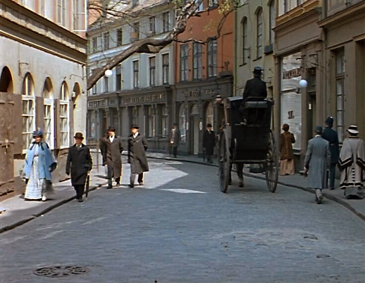
The first episode of the Soviet film about the adventures of the great detective and his faithful companion was released in 1979. Naturally, filming in London was out of the question. Therefore, London was portrayed by Riga, Tallinn, and Petersburg. The role of the Reichenbach Falls was "played" by the Gegsky (Circassian) waterfall in Abkhazia. Riga’s Jauniela Street and house number 22 on it stood in for Baker Street and 221B. (This same street was also used in the TV film *Seventeen Moments of Spring* as "Flower Street" in the city of Bern.) The county of Devonshire, where the events of the novel *The Hound of the Baskervilles* take place, was replaced by Estonian landscapes, and the manors of the Estonian barons stood in for Baskerville Hall and Merripit House.
Banksy’s London Collection

Banksy’s London Collection

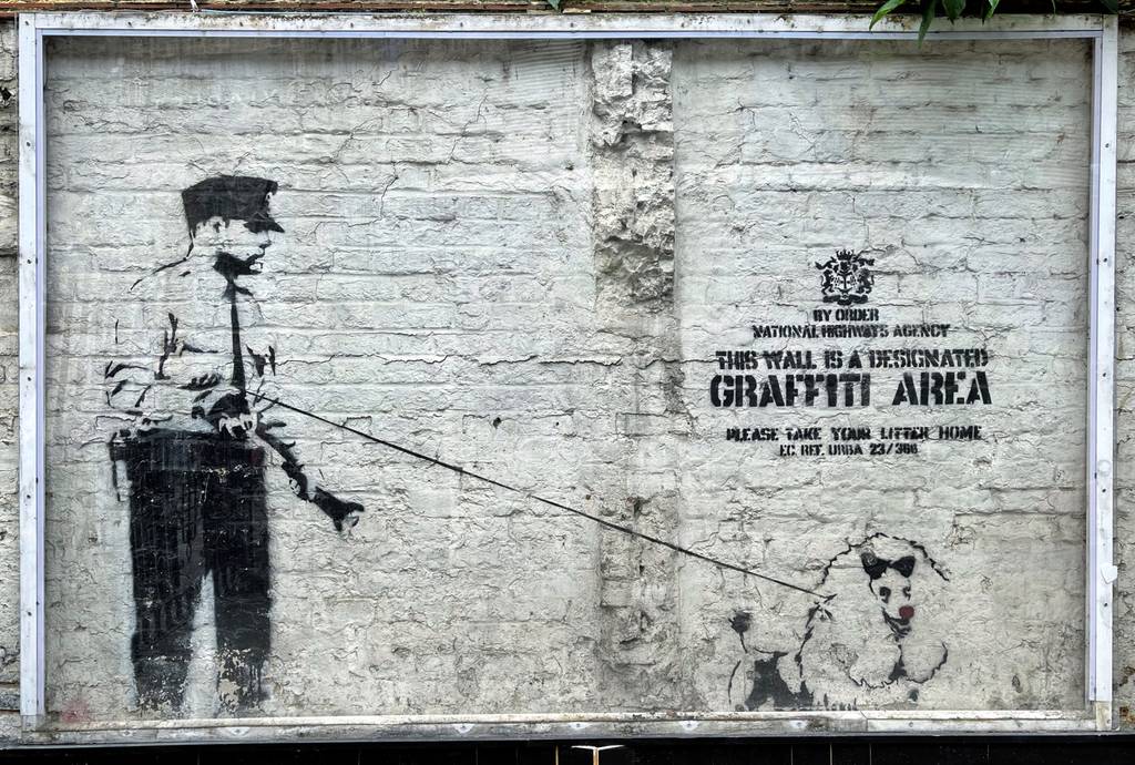
Banksy, the enigmatic street artist, has captured the world's imagination with his thought-provoking and visually stunning graffiti. His art transcends traditional boundaries, using humor, irony, and social commentary to challenge norms and provoke thought. Banksy's ability to remain anonymous, coupled with his global reach through social media and exhibitions, has made him an international icon. His graffiti has not only adorned city streets but also transcended into galleries and auction houses, cementing his influence on contemporary art worldwide. This is a collection of sites in London where you can find some of his best-known public artworks. Word of caution: street art can be painted over, suffer from decay and vandalism. We try to keep our stories up to date, but unfortunately we cannot guarantee that all the pieces described in the collection stay intact.
Lithuania: In the Footsteps of the Holocaust

Lithuania: In the Footsteps of the Holocaust

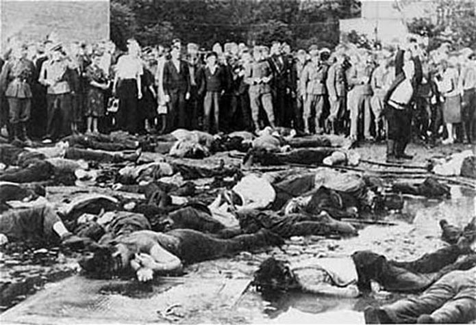
The southernmost and largest of the Baltic countries. Jews lived in Lithuania since the 14th century. Under the Non-Aggression Pact between Nazi Germany and the Soviet Union, signed just a few days before the start of World War II in September 1939, Lithuania fell into the Soviet sphere of influence. On October 30 of the same year, Lithuania was returned control over Vilnius, which had previously belonged to Poland. After this, the Jewish population of Lithuania increased from 100,000 to 250,000 people. This number included about 15,000 Jewish refugees from Nazi-occupied Poland. The majority of the Lithuanian population was embittered by the pact with the USSR, which deprived Lithuania of its independence. Their frustration was taken out on the Jews, which manifested in their persecution and attacks on their property. On June 15, 1940, Soviet army units entered Lithuania; seven weeks later, Lithuania was officially annexed by the Soviet Union. The country's incorporation into the USSR greatly affected the life of Lithuanian Jewry. On the one hand, Jewish representatives entered the republic’s government, and Jews could now study in higher education institutions without restrictions. On the other hand, their enterprises were nationalized, and many political, cultural, and charitable organizations were closed. On June 14, 1941, Soviet authorities deported tens of thousands of Lithuanians declared "enemies of the people"; among them were 7,000 Jews. Although Jews themselves suffered under Soviet rule, Lithuanians considered them supporters of the Soviets. As a result, many Lithuanians, including members of the nationalist organization Lithuanian Front, terrorized Jews. On June 22, 1941, Germany attacked the USSR, and Lithuania was occupied by the Germans. Most of the Lithuanian population welcomed the Germans, believing that Germany would grant the country independence. Many willingly collaborated with the occupiers. Even before the occupation of Lithuania was complete, Lithuanians themselves organized Jewish pogroms in at least 40 settlements. Jews were killed, beaten, raped; rabbis were mocked. However, Germany had no intention of granting Lithuania independence: the country became part of the Reichskommissariat Ostland, one of its "general districts" (Generalbezirk Litauen). Just a few weeks after the occupation of Lithuania, the Nazis launched a systematic campaign to exterminate Lithuanian Jewry, led by the 3rd Einsatzkommando, Einsatzgruppe A. Many stages of the extermination, including gathering Jews in one place, guarding them, and transporting them to the site of execution, were carried out by Lithuanian soldiers and police. In the summer of 1941, many Jews from the provinces were killed. From September to November, the extermination of Jews from large cities, gathered after the occupation into ghettos, was carried out. By the end of 1941, only 40,000 Jews remained in Lithuania; they were concentrated in four ghettos (in Vilnius, Kaunas, Šiauliai, and Švenčionys) and several labor camps. During the summer and autumn of 1943, the ghettos in Vilnius and Švenčionys were liquidated, and the ghettos in Kaunas and Šiauliai became concentration camps. About 15,000 Jews were transferred to labor camps in Latvia and Estonia, where they perished, and 5,000 Jews were deported to extermination camps. Before leaving Lithuania in the summer of 1944, the Germans evacuated about 10,000 Jews from the camps in Kaunas and Šiauliai to German concentration camps. Those who tried to resist were killed. Only a few thousand Lithuanian Jews survived. http://holocaustatlas.lt/EN/
Moscow: The Necklace of Moscow Region Estates

Moscow: The Necklace of Moscow Region Estates

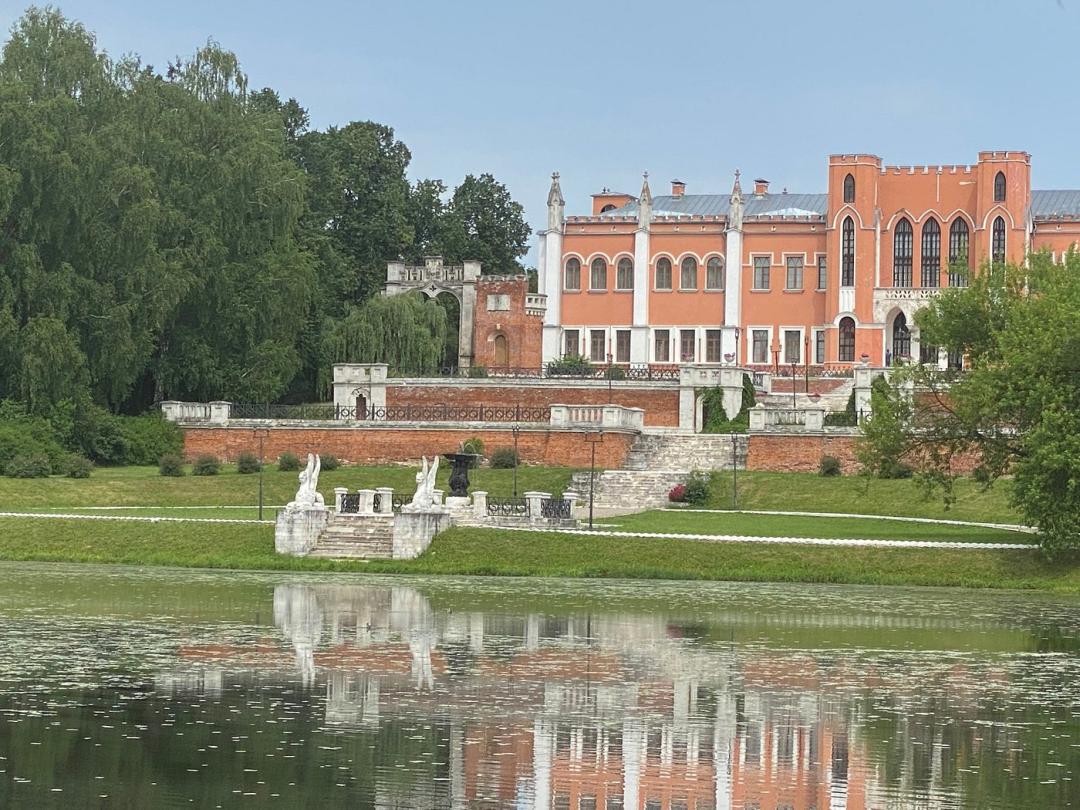
The estates of the Moscow region represent a distinct layer of Russian history and culture. Their former owners were poets and writers, illustrious princes, and millionaire industrialists. The old manors resemble pearls scattered across the map: each one is notable for its outstanding architectural and landscape design.

Petersburg: Mansions and Summer Houses of Kamenny Island

Petersburg: Mansions and Summer Houses of Kamenny Island

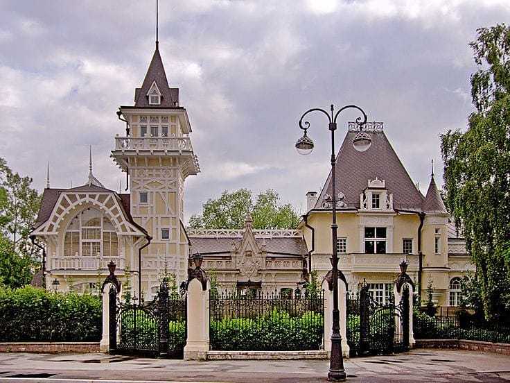
Kamenniy Island is a district in the historic center of Petersburg, known for its unusual mansions, panoramic views, and green recreational areas. The island has changed several times: from a neighborhood of aristocrats with gardens and estates, it transformed into a public park with sanatoriums, and then once again became a place with private residences.
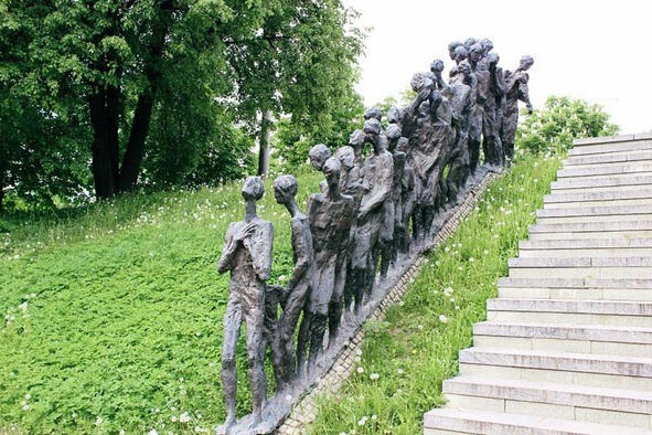
Belarus: In the Footsteps of the Holocaust

Belarus: In the Footsteps of the Holocaust

The topic of the Holocaust is endless, as it brought so much sorrow; each tragic fate is a separate book. First and foremost, Belarus as a whole became a victim, where the Holocaust began and had terrible consequences. To understand the damage the Holocaust inflicted on Belarus, its citizens, and its culture, one must know about the Holocaust within it. While camps were still being built in Germany, mass extermination of Jews had already begun in Belarus in July 1941. The total number of Jews killed in Belarus amounted to 800,000. The development of genocide here was harsher and faster; only Jews who managed to escape from ghettos and hide in the forests survived. It is interesting how those who fled could survive in conditions where local residents were killed simply for helping Jews. It turns out that survival was mainly due to the efforts of partisans. Although some Belarusians still risked their lives to save Jews. It should be noted that from the beginning of the war, civilians were forbidden to join partisan detachments. Permission was granted only in 1943, by which time a huge number of Jews had already perished. The development of the partisan movement in Belarus began in 1941 (summer). But at first, only military personnel engaged in partisan activities. Only in spring 1943 (May), following an issued order, all able-bodied persons, including women, were allowed to join partisan detachments. However, at the same time, there was an order forbidding the acceptance of spies into detachments. During this turbulent time, even innocent people and children could be labeled as spies. In some cases, Jews were killed not only by Germans but also by partisans. On June 22, 1941, Germany attacked the USSR. By the end of August, German troops had fully occupied Belarusian territory, advancing so rapidly that only a negligible number of Jews managed to evacuate deeper into the Soviet Union. Several stages can be distinguished in the implementation of the Holocaust on Soviet territory: - June 22, 1941 (attack on the USSR) – January 1942 (Wannsee Conference) - February 1942 – Autumn 1943 (liquidation of ghettos and labor camps in German-occupied zones) - Winter 1943/1944 – Autumn 1944 (transfer of surviving Jews to concentration camps and complete liberation of occupied USSR territory). These periods are relevant to Belarus, which was liberated in July 1944. Belarus (its territory) was divided into several zones: - Rear area of Army Group "Center," including Vitebsk, Mogilev, a significant part of Gomel, eastern districts of Minsk, and several districts of the Polesie region. - General District "Belorussia" of the Reich Commissariat "Ostland" — about one-third of the BSSR, including part of the Vilnius region (Lithuania). - Partial inclusion in the Reich Commissariat "Ukraine" — Pinsk, Brest, and part of the Polesie regions. - Partial incorporation into the Third Reich — the entire Bialystok region and part of the Grodno region. Regarding the first zone, it can be said that military authorities operated there, persecuting and exterminating the Jewish population. In other zones, this grim task was entrusted to the civilian occupation administration. It has been noted that Wehrmacht soldiers were most active precisely in Belarus. In many places in Belarus where Jews lived, the Germans began exterminating them immediately upon arrival. Already in summer 1941 (June 27), 2,000 Jews were killed by German executioners in what was then Belarusian Bialystok. A few days later, several thousand more were killed. From August 5 to 7, the Germans killed 10,000 Jews in Pinsk. On July 10, in Brest-Litovsk, the Nazis shot 5,000 to 10,000 Jewish citizens (figures vary in different sources). On October 30, Wehrmacht soldiers shot four and a half thousand Jews from the Nesvizh ghetto. By the onset of winter, up to 50,000 Jewish people had been exterminated. In the first months of Hitler’s occupation, Jews in cities such as Vitebsk, Gomel, Bobruisk, and Mogilev were exterminated. On October 8, the Vitebsk ghetto was liquidated, with 16,000 people killed. At the end of 1941 (December 8), 4,500 Jews in Novogrudok were exterminated, accounting for 64.3% of the entire Jewish population in this small town. In Belarus, in January 1942 alone, Einsatzgruppen shot 33,210 Jews. In the Nazi-occupied Belarusian territory controlled by the civilian administration, by the end of January, 139,000 Jewish citizens remained alive. The Nuremberg racial laws, aimed at isolating Jews, were enforced in the occupied territories. In 1943 (summer and autumn), the Nazis began actions to liquidate ghettos in Western Belarus. Jews from settlements such as Kossovo, Mir, Kletsk, Lyakhovichi, Nesvizh, and others were exterminated. By March 12, 1943, the Jewish population of Grodno, which numbered over 25,000, was completely destroyed. October 21, 1943, marked the time of the last pogrom in the Minsk ghetto. All its inhabitants were doomed to extermination. On December 17, the Baranovichi ghetto was liquidated; the Germans killed 3,000 people, and the survivors were transferred to concentration camps. During the war years, a total of 700,000 to 898,000 Jewish citizens died in Belarus (according to varying estimates). In addition, the Nazis exterminated 85,000 to 90,000 Jews from other countries on the territory of the republic. One of Belarus’s leading specialists in war history, Doctor of Historical Sciences Emmanuil Ioffe, suggested that as of June 22, 1941 (at which time the Bialystok region was part of Belarus), 946,000 Jewish citizens died during the war years. Of these, 898,000 perished due to the Holocaust, and 48,000 died in battles.
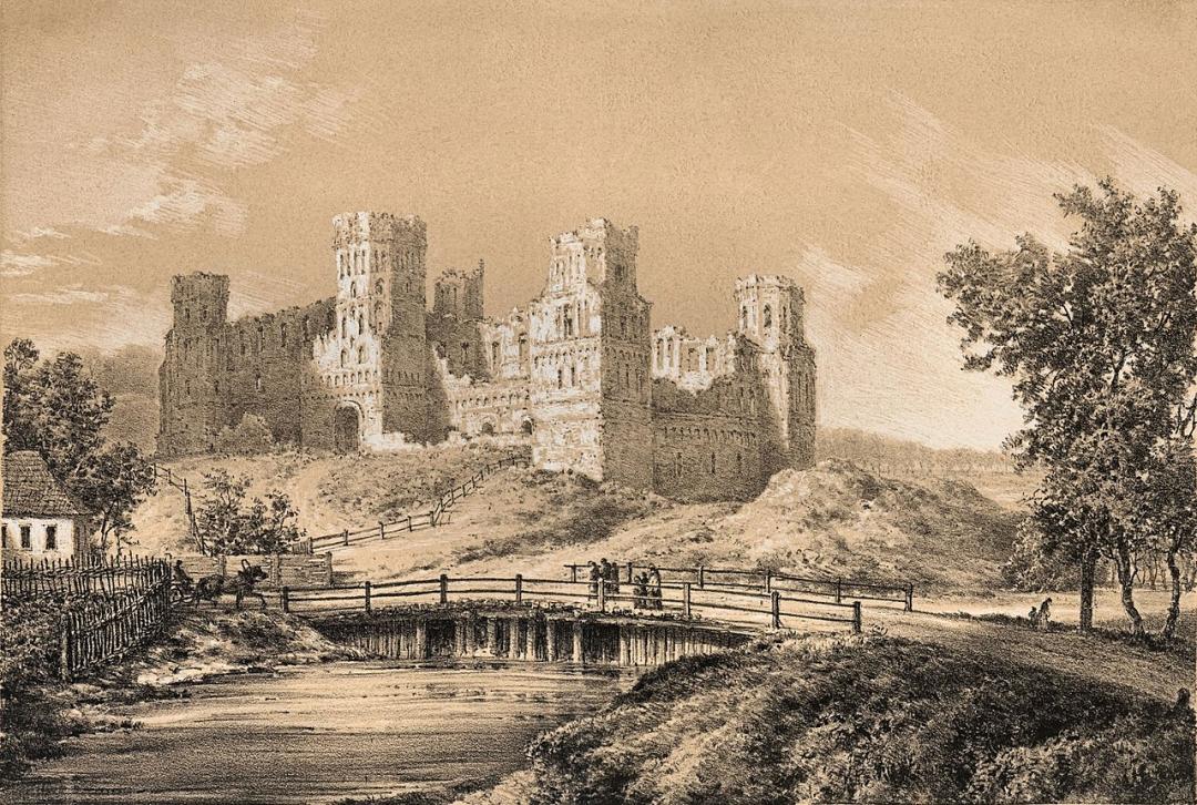
Belarus: Historical Cities and Towns - Mir

Belarus: Historical Cities and Towns - Mir

It is possible that Mir got its name from the word "emir" (referring to the rank of the head of the detachment of Tatar warriors stationed here), or from the direct meaning of the word "mir" (peace), due to the nearby border between Rus and Lithuania; however, there is no reliable evidence of any peace treaty being concluded here. In Belarusian historiography, it was commonly believed that Mir was first mentioned in the so-called "Lindenblatt Chronicle" in 1395, in connection with an attack by the Teutonic Order's troops. However, historians have recently established a new date for the first mention of Mir. This date is May 28, 1434, when the Grand Duke of Lithuania, Sigismund Kęstutaitis, granted the Mir estate and surrounding lands to his ally, the Vilnius castellan Senka Hedyholdovich. In 1486, it became the property of the Ilyinich family. In 1569, Mir passed to the Radziwiłł family. At the end of the 16th and beginning of the 17th centuries, the Mir estate was surrounded by earthen ramparts and turned into a fortress, which could only be entered through gates named after the main roads leading from them (Castle Gate, Vilnius Gate, Minsk Gate, Slonim Gate). The multinational composition of the town is well reflected by the various religious buildings surrounding the Market Square — a Tatar mosque, built before 1795, burned down in 1939, now replaced by a shed; a synagogue courtyard; a yeshiva; the Trinity Church; and the Church of St. Nicholas. Since the 18th century, Mir has been an important spiritual center of Polish-Lithuanian Jewry.

Belarus: The Lost Jewish World

Belarus: The Lost Jewish World

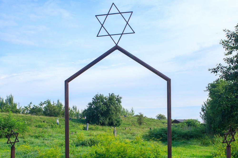
It is very difficult to imagine modern Belarus without Jewish heritage, just as it is to imagine Israel without Belarusian heritage. It’s no joke – before the start of World War II, about 1 million residents of Belarus (which was a full 15% of the population at the time!) were Jews. Finding a Belarusian town or shtetl without a synagogue at the end of the 19th century was impossible. But the upheavals of the 20th century almost completely destroyed the remarkable culture of Belarusian Jews at its root. Data on when the first Jews appeared on the territory of Belarus vary. The official history of Jews in these lands begins during the time of the Polish-Lithuanian Commonwealth, when they were allowed to settle on Polish and Lithuanian lands, and a large number of Jewish migrants from Germany (the German principalities), where they were oppressed, moved eastward to the relatively tolerant and religiously permissive Polish-Lithuanian state. It is known that Jews began to migrate en masse to the territory of the Grand Duchy of Lithuania as early as the 13th century. The authorities of the Polish-Lithuanian Commonwealth were known for their tolerance, so after several centuries, one of the largest Jewish diasporas in the world lived on the territory of modern Belarus, Ukraine, Poland, and Lithuania, and Minsk became one of the centers of the global Zionist movement (that is, the movement for the return of all Jews to Israel). After the partitions of Poland at the end of the 18th century, Jewish shtetls found themselves within the Russian Empire, and the Pale of Settlement was created, restricting the movement of Jews from their traditional settlements (in the territories of modern Poland, Ukraine, Belarus, Lithuania), and Jews remained in these shtetls until the very collapse of the Empire. The situation began to change at the end of the 19th century. That was when the first pogroms began within the Pale of Settlement. The horrors of revolutions and World War I only worsened the situation of the Jewish population. Only the Provisional Government after the February Revolution of 1917 abolished the decree banning the movement of Jews across the country. In the late 1920s and early 1930s, the USSR had a very ambivalent policy: there was propaganda of cosmopolitanism and equality. Jews held power and leading positions in culture. But this was accompanied by a struggle against their identity as Jews and the erasure of boundaries – everyone was supposed to be Soviet citizens. The authorities sought to make Yiddish part of the Soviet world, while Hebrew and everything related to Judaism (art, schools, religious associations) was harshly repressed. For example, at Belarusian State University there was a Yiddish faculty, but studying the Torah there was forbidden. Read Marx – he was Jewish too. Incredibly but true, from the mid-19th century until the beginning of the Great Patriotic War, the capital of Belarus, Minsk, was predominantly a Jewish city – Jews made up 52% of the city’s population, the largest community in the city. Moreover, until 1936, alongside Belarusian, Russian, and Polish, Yiddish was an official language of the BSSR. Today, almost nothing reminds us of the pre-war and especially pre-revolutionary Jewish heritage; the number of Jews has decreased from more than half the city’s population to a statistical margin of error, and old Jewish schools and synagogues have been closed or repurposed for civilian use. However, if desired, traces of Jewish presence can still be found. Before the revolution, Minsk had 83 synagogues – more than the number of Orthodox and Catholic churches combined. After World War II, Jewish culture in Belarus was destroyed. The surviving Jews, under pressure from the authorities’ anti-Semitic policies, actively assimilated. Mass aliyah (repatriation) began in the 1990s after the collapse of the Soviet Union. Today, according to the latest census, there are about 12,000 Jews in Belarus.
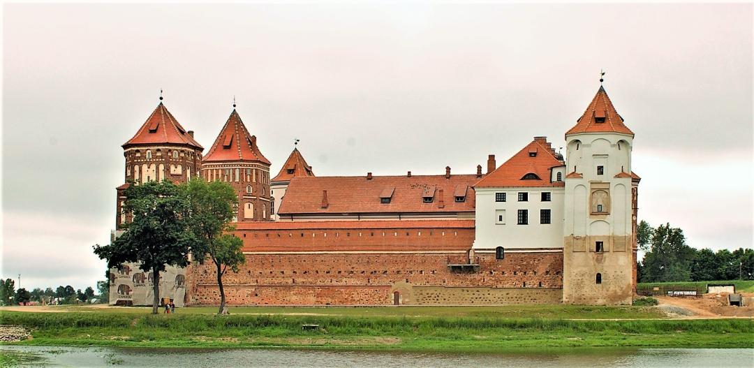
Belarus: Castles and Palaces, History and Legends

Belarus: Castles and Palaces, History and Legends

Castles of Belarus are defensive structures built on the territory of modern Belarus in the 13th–17th centuries. Most of the castles have not survived to the present day. A castle as a type of structure is a defensive object that represents an enclosed complex of defensive, residential, and other specialized buildings, serving residential as well as administrative and public functions. Castles were built in locations convenient for defense — on elevations ("mountainous") or in lowlands ("valley"), and had regular or irregular plan compositions. In the territory of Belarus, the construction of wooden castles was widespread (in Svir, Orsha, Radoshkovichi, Pinsk, Gomel, Glusk, Mogilev, and other places) as well as stone castles (Lida, Kreva, Novogrudok, Mir, Bykhov, Smolensk, Lyubcha, Lyakhovichi, and Zaslavl castles).
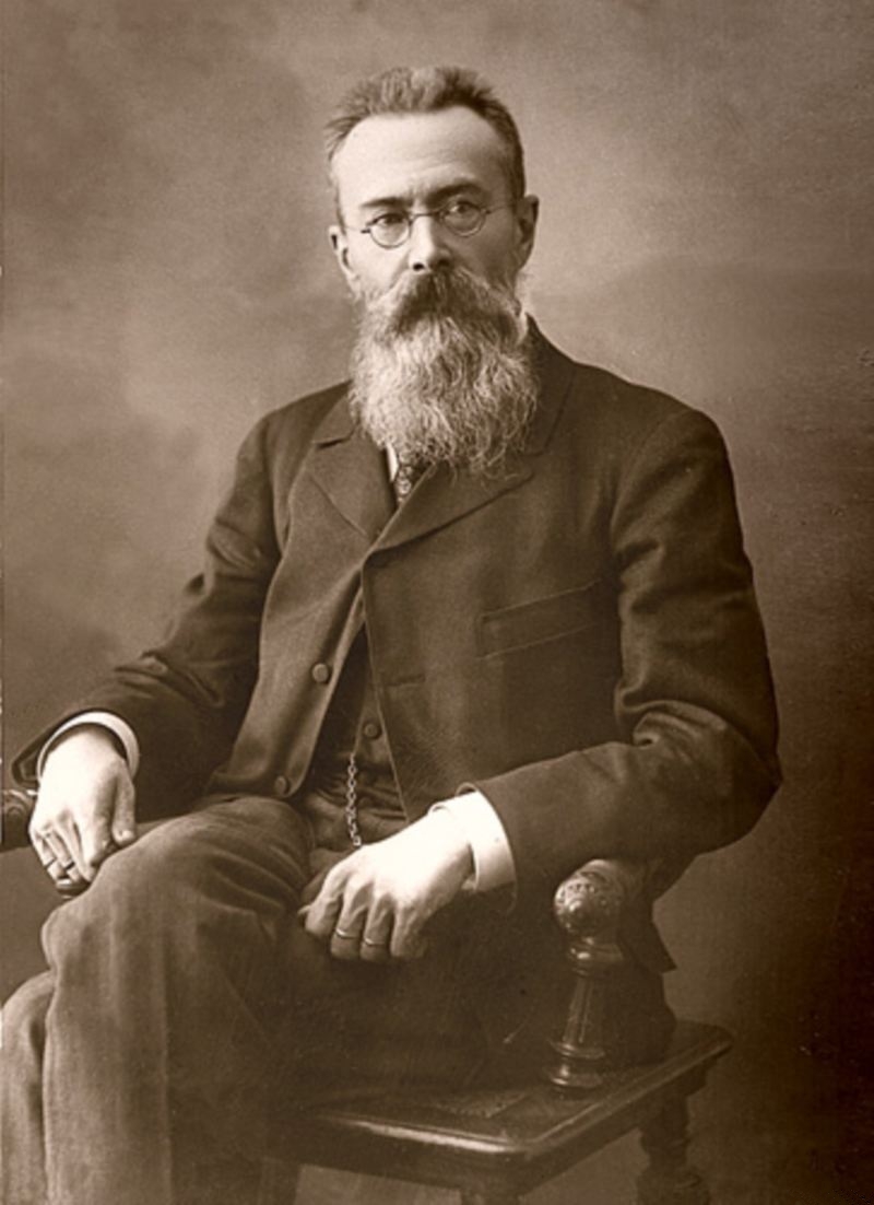
Great Composers: Nikolai Andreyevich Rimsky-Korsakov

Great Composers: Nikolai Andreyevich Rimsky-Korsakov

Born on March 6 (18), 1844, in Tikhvin, Novgorod Province, into the noble family of the Rimsky-Korsakovs, known for their traditions of naval service. The family home was located on the bank of the Tikhvinka River, opposite the Bogorodichny Assumption Monastery. The composer’s father, Andrey Petrovich Rimsky-Korsakov (1778–1862), served for some time as the vice-governor of Novgorod and later as the civil governor of Volyn; his mother, Sofya Vasilievna (1802–1888), was the daughter of a serf peasant and a wealthy landowner Vasily Fyodorovich Skaryatin (brother of Ya. F. Skaryatin). In his memories of his mother, the composer noted: “By the standards of the time, she received a good education. She was fluent in French, could play the piano, and in her youth mastered everything expected of a young lady in a wealthy family of the Alexandrian era.” A strong influence on the future composer was his elder brother, Voin Andreevich, a naval officer and future rear admiral. At six years old, Rimsky-Korsakov began home schooling, including piano lessons, but compared to books, music made less impression on him: among music, he preferred church music and Russian folk songs. At 11, he began composing his first musical works. In 1856, his father sent the travel-dreaming Nikolai to the Naval Cadet Corps. In 1858, the future composer developed a genuine passion for music. “I was a 16-year-old boy, passionately loving music and playing it,” he recalled later. Feeling the need for more serious musical education, from autumn 1859 Nikolai began taking lessons from pianist F. A. Kanille. In 1862, his father died, and the Rimsky-Korsakov family moved to Saint Petersburg. That same year, thanks to Fyodor Kanille, Nikolai met composer Mily Balakirev and became a member of his circle, which had a decisive impact on the formation of his personality and aesthetic views. At that time, Balakirev’s circle, later called “The Mighty Handful,” included besides its leader Balakirev and Rimsky-Korsakov himself, C. A. Cui and M. P. Mussorgsky. Balakirev guided the work of his younger colleagues, not only suggesting correct compositional solutions for their works but also helping with orchestration. Under the influence and guidance of Mily Alekseyevich, Rimsky-Korsakov began his first major work — the First Symphony. According to the composer himself, sketches of the symphony’s beginning existed during his studies with Kanille, but serious work on the composition unfolded only in 1861–1862 — and “by May 1862, the first movement, scherzo, and finale of the symphony were composed and somewhat orchestrated by me.” That same spring, Nikolai graduated with honors from the Naval Corps and was accepted as a midshipman for naval service. From 1862 to 1865, he served on the clipper Almaz, which took part in an expedition to the coasts of North America, allowing him to visit several countries — England, Norway, Poland, France, Italy, Spain, the USA, Brazil. Service on the clipper left no time for music, so the only composition from this period was the second movement of the First Symphony, Andante, written at the end of 1862, after which Rimsky-Korsakov temporarily set aside composing. The impressions of naval life later found expression in the “sea landscapes” that the composer managed to capture in his works through orchestral colors. Upon returning from the journey, Rimsky-Korsakov rejoined the society of Balakirev’s circle members. A milestone work for the composer was the musical picture “Sadko” (1867, later its music was partially used in the opera of the same name), the earliest of Rimsky-Korsakov’s programmatic compositions. In “Sadko,” Rimsky-Korsakov, later called a “storyteller,” first encountered the world of fairy tales; here he first used the symmetrical scale he invented, the so-called “Rimsky-Korsakov scale,” which he continued to apply to characterize the fantastic world in his musical works. Also, for the first time, the composer attempted to depict the sea element through orchestral colors (later he did this repeatedly in such works as the suite “Scheherazade,” the prelude-cantata “From Homer,” and the operas “Sadko” and “The Tale of Tsar Saltan”). Turning to the operatic genre, which later became dominant in his work, in 1872 the composer completed the opera based on Lev Mei’s drama “The Maid of Pskov.” In the summer of the same year, on June 30, he married pianist Nadezhda Purgold; one of the sponsors at their wedding was Modest Petrovich Mussorgsky. The 1870s saw the expansion of Rimsky-Korsakov’s musical activities: in 1871 he became a professor at the Saint Petersburg Conservatory, where he taught practical composition, instrumentation, and orchestration; from 1873 to 1884 he was inspector of the “musicians’ choirs of the Naval Department” (with a rank change from naval lieutenants to collegiate assessors); from 1874 to 1881 he was director of the Free Music School. Starting in 1874, the composer took up conducting — first symphonic concerts, then opera performances. From 1882, Rimsky-Korsakov headed the Belyayev circle; from 1883 to 1894 he was also assistant manager of the Court Singing Chapel with the rank of state councilor. From 1886 to 1900, he was the permanent conductor of the “Russian Symphony Concerts.” For example, on October 31 (November 12), 1887, the “Spanish Capriccio” was performed for the first time under Rimsky-Korsakov’s baton, and in 1888, in the Petersburg Hall of the Nobility Assembly, the composer conducted the performance of the “Sunday Overture,” which he dedicated to the memory of Borodin and Mussorgsky. In 1906, he was elected a member of the Royal Swedish Academy of Music. In the early 1890s, there was a certain decline in the composer’s creative activity: during this period he studied philosophy, wrote articles, and revised and edited some of his earlier works. Then his creativity gained exceptional intensity: one after another, operas appeared from his pen — “Christmas Eve” (1895), “Sadko” (1896), “Mozart and Salieri” (1897), the prologue to the opera “The Maid of Pskov,” and “The Tsar’s Bride” (based on Lev Mei’s drama, 1898). During the revolutionary events of 1905–1907, Rimsky-Korsakov actively supported the demands of striking students and openly condemned the actions of the administration of the Saint Petersburg Conservatory: he resigned and returned to the conservatory only after it was granted partial autonomous rights and leadership changed. In 1907, he was a member of the Committee for organizing “Historical Russian Concerts” in Paris. He died on June 8 (21), 1908, at the age of 64 from a myocardial infarction in Lyubensk, at his country estate, which now houses the composer’s Memorial Museum Complex, combining two reconstructed estates — the house in Lyubensk and the neighboring Vechas estate, where the composer lived until 1907. He is buried in Saint Petersburg at the Novodevichy Cemetery. In the 1930s, his remains were transferred to the Necropolis of Artists of the Alexander Nevsky Lavra.
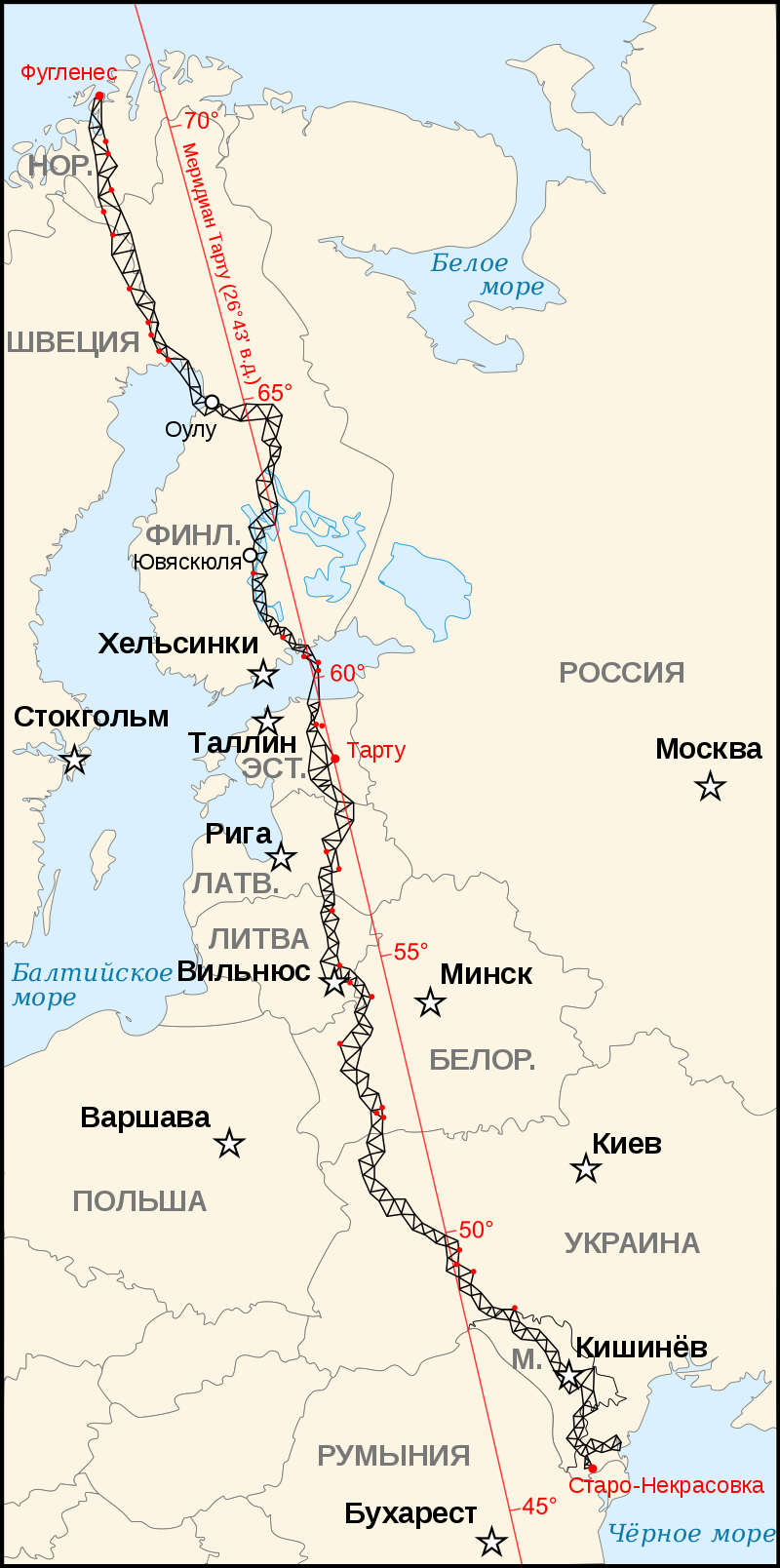
Struve Arc: Russo-Scandinavian Arc

Struve Arc: Russo-Scandinavian Arc

The Struve Arc is a chain of triangulation points stretching 2,820 km across the territories of ten European countries. The reference points of the meridian network were marked on the ground by hollows carved into rocks, iron crosses, stone pyramids, or specially erected obelisks. Monuments were installed at the terminal points of the Arc: the "Fuglenes Point" lies on the coast of the Barents Sea, near the North Cape and the Norwegian city of Hammerfest (70° 40′11″ north latitude), and the "Staro-Nekrasovka Point" is located in the Odessa region of Ukraine near the city of Izmail (45° 20′28″ north latitude). These reference observation points were established during the period 1816–1855 by the astronomer Friedrich Georg Wilhelm Struve (also known as Vasily Yakovlevich Struve), who thus carried out the first reliable measurement of a large segment of the Earth's meridian arc. This allowed for the precise determination of the size and shape of our planet, which was an important step in the development of Earth sciences and topographic mapping. The work related to the Russian arc was carried out under the auspices of the St. Petersburg Academy of Sciences. Measurements on the Scandinavian arc were conducted with the approval of King Oscar I of Sweden and Norway, through the joint efforts of Swedish, Norwegian, and Russian surveyors and officers, with the assistance of astronomers from the Pulkovo Observatory. In 1828, the renowned surveyor and cartographer, later Lieutenant General of the Russian Imperial Army, Iosif Khodzko, participated in connecting the Lithuanian degree measurement with the Livonian one, which was then being conducted by the director of the Dorpat Observatory, Vasily Struve. Struve’s measurement accuracy was very high: verification by satellite methods in the 20th century showed an error of only 2 cm. This was an exceptional example of scientific cooperation between scholars of different countries and between reigning monarchs. Initially, the "arc" consisted of 258 geodetic "triangles" (polygons) with 265 main triangulation points. The World Heritage site includes 34 such points (the best preserved to date), which are marked on the ground in various ways, such as hollows carved into rocks, iron crosses, stone pyramids, or specially erected obelisks. The purpose of the degree measurement is to determine the length of the meridian with an accuracy of one degree of arc to calculate the shape and size of the Earth using the results of precise geodetic, astronomical, and gravimetric measurements and observations. To prove that the Earth is not perfectly spherical, the Paris Academy of Sciences organized two expeditions in 1735: one to the equator in Peru, and another to the polar line in Lapland. At the same time, third-degree measurements were conducted in France. The expeditions of the Paris Academy of Sciences determined that the length of the meridian arc corresponding to 1° is 110.9 km at the equator, 111.3 km in Paris, and 111.9 km at the polar line. Thus, degree measurements proved that the Earth is flattened at the poles. In the 19th century, measurements over several degrees were conducted in Europe, India, and America. The most important among them were the Anglo-French degree from northern Scotland to Algeria (1783–1808) and the Russian Academy of Sciences’ measurements from the Arctic Ocean to the Danube during 1816–1855. Friedrich Georg Wilhelm Struve (1793–1864) was a German astronomer and surveyor, academician of the St. Petersburg Academy of Sciences since 1832, director of the Tartu University Observatory from 1820 to 1839, and professor of astronomy and geodesy at Tartu University from 1814 to 1838. He was the founder and director of the Pulkovo Observatory from 1839 to 1862. Karl Friedrich Tenner (1783–1859) was born in Virumaa County, Vaivara Parish, Auvere. He began studying geodesy in St. Petersburg in 1802. In 1809, he was tasked with creating a triangulation network from St. Petersburg through Narva to Tallinn, and from there to Tartu. In 1816, Tenner and his colleagues began creating triangulation in the territory of modern Lithuania. Based on an agreement concluded in 1828, the Struve and Tenner arcs were combined, with Tenner retaining the geodetic part and Struve the astronomical. The measurement of the meridian arc length was conducted from 1816 to 1855 under the leadership of astronomer Struve. The high accuracy for that time (±12 m) demonstrated the first precise measurement of a long segment of the meridian arc. Measurements of the meridian arc led to determining the length of the corresponding meridian arc (2,880 km) at 25° 20′, which was the largest degree measurement in the 19th century. Comparison of measurements of various sections of the Tartu meridian arc showed that the length of the arc corresponding to one degree of latitude increases unevenly toward the pole. The results of the meridian arc were used by Gauss to refine cartographic projections and by Bessel to determine the parameters of the ellipsoid (Bessel 1841). Further (final) processing of the Struve meridian arc measurement data was carried out on the Bessel ellipsoid. The Earth ellipsoid parameters determined by Bessel were used in Estonia until 1946, and in some countries (Indonesia, Japan, Korea, etc.) they are still used today. On July 15, 2005, in Durban, South Africa, a meeting of the UNESCO World Heritage Committee took place, at which the Struve Geodetic Arc was included in the list of World Heritage sites. To confirm this, each country was issued a certificate confirming that the Struve Meridian Arc is a UNESCO World Heritage site. The surviving points of the Struve Meridian Arc were added to the list from ten countries (a total of 34 points) as follows: Norway (4 points), Finland (6 points), Russia (2 points), Estonia (3 points), Latvia (3 points), Lithuania (3 points), Belarus (5 points), Moldova (1 point), and Ukraine (4 points). https://whc.unesco.org/en/list/1187
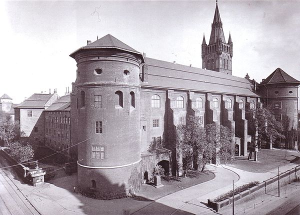
Kaliningrad: Order Castles

Kaliningrad: Order Castles

The network of castles in East Prussia, part of whose territory now belongs to the Kaliningrad region, began to take shape during the conquest of Prussia by the Teutonic Knights in the 13th century. The Order continued to build stone castles until 1410. In total, about forty castles were built on the territory of the present-day Kaliningrad region. Initially, the knights mainly used the fortresses of the Prussians. Such fortresses usually consisted of earthen ramparts and palisades and were located on hills. New castles (that is, castles located where there had previously been no Prussian fortresses) were also established as wooden fortifications. Later, the castles were rebuilt in brick and stone.

Kaliningrad: Churches Preserved or Restored

Kaliningrad: Churches Preserved or Restored

In the territory of East Prussia, stone churches first appeared in the second half of the 13th century, when the Teutonic Order founded the churches of Steindamm in 1256, Pörschken in 1261, Juditten in 1288, and some others. From the beginning of the 14th century, the widespread establishment of German towns and the construction of Catholic churches began in these lands, continuing until the defeat of the Teutonic Order in 1410. After that, the construction of churches slowed down, but from the mid-19th century it "revived" again and continued until the beginning of World War II. Many churches were seriously damaged during the First and Second World Wars. After the war, most churches were repurposed for economic needs, clubs, etc. Many were not used at all and gradually deteriorated due to natural forces and local residents dismantling the temples for building materials. Some churches were demolished to free up space for residential construction. In the 1980s–1990s, when attitudes toward the pre-war past of the region changed, conservation and restoration of some churches began (such as Arnau or Mühlhausen), with their transfer to the Russian Orthodox Church and Protestant communities. It is worth noting that often the conservation or restoration of churches was funded by former German residents of this region.

Kaliningrad: the ring of forts "The Night Featherbed of Königsberg"

Kaliningrad: the ring of forts "The Night Featherbed of Königsberg"

Königsberg, as a fortress, was built and rebuilt throughout the centuries, and the culmination of these continuous reconstructions was a powerful ring system of city forts, erected in the 19th century, blocking the approaches to the city. The ring was located about 5 kilometers from the city walls and consisted of 12 large and 3 small forts. The diameter of the ring was about 13 kilometers, with a total length of more than 40 kilometers. The distance between the forts was 2–4 kilometers, which ensured visual and fire communication between them. Where this was impossible due to terrain conditions, small (lettered) forts were arranged in the gaps between the large forts. They were significantly smaller in size and housed a garrison of up to a company with several cannons. The usual garrison of a fort consisted of 200–300 soldiers and 30–40 guns. The buildings of both large and small forts (casemates, caponiers, barracks) were brick with vaults at least 1 meter thick. A layer of earth about 3 meters thick was planned above the structures. All forts were given proper names in honor of famous German commanders and kings.

Kaliningrad: The Ancient City of Kings (Königsberg)

Kaliningrad: The Ancient City of Kings (Königsberg)

There are several versions of the origin of the name Königsberg. The most common version associates the name of the fortress Königsberg, meaning "King's Mountain," with King Ottokar II. According to this version, the fortress and the future city were named in honor of the King of Bohemia. Other versions of the toponym's origin link it to the Vikings or the Prussians. It is possible that "Königsberg" is a form of "Konungoberg," where "konung," "kunnigs" means "prince," "chieftain," "head of a clan," and the word "berg" can mean both "mountain" and "steep, high shore." In Russian chronicles and maps until the end of the 17th century, instead of the name Königsberg, the toponym Korolevets was used.

Kaliningrad: the ring of Königsberg fortifications in the mid-19th century

Kaliningrad: the ring of Königsberg fortifications in the mid-19th century

Königsberg (now Kaliningrad) was founded as a castle and remained a fortress city until the end of World War II. In military science, Königsberg was considered a "double tête-de-pont," meaning "a coastal fortress on both sides of the river." The city began with a castle in 1255 and developed a fortification-defense structure throughout almost its entire history: the Königsberg fortress-castle, city walls and defensive ramparts, city gates, forts. It developed so extensively that, except for World War II, it was never actually needed since the 13th century. Nevertheless, Königsberg responded promptly to every movement in European military engineering thought, building or rebuilding various fortresses, redoubts, outer rings of forts, or systems of pillboxes. If we mentally lay out all these structures into a fortification chain, we will see the following picture of the evolution of the fortress city.
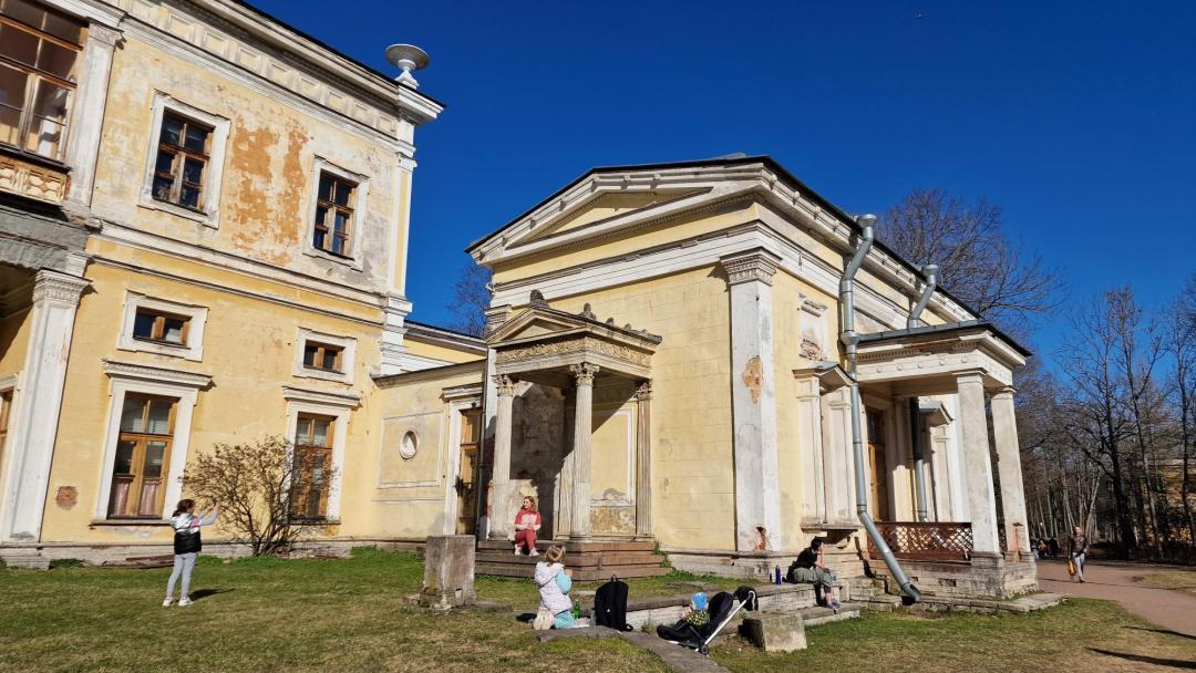
Petersburg: Estates of the City and Surroundings (Leningrad Region)

Petersburg: Estates of the City and Surroundings (Leningrad Region)

A couple of centuries ago, near Saint Petersburg, there were real luxurious estates. They began to appear alongside the development of Saint Petersburg, that is, already in the 18th century. By the beginning of the 20th century, there were about two thousand estates. Unfortunately, only about fifty of them have survived to this day. Some house museums, others are gradually being restored. And there are those estates in the Leningrad region that stand in an almost ruined state but still attract crowds of tourists with their former beauty. Mostly, all the estates occupied vast territories, which included a large manor house and a beautiful garden. Estates also had farm complexes, livestock yards, barns, and the land allowed for agricultural fields. Some estates often changed owners and were rebuilt, while others were true family nests passed down from generation to generation.

Derbent: One of the oldest "living" cities in the world

Derbent: One of the oldest "living" cities in the world

Derbent (from the Persian Derbend — "closed (bound) gates," Azerbaijani Dərbənd — "narrow gates") is located where the mountains of the Greater Caucasus come closest to the Caspian Sea, leaving only a narrow three-kilometer strip of plain; by closing it off, the city formed the so-called Caspian or Derbent Pass. The role of Derbent and the Derbent Pass in the formation of the Great Silk Road was significant, as it was situated in one of the most strategically important and topographically convenient locations of the famous Trans-Caspian route, connecting Eastern Europe and the Near East. Derbent is one of the oldest "living" cities in the world and the southernmost city of the Russian Federation. Archaeological excavations have determined its age to be over 5,000 years. The first settlements appeared here in the Early Bronze Age — in the 4th millennium BCE. The first mention of the Caspian Gates, one of the ancient names of Derbent, dates back to the 6th century BCE, cited by the ancient Greek geographer Hecataeus of Miletus. Chares of Mytilene, who described events of the 8th–7th centuries BCE, writes about a fortress that existed here from the 4th century BCE. The ancient Greek historian Herodotus was among the first to provide information about the Caspian Pass in the 5th century BCE. The strategic importance of the Caspian Pass attracted many nomadic steppe tribes — Scythians, Sarmatians, Mongols, Alans, and others. Here lay one of the most important sections of the Great Silk Road, as a crossroads of civilizations connecting East and West, North and South, via several maritime and overland routes. One of the Great Silk Road routes passed through Derbent. The Seleucid Empire also showed great interest in the city; its first expedition was organized under Seleucus I in 290–281 BCE. In 66–65 BCE, military campaigns by Lucullus and Pompey took place in the Caucasus, with one of their main objectives being the capture of Derbent. Throughout its history, the fortress on the Caspian was alternately controlled by Albanians, Persians, Arabs, and Russians. The keys to the city of Derbent were presented to the Russian Emperor Peter I during the Persian campaign, also known as Peter I's Lezgin campaign in Persia. It was only in 1813 that Derbent was finally annexed to the Russian Empire. According to several authors, an important fact in Derbent's history, as part of Caucasian Albania, was the adoption of Christianity in 313 CE, making it the northern outpost of this state and the main Christian stronghold against Zoroastrianism and other forms of paganism. From the 5th century CE, the city began to actively develop, along with fortification construction aimed at protecting the Near East from a new wave of various nomadic steppe tribes. Between 439 and 457 CE, fortifications were built by Yazdegerd I on the foundations of the former fortress laid by the local population of Albanian origin. Between 488 and 531 CE, the mudbrick walls were replaced with stone masonry by Khosrow I Anushirvan, who, according to legend, built these fortress walls extending over 60 kilometers (some fragments of these walls have survived to this day). The fortress began to take on the appearance that has been preserved to the present time. From the fortress, located at the foot of the mountain range, two walls descended to the sea, blocking the Caspian Pass, designed to protect the city and the trade route. A new stage in the development of Derbent is associated with the Arab invasion in the 7th century CE; however, they were able to firmly establish control only under Maslama ibn Abd al-Malik in 733–734 CE. With the Arab conquest of Derbent, the city became the main stronghold of the Caliphate in the Caucasus, an important military, political, and ideological center. Derbent became the largest medieval port city, a crucial center of international transit trade between East and West, North and South, with developed crafts (pottery, glassmaking, metalworking, jewelry, stone carving and construction, weaving, carpet making, paper production, silk, soap) and agriculture (farming, gardening, cultivation of saffron, madder, cotton, flax, etc.). Trade caravans and ships arrived here from Khorasan, Khwarezm, India, China, Rus, Volga Bulgaria, and others. A monumental witness to the era of the great migration of peoples, one of the main strongholds of the Great Silk Road, and an outstanding monument of defensive architecture, the Derbent fortress complex served defensive functions for 1,500 years. It includes the Naryn-Kala fortress, to which lead two long city walls that completely blocked the pass and extended far into the sea, forming a port. In 2003, UNESCO recognized the old part of Derbent as a World Heritage Site.

Veliky Novgorod: Attractions, Stories, People, and Legends

Veliky Novgorod: Attractions, Stories, People, and Legends

The official founding date of Novgorod is considered to be the year 859, based on the first mention of the city in the later Nikon Chronicle (16th century). In the "Tale of Bygone Years," created in the 12th century, the city is first mentioned under the year 862. However, the chronicles may have retrospectively attributed the city's existence to this time, since reliably dated archaeological layers of Novgorod date no earlier than the 930s. According to archaeologists, Novgorod appeared roughly at the turn of the 9th–10th centuries or in the early 10th century at the source of the Volkhov River from Lake Ilmen. In the second quarter of the 10th century, the first bridge over the Volkhov was built. In 1136, Novgorod became the first free republic on the territory of feudal Rus' (from this point, the powers of the Novgorod prince were sharply limited). From the 12th to the 15th centuries, Novgorod was part of the Hanseatic trading league. For the period starting from 1136 and ending in 1478, when Novgorod lost its political independence (as a result of the victory of the Moscow prince Ivan III the Great over the Novgorodians), the term "Novgorod Republic" is used in relation to the Novgorod land (the government of the latter used the designation "Lord Great Novgorod"). Novgorod was not subjected to the Mongol invasion; although it paid tribute to the Horde, it preserved unique monuments of ancient Russian pre-Mongol architecture (the most famous of which is the St. Sophia Cathedral) and was the only one among the ancient Russian cities to avoid decline and fragmentation in the 11th–12th centuries. In 1569–1570, Novgorod suffered the oprichnina massacre under Ivan the Terrible, accompanied by mass killings of townspeople. From 1611 to 1617, the city was under Swedish control. After the founding of Saint Petersburg, the city lost its economic significance, in particular remaining off the main trade routes. Since 1727, Novgorod became the center of Novgorod Governorate. Since 1927, it has been part of Leningrad Oblast. During the Great Patriotic War, the city was occupied by the Germans and almost completely destroyed. After liberation, it again became a regional center, was rebuilt, and many historical buildings were restored.