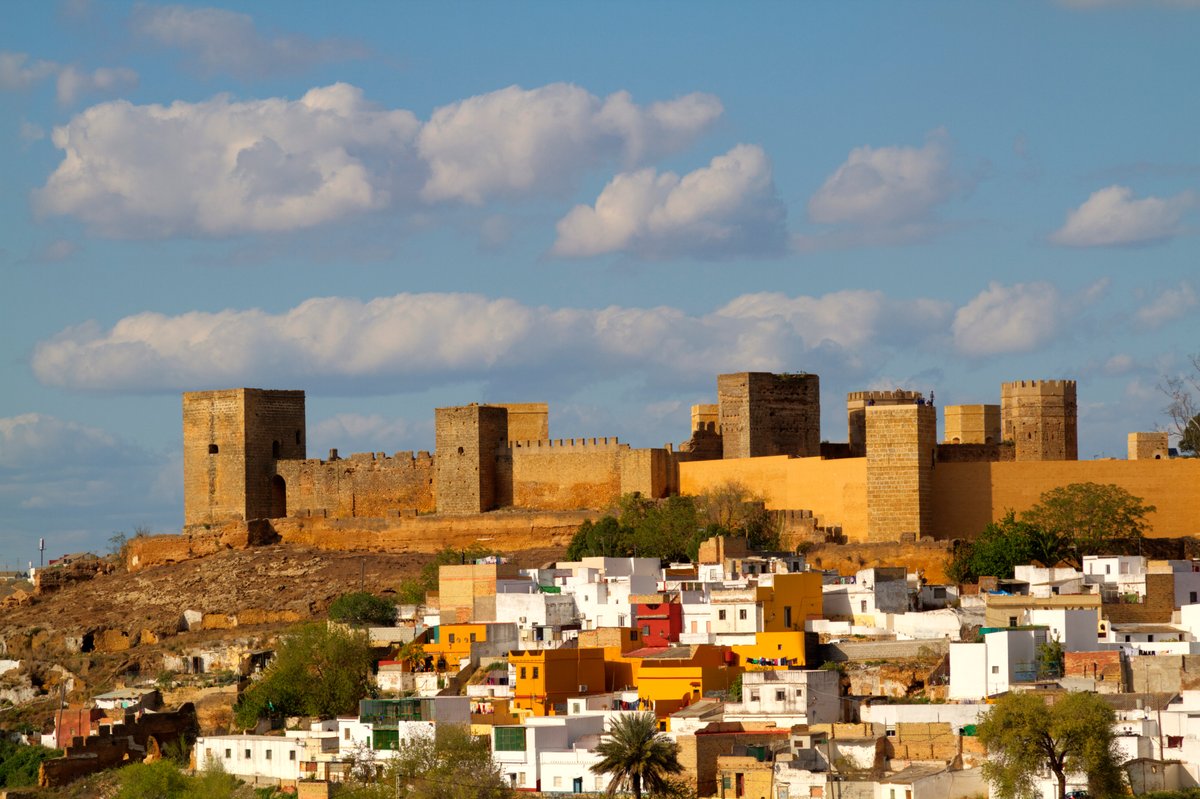

The Castillo de Alcalá de Guadaíra is not just a single building but a sprawling complex of fortifications. It sits on the Cerro del Castillo, tucked into the western edge of the town where the Guadaíra river carves a sharp meander through the land. This site served as a strategic gateway, holding the line between Seville and the frontier with Granada.
The structure evolved through centuries of military necessity. While the complex would begin with a first Iberian settlement, the fortification generally occurred between the second half of the 12th and first third of the 13th centuries. From the middle of the 13th century until the beginning of the 14th century, the fortification took its definitive form, supported on previous Almohad constructions and layouts. The core of the current work was built from the Castilian conquest of Alcalá in 1246 until the mid-14th century. By the late 15th century, the fortress saw a final major renovation when it became a base of operations for Rodrigo Ponce de León, a Marquis who used these walls to launch campaigns against the neighboring cities of Seville and Jerez.
Walking the site today, you can still trace the distinct internal sections. To the south lies the Patio de la Sima, adjacent to the Patio de los Silos. Further west, the third courtyard, which is smaller, features residential structures of a palatial style. To the east stands the Torre Mocha, a formidable alcazaba with complex masonry that reflects layers of modifications over the centuries.
Sources: Wikipedia, OpenStreetMap, Wikidata, Wikimedia Commons
Written by Nik Frost
Discuss this with the author and others
No comments yet. Be the first to start the conversation.