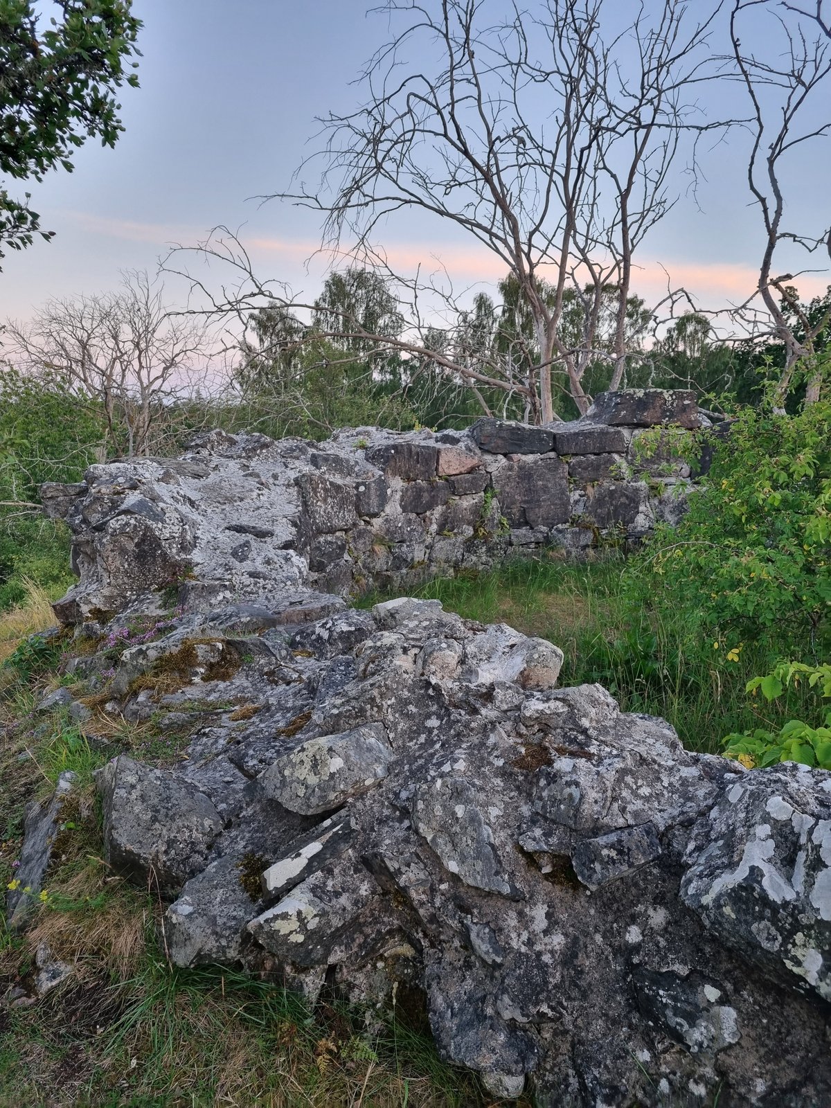

The limestone remains of the Uttersbergs kastal occupy a strategic rise above the farmsteads and Svintuna lake. This defensive tower dates to the 1100s and functioned as a component of a larger fortification network following the old Eriksgatan road.
Scholars believe its proximity to the royal road made it an ideal stopping point for noble entourages. It is considered a plausible site for the exchange of hostages between people from Sörmland and Östergötland in connection with the royal roads. While local lore suggests the tower served as a prison for the former Krokek monastery, historical research dismisses this as a folk legend.
We find the masonry walls to be roughly a meter thick, featuring a polygonal exterior of seven or eight corners surrounding a circular interior.
This structure persisted even as the identity of the area shifted. The name Uttersberg was only formalized in 1665 when Peder Månsson Utter united nearby farms to build a manor house right beside the tower until the early 1700s.
Today, the tower remains a preserved landmark within a sheep pasture. The ruin is up to three meters high with a diameter of approximately eight meters.
Sources: Wikipedia, OpenStreetMap, Wikidata, Wikimedia Commons

Written by Nik Frost
Discuss this with the author and others
No comments yet. Be the first to start the conversation.