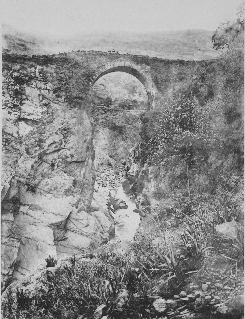

For more than three hundred years, the Ponte de Salime served as a vital artery between Asturias and Galicia. It occupied a dramatic position in the landscape, located in the ozca coñecida como El Carpio where the Navia river flows between the peaks of Buspol and Bornela. This was the only crossing point for the last seventy kilometres of the river's journey.
Built in the first half of the 16th century, specifically in 1548, the bridge featured a single stone semicircular arch. It sat roughly 40 metres above the riverbed at a narrow point. To reach it from the south, travellers had to navigate a sharp descent from Verducedo and a subsequent, arduous climb known as A costa de Grandas to reach the village of Salime.
The bridge collapsed in 1936 when a landslide on the right bank of the river caused the structure to fall, claiming two lives. The bridge was rebuilt in 1938 using four reinforced concrete half-vaults weighing nearly six tonnes each. It remained in use until 1953, when the construction of the Salime reservoir flooded the area, submerging the bridge and the surrounding village.
Today, the bridge is gone, lost beneath the waters of the reservoir. Most of the original village of Salime is also underwater, though one house remains standing today as a solitary survivor above the maximum water level.
Sources: Wikipedia, OpenStreetMap, Wikidata, Wikimedia Commons
Written by Nik Frost
Discuss this with the author and others
No comments yet. Be the first to start the conversation.