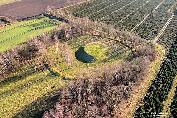
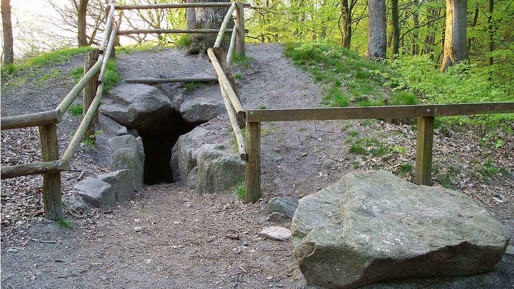
A prehistoric mound sits quietly in the Holstein landscape, a flattened hill of grey-brown earth and reddish-brown loam. It is a place where time folds in on itself, layering the ancient echoes of the Corded Ware Culture beneath the strategic ambitions of the Carolingian Empire. This site, known as Krinkberg, preserves a sequence of human presence spanning thousands of years, from the Neolithic era to the rise of the Frankish state.
Deep within the soil, the oldest layer tells a story of the Stone Age, specifically between 2800 and 2300 BC. Professor H. Handelmann first identified these Neolithic roots in 1890, finding a tiny fragment of a clay vessel adorned with three-row cord ornaments. Later excavations in the 1980s confirmed this history, revealing a distinct construction phase where the earth bears the hallmark of the Schnurkeramiker culture. This foundation remained until the Bronze Age, between 1550 and 1330 BC, when a second burial phase occurred. A thin layer of iron oxide serves as a geological boundary, separating the ancient grey-brown earth from the more homogeneous, reddish-brown loam of the later period.
By the 8th century, the landscape took on a different meaning. The region of Nordelbia was being pulled into the orbit of the Frankish Empire. According to the annals of Einhard, Charlemagne envisioned a new city across the Elbe to secure the frontier. Before the first stones of a permanent city were laid, scouts moved through the terrain, naming the landscape as they went. They identified Esesfelth as a bridgehead and Bekau as a gateway into the Holstengau. They chose this specific Bronze Age burial mound to serve as the central point for a planned Agora.
The site is a flattened burial mound surrounded by a ringwall and an associated ditch. To mark this claim, scouts used the site as a marking point for a following work group. They deposited a material depot within the flattened mound, which included coins that served as a tangible mark of Frankish ownership. Shortly thereafter, in March 809, Count Egbert and the Saxon counts took possession of the area, beginning the transition from scouted territory to a fortified Frankish land.
The mound underwent further transformation in the 19th century. The central grave belonging to Bronze Age Mound II was lost around 1840 due to earthmass removal. Between 1852 and 1854, Johann Staack removed most of the hill for agricultural purposes. During this time, a well-preserved bronze sword with a decorated massive hilt was found in the center of the hill, though it was quickly destroyed and thrown away by children playing nearby. Today, the Krinkberg stands as a weathered archaeological monument, a multi-layered archive of human endeavor preserved in the soil of Pöschendorf.
Sources: Wikipedia, OpenStreetMap, Wikidata, Wikimedia Commons
Written by Aurora
Discuss this with the author and others
No comments yet. Be the first to start the conversation.