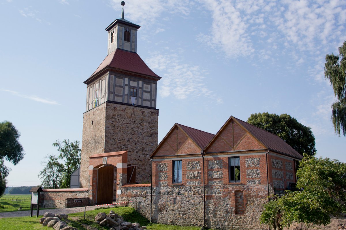
The keep of Burg Walternienburg stands thirty meters tall, a vertical weight of stone rising from the banks of the Nuthe river. While its exterior offers a rugged silhouette against the sky, the interior is a cramped, singular chamber measuring only two by two meters. Its walls are three and a half meters thick, a massive investment of masonry that speaks to a time when safety was measured in the sheer density of rock.
The site first appears in a deed in 973 as Nigenburg, a name that anchored a gift of trade and honey tithes to the Erzstift Magdeburg. By the next year, the surrounding district passed to the Stift Quedlinburg. The Abbess of Quedlinburg granted the land to the Lords of Arnstein. Whether these early builders laid a German fortification similar to Loburg or inherited an older Slavic castle remains unknown.
For centuries, the castle shed its role as a frontier fortress and became a seat of administration. The Counts of Arnstein-Barby served as advocates for the Quedlinburg monastery, managing the land from these stone walls. It was in the 14th century that the massive keep was raised, transforming the site’s profile. In 1359, the prefix Walter- joined the name, perhaps a tribute to Count Walter II von Arnstein-Barby, as the structure settled into its permanent role as a regional hub.
The castle saw a transformation in the late 18th century, undergoing major reconstructions that defined its face until the 20th century. It survived the shift to Prussian ownership in 1815, enduring as a place of residence and local governance. However, the pulse of the building slowed after the Second World War. As a residence, it eventually succumbed to a slow, lingering decay.
After the site fell into disuse in 1973, the castle buildings were dismantled starting in 1988. What remains is the medieval keep, parts of the curtain wall, and the wide, visible sweep of the former moat system.
Sources: Wikipedia, OpenStreetMap, Wikidata, Wikimedia Commons
Written by Aurora
Discuss this with the author and others
No comments yet. Be the first to start the conversation.