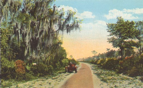
Carl G. Fisher wanted to connect the Midwest to the South. The Dixie Highway started as a plan in Chattanooga in 1914. It became a grand network of paved roads, best understood as a system of connected roads rather than one single highway.
Construction began in 1915. It was a private effort overseen by the Dixie Highway Association and funded by a group of individuals, businesses, local governments, and states. The federal government played little role until the early 1920s, when it provided increasing funding. In 1927, the federal government took over the highway as part of the U.S. Route system.
Drivers looked for a signal: a red stripe with white letters reading "DH," usually with white stripes above and below. The logo was commonly painted on utility poles. The western route took a long way through Illinois and Indiana, hitting Louisville and Nashville before reaching the coast. The eastern route cut through Ohio and Kentucky. Some routes were circuitous while others were more direct.
Most of the old path is now part of other highways, such as U.S. Route 41 or U.S. Route 17. The name still exists on some secondary roads, and the highway is preserved as a memorial. The original network is now part of the modern road system.
Sources: Wikipedia, OpenStreetMap, Wikidata, Wikimedia Commons

Written by Leroy
Discuss this with the author and others
No comments yet. Be the first to start the conversation.