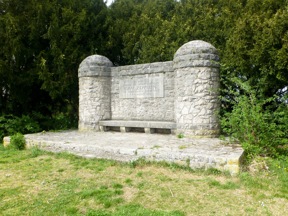
The monument is located on the right bank of the Rhine at Rhine kilometer 480, opposite the town of Nierstein. Built in 1909, it sits on the Kornsand in Geinsheim, marking a single evening in August 1908 when a Zeppelin owned by Count Ferdinand von Zeppelin made an emergency landing.
That year, Count Ferdinand von Zeppelin launched the LZ 4 from Friedrichshafen. The goal was a long-distance test flight to Echterdingen, a voyage intended to prove to the military that airship technology could conquer great distances. The ship moved toward Mainz and Mannheim, but a motor defect stole its lift. By 17:24, the LZ 4 was forced into an emergency landing on the Kornsand.
Local farmers dropped their tools and left their fields to help. They moved with purpose, unloading empty gasoline tanks and surplus gear to lighten the vessel. Five people had to disembark from the airship during the emergency. After a five-hour break, the Zeppelin resumed its journey at 22:22, lightened by 1270 kg, and continued its trek until it finally caught fire in a fruit tree during a thunderstorm in Echterdingen.
The memorial was built just one year later. The community of Geinsheim inaugurated it in a small circle of people who had actually participated in that long-distance flight. Its shape reflects the Buhnen, the mooring structures the LZ 4 used while it waited for its strength to return. The structure consists of nearly unhewn natural stones joined in a mosaic-like fashion, with two pylons approximately three meters high connected by a two-and-a-half-meter-high wall of masonry.
Today, the site is a grove-like sanctuary managed by the Staatlichen Schlösser und Gärten Hessen. A stone bench sits before the central plaque, tucked between the protruding pylons. The inscription on the stone is simple; it tells you why the monument exists but remains illegible from a distance.
Sources: Wikipedia, OpenStreetMap, Wikidata, Wikimedia Commons


Written by Aurora
Discuss this with the author and others
No comments yet. Be the first to start the conversation.