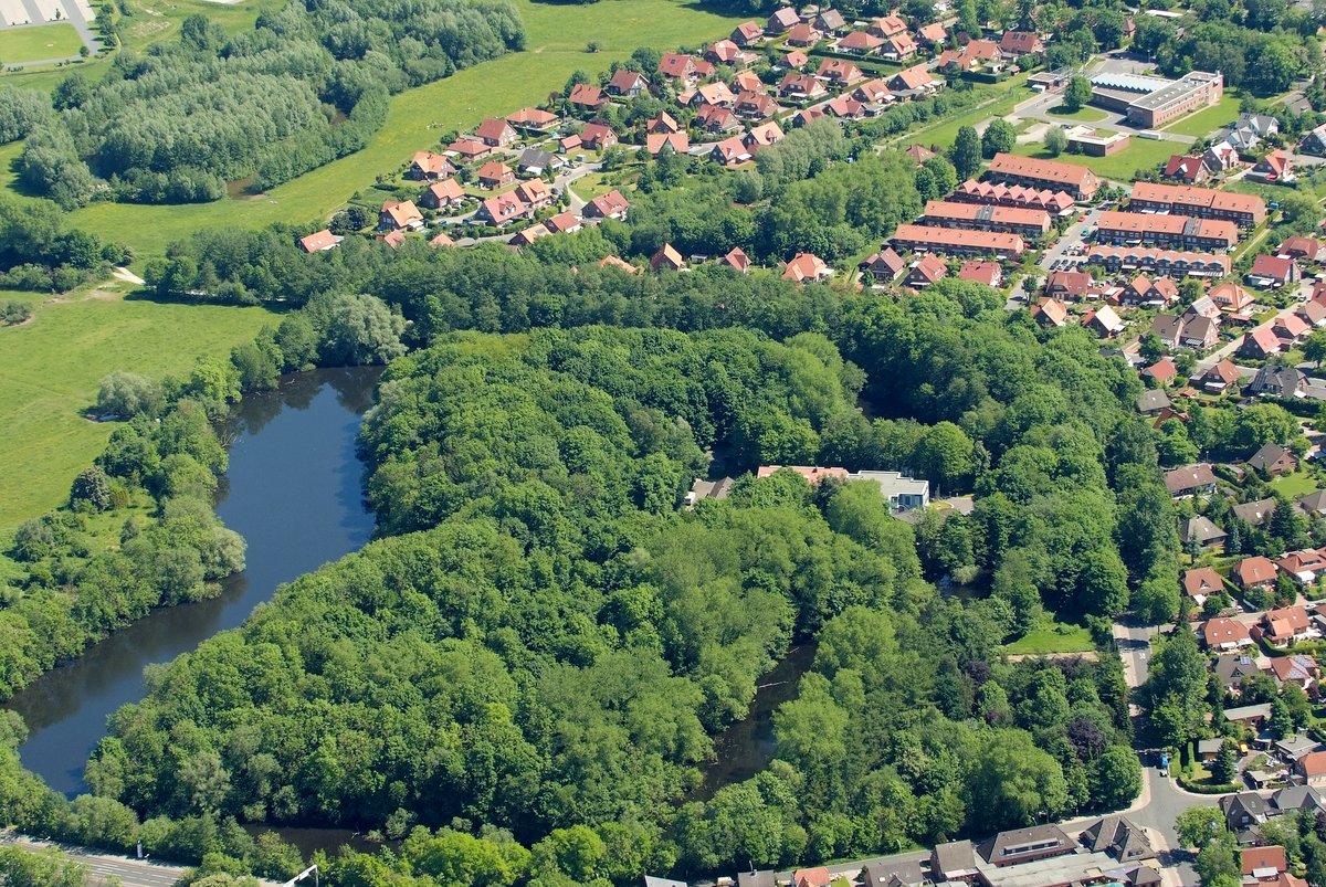
Fort Rüstersiel was part of the Wilhelmshaven fortress plan to protect the Prussian navy port. Located in the Rüstersiel district near the Maade, it is the best-preserved fort of the Wilhelmshaven fortress system. The scale of the structure is significant - it has a total length of 420 meters from southwest to northeast and a width of 265 meters. The complex features a ditch up to 70 meters wide and walls up to 6 meters high.
Construction of the Maade forts, including Rüstersiel, Mariensiel, and Schaar, was announced in the Wilhelmshavener Zeitung on August 4, 1876. Work began shortly after, and by June 24, 1878, General von Voigt-Rhetz inspected the progress. The project ended on November 4, 1880. To allow the military to flood the surroundings in case of an attack, wooden sluices were rebuilt as stone sluices.
Initially, the fort was armed with two 15-cm-Kanonen-L/22, ten 15-cm-Ringkanonen, and eleven 12-cm-Kanonen and 9-cm-Kanonen, later shifting to 6-cm to 15-cm flat-trajectory guns. The III. Stamm-Seebataillon was stationed in Rüstersiel before World War I as a replacement for the East Asian Kiautschou. Logistics were handled via a fortification road equipped with an ammunition railway connecting Fort Rüstersiel to Fort Heppens.
After 1918, the fort served as an ammunition depot. A park called Delepark, named after landlady Adele Tiesler, was built directly outside the ditch. After World War II, the trees of Delepark were cut down for fuel. In 1948, the British blew up the brick-built casemates of the fort.
Today, the site has been under landscape protection since 1968. Since 1966, it has served as the home of the Institute for Bird Research 'Vogelwarte Helgoland'. The site remains a study in preservation, having shifted from a military role to a sanctuary for wildlife.
Sources: Wikipedia, OpenStreetMap, Wikidata, Wikimedia Commons
Written by Aurora
Discuss this with the author and others
No comments yet. Be the first to start the conversation.