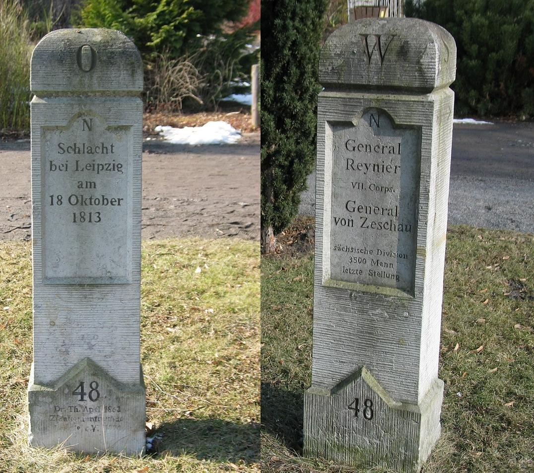
A solitary pillar of stone stands here, a quiet marker of a loud and violent history. It is an Apelstein, one of fifty monuments scattered across the landscape to trace the movements of the Battle of Leipzig in 1813. These stones were not placed by the state or the military, but by the private hands of a local man, the writer Theodor Apel, who spent his own funds between 1861 and 1864 to map the chaos of the past.
To understand these markers, one must look at the geometry of their heads. They are rectangular pillars of stone, roughly one and a half metres tall, but their tops tell the story of allegiance. For the Coalition forces, the stones wear a pointed head - an inverted V - to signify the Verbündete. The Napoleonic forces are marked with a rounded head and the letter N. On the narrow sides, two arrows point the way, indicating the exact course of the front line as it moved through the fields. Even the numbering followed a strict logic: up to marker number 42, even numbers belonged to the Coalition and odd numbers to Napoleon.
The inscriptions are split between two sides of the stone. One face, oriented toward the battlefield, names the specific engagement and its date. The opposite side offers the technical data of war: the names of the commanders, their troop designations, and the total strength of their forces. It is a dense archive of information compressed into a single block of masonry. On the heads of the stones, the cardinal directions are noted, ensuring that anyone who finds them can orient themselves within the old geography of the fight.
Time has been less kind to the original materials. Because the soft sandstone proved too fragile against the elements and the encroaching city, many stones were replaced during the 19th century. These copies often vary in size or shape, such as the tapered versions found in western Leipzig, and some even feature added bases or toppers. In the rush to preserve the memory, some copies even contain small errors in the text. Yet, they remain standing as a precise, physical transcription of a day when the continent's fate shifted.
Today, the stone remains a point of reference for the walker and the historian alike. It is a fragment of Theodor Apel's labor, a man who published a guide in 1863 to help others navigate these battlefields. While the smoke of 1813 has long cleared, the arrows on the side of the stone still point toward where the front once stood, holding a map in plain sight.
Sources: Wikipedia, OpenStreetMap, Wikimedia Commons





Written by Aurora
Discuss this with the author and others
No comments yet. Be the first to start the conversation.