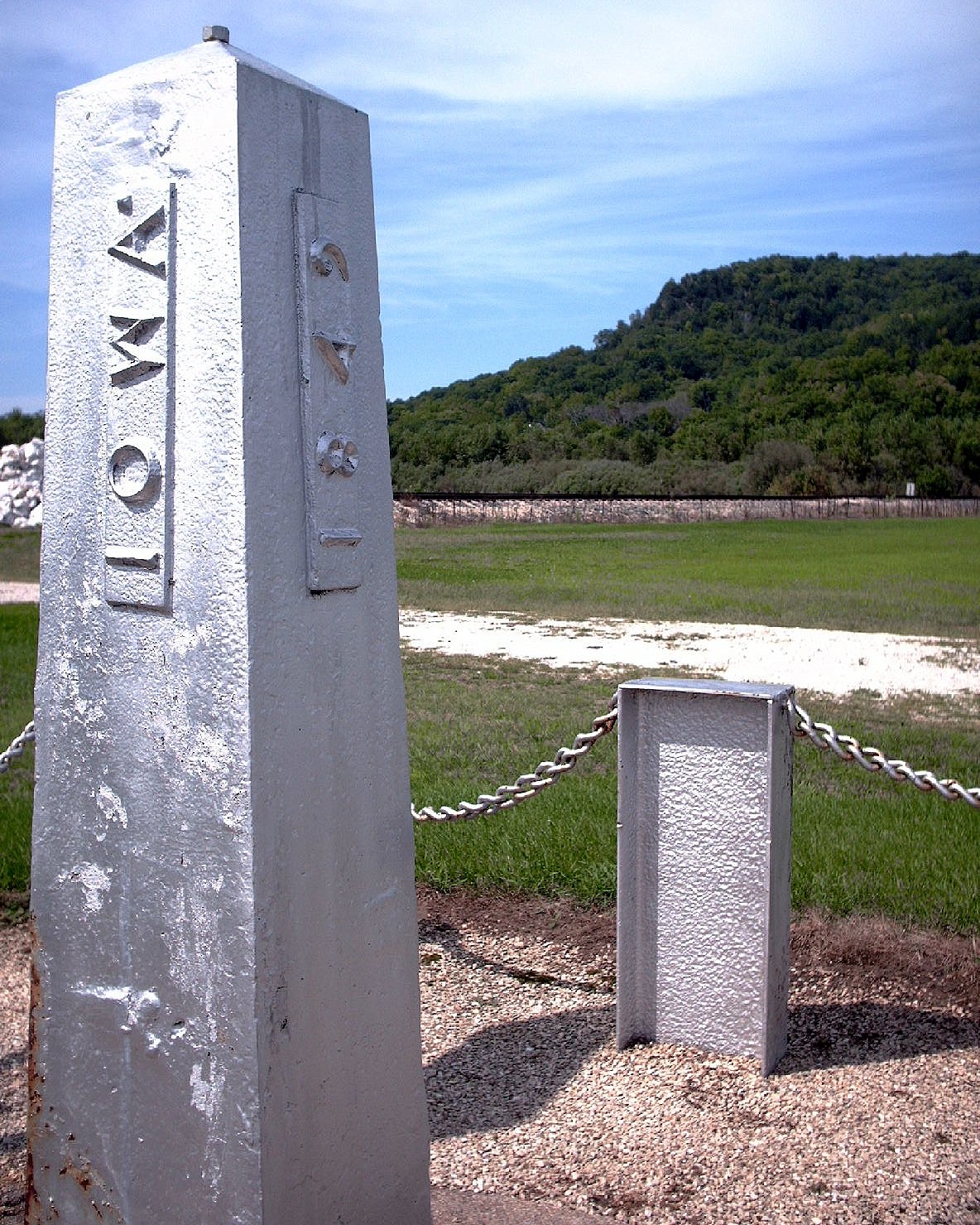

This cast iron obelisk isn't just a piece of lawn art; it is a literal boundary line. In 1849, the U.S. Congress was trying to settle a messy border dispute between Iowa and the Minnesota Territory. They landed on a specific latitude, and Captain Thomas Lee of the U.S. Army Corps of Topographical Engineers was sent out to make it official.
John Ross hauled the post across the frozen Mississippi River from Victory, Wisconsin, using a sled pulled by a team of oxen. The 54-inch obelisk was placed here to mark the border between the two entities, which the United States Congress had designated on August 4, 1846, as Iowa's northern border.
If you look closely at the four faces of the post, you can see the history of the work. It marks the border with "Iowa" on the south side and "Minesota" on the north (the records keep the original spelling). The east face shows the year 1849, while the west side records the latitude. It also served as a practical surveying base for the territory all the way to the Big Sioux River.
It was added to the National Register of Historic Places in 1976. Today, it remains a steady, aluminum-colored sentinel marking where one state ends and another begins.
Sources: Wikipedia, OpenStreetMap, Wikidata, Wikimedia Commons


Written by Friendly Jane
Discuss this with the author and others
No comments yet. Be the first to start the conversation.