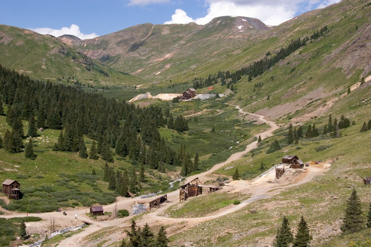

This ghost town, riding at an altitude of 11,185 feet (give or take 25 feet, depending on the story), is the highest mining camp in all of North America. Back in the day, it was a bustling hub, housing 450 people. But those days are long gone, leaving only a pile of rusted, weathered tombstones that used to be wooden buildings. So, what happened? You guessed it: mining. This haul, located 12 miles (or 19 km, if you're an international mining fan) northeast of Silverton in San Juan County, Colorado, United States, had its time in the spotlight–a boom, a bust, a temporary rebound, another bust, and then, the sweet silence.
The first log cabin was erected in 1873, and the Animas Forks post office was established on February 8, 1875. By 1883, 450 people called Animas Forks home. A newspaper, the Animas Forks Pioneer, started publishing in 1882 and ceased in October 1886. Every fall, the inhabitants of Animas Forks would jog south to the balmier town of Silverton. In 1884, a 23-day blizzard blanketed the town with 25 feet (7.6 meters) of snow; the residents had to dig tunnels to get from building to building.
Mining, speculation, and processing mills fueled the growth of Animas Forks. However, when mining profits began to dwindle, investing in Animas Forks was no longer profitable. Although mining saw a brief rebound in 1904 with the construction of the Gold Prince Mill, the town's mining days were numbered. The Silverton Northern Railroad, constructed in 1896, revitalized interest in mining in the community, but the railroad never reached its full potential.
The Gold Prince Mill shut down in 1910, and the Animas Forks post office closed on November 30, 1915. By 1917, most of the mill's key components were removed for a fresh facility in Eureka. The mill's dismantling signaled the beginning of the end for Animas Forks. The town was deserted by the 1920s. Today, the site continues as a tourist attraction. A grant from the Colorado State Historical Fund to San Juan County, in collaboration with the Bureau of Land Management, funded the stabilization of the remaining structures in 1997 and 1998.
In 2011, the townsite was listed on the National Register of Historic Places, opening up opportunities for additional funding. The initial stabilization effort of the late 1990s was followed up with a comprehensive restoration of the buildings in 2013–2014. Work identified in the 2009 Historic Structures Assessment was completed under two subsequent grants from the State Historical Fund, wrapping up in 2014, just in time for the celebration of the 25th Anniversary of the establishment of the Alpine Loop Scenic Byway.
Sources: Wikipedia, OpenStreetMap, Wikidata, Wikimedia Commons
Written by Friendly Jane
Discuss this with the author and others
No comments yet. Be the first to start the conversation.