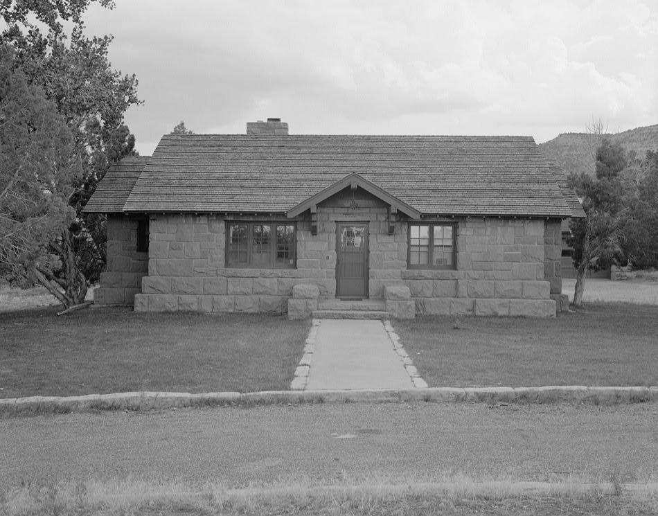
The Saddlehorn Caretaker's House and Garage, also known as the Stone House, the Rock House, and the Superintendent's Quarters, is a house and asset listed on the National Register of Historic Places in the Colorado National Monument. Designed in 1934 by architect W.G. Carney, the structure was built between 1935 and 1936. Its construction was funded by money appropriated from the Emergency Conservation Work (ECW) Act of 1933, and the project was administered by the Public Works Administration.
Members of the Civil Conservation Corps (CCC) built the house, with many workers hired through New Deal Relief appropriations. These workers were trained by locally sourced stonemasons and carpenters. Construction materials included locally sourced red sandstone from the immediate vicinity and the Rim Rock Drive construction project. The house and garage were designed to shelter CCC workers who were based out of Camp NM-2-C, which was set up at the Monument Canyon trail-head in March 1933 before being moved to a more permanent location at Saddlehorn.
In 1935, plans were drawn up for a baseball field, a permanent administration building, a recreation hall, a mess hall, a latrine, and five barracks. Records from the park's Chief Ranger indicate that one of the structures was set on fire as a fire training exercise. The last buildings of the camp were removed in the early 1960s when newer facilities were built elsewhere. As of June 2020, the National Register of Historic Places lists the house and garage as 'vacant/not in use'.
The exterior of the structure is gabled, of moderate rise, and covered with cedar shingles. The main structure at the gable ends has weatherboard wood siding with exposed log purlin ends and louvered vents. The residence features one off-center coursed ashlar sandstone chimney, while the two small wings at either end have gabled roofs. All wood trim is painted rust color. The interior features a living room, two bedrooms, a kitchen, and a bathroom, with the kitchen, bathroom, and basement having been remodeled in 1973.
Sources: Wikipedia, OpenStreetMap, Wikidata, Wikimedia Commons


Written by No Other
Discuss this with the author and others
No comments yet. Be the first to start the conversation.