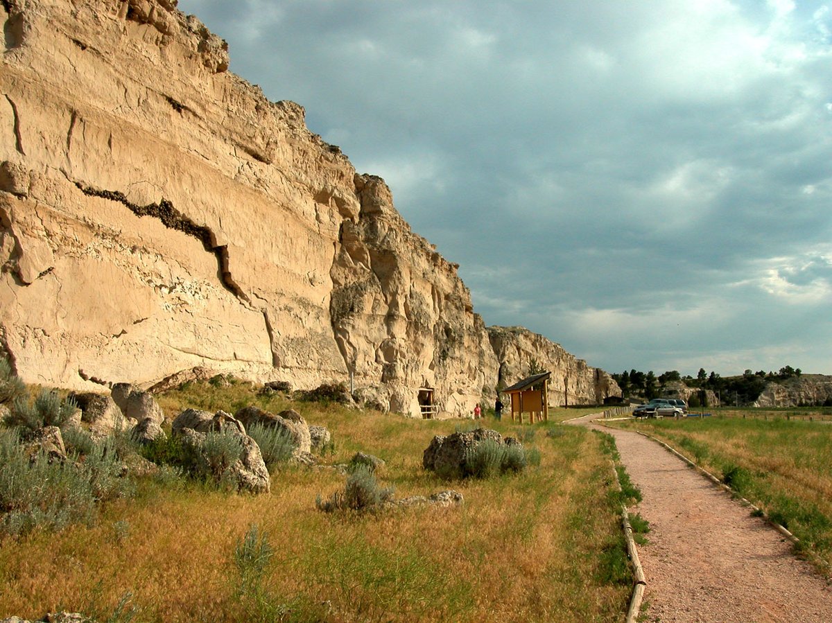

Register Cliff is a sandstone cliff and a key navigational landmark featured prominently in 19th-century guidebooks about the Oregon Trail. Rising more than 100 feet above the North Platte River, the site consists of horizontal layers of sedimentary rocks eroded by water, wind, and rain. It served as a critical checkpoint for parties heading west along the Platte River valley, allowing travelers to verify they were on the correct path toward South Pass and not moving into impassable mountain terrain.
During the western migrations of the 19th century, hundreds of emigrants followed the custom of 'registering' by chiseling their family names into the soft stones of the cliff. This site is the easternmost of three prominent emigrant recording areas in Wyoming, the others being Independence Rock and Names Hill. An estimated 500,000 emigrants used these trails from 1843 to 1869, with up to one-tenth dying along the way, usually due to disease.
The site was listed on the National Register of Historic Places in 1969. According to its nomination, it was a place where emigrants would camp on their first night west of Fort Laramie. The property was donated by Henry Frederick to the state of Wyoming to be preserved.
Sources: Wikipedia, OpenStreetMap, Wikidata, Wikimedia Commons



Written by Friendly Jane
Discuss this with the author and others
No comments yet. Be the first to start the conversation.