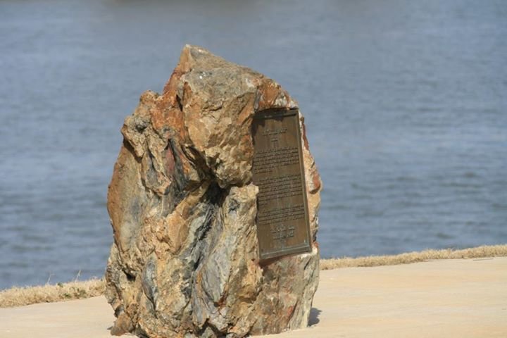
First identified as a significant river landmark in 1722 by French explorer Jean-Baptiste Bénard de la Harpe, the Little Rock is a stone outcrop projecting into the Arkansas River from its south bank. Today, the stone supports a pier of the Junction Bridge crossing the river, and a portion of the outcrop has a bronze plaque mounted on it.
In 1818, the rock was used as a survey marker, forming the starting point for land surveys in the region south of the river. It was originally estimated to rise about 18 feet above the river.
The Little Rock was listed on the National Register of Historic Places in 1970. It serves as the eponym of the city of Little Rock, Arkansas.
Sources: Wikipedia, OpenStreetMap, Wikidata, Wikimedia Commons



Written by Leroy
Discuss this with the author and others
No comments yet. Be the first to start the conversation.