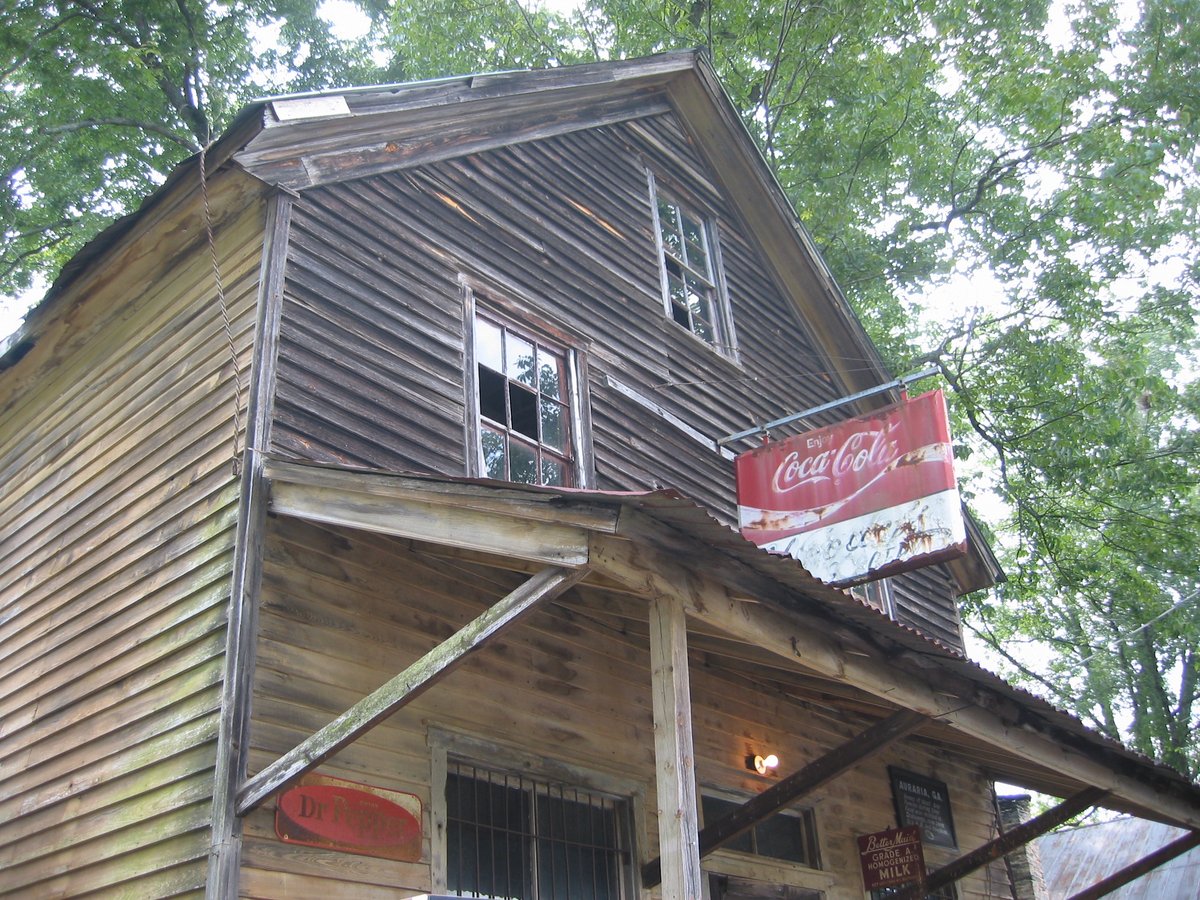

Auraria, Georgia: A town born in gold, a town that became a gold rush hub, and a town that eventually went belly-up. Let's take a step back in time and learn about this once-thriving gold town in Lumpkin County, Georgia.
Auraria, named for the Latin word for gold, was a gold-rush boomtown established in 1832. Thousands of settlers came to these former Cherokee lands in search of gold. One of the first was William Dean, who built a cabin in Auraria in June of that year.
The first session of the Superior Court of Lumpkin County met in what became known as Dahlonega, Georgia. Auraria experienced a sharp decline as businesses and county offices relocated to that area. Due to its location and political influence, Dahlonega received a federal mint for gold coins.
In its early days, Auraria was home to several taverns, hotels, and even a bank. John R. Plummer won the 40-acre gold lot on which most of Auraria stood. The banks of the Etowah River, Camp Creek, and Cane Creek had many mines, including the Barlow Mine, Battle Branch Mine, Ralston Mine, Whim Hill Mine, Hedwig-Chicago Mine, Gold Hill Mine, and Etowah Mine.
But as the gold rush in Georgia declined, Auraria's population began to dwindle. The discovery of gold in California and soon after in Colorado caused a mass exodus of miners, leading to the decline of gold mining in Georgia and eventually its cessation. Auraria's population quickly dwindled, and the community deteriorated.
Today, there are still a few old buildings standing: Woody's store located at Castleberry Bridge Road, once open till the early 1980s; a red house, once a bank; another house across the street; and a couple of foundations. To visit Auraria, travel from the square in Dahlonega on the west road to Dawsonville, pass the college (the gold-domed building built on the foundation of the old mint) and turn left at the bottom of the hill after passing the college. Continue about 3 miles to reach Auraria, located on Castleberry Bridge Road. The old red house on the left is the bank and after it, there previously was a collapsing building (the remains of which were removed in the early 2010s), which was the old hotel, and just beyond on the left is the old Woody's store. Castleberry Bridge Road leads down to the Etowah River.
Sources: Wikipedia, OpenStreetMap, Wikidata, Wikimedia Commons
Written by Friendly Jane
Discuss this with the author and others
No comments yet. Be the first to start the conversation.