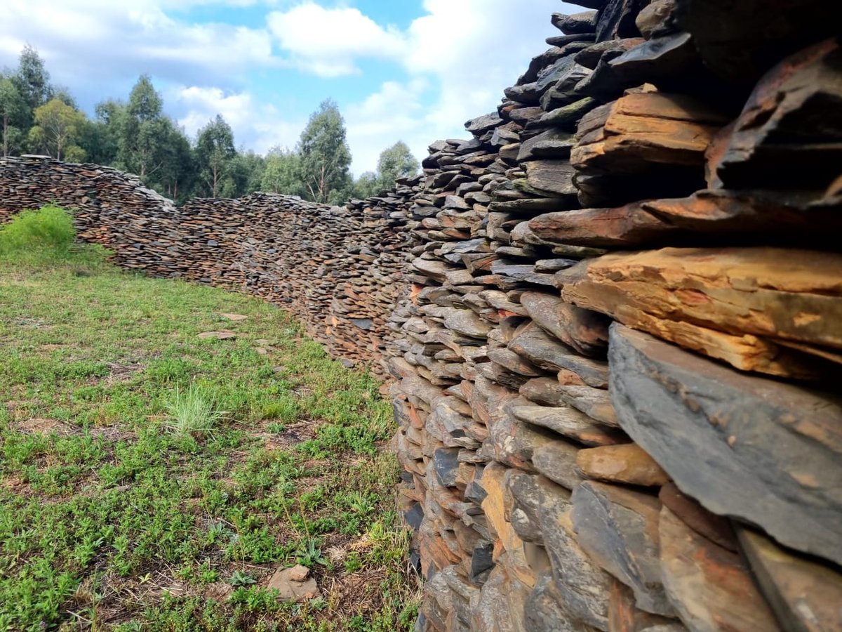

The Blaauboschkraal stone ruins are a provincial heritage site in the Mpumalanga province of South Africa. These ruins are part of a large, complex stone walling system built by the Bokoni people, who are estimated to have settled the region between the 16th and early 19th centuries. The site was declared a national monument on 18 April 1975 and is recognized by the South African Heritage Resources Agency.
Located on a steep-sided valley where the Blouboskraalspruit river flows, the ruins are assumed to have been used for housing, cattle enclosures, and agricultural terracing. The Bokoni people built these settlements during the third phase of their civilization, a period characterized by an increasing threat of domination from outside invaders. To increase defense, they built refugee settlements in steep-sided wooded valleys, like the kloof where the Blaauboschkraal ruins are situated, instead of their traditional open-valley homesteads.
The stone walls are built from local stone, featuring an outer structure of larger stones filled with smaller ones and topped with flat slabs. While the exact height of the ruins is unknown, similar walls in the region reach up to 2 metres tall. The inner circular structures likely served as homesteads, while the more complex walling around them functioned as kraals to prevent livestock - including cattle, sheep, goats, and chickens - from grazing on crops.
The site also features agricultural terracing designed to retain moisture and protect soil from erosion in a region with high annual rainfall. This intensive food production allowed the Bokoni to trade agricultural products along the Zimbabwe-Portuguese trade route. The location of the ruins was likely influenced by its proximity to water, which facilitated this trade with the rest of the world.
Sources: Wikipedia, OpenStreetMap, Wikidata, Wikimedia Commons

Written by Mutabor
Discuss this with the author and others
No comments yet. Be the first to start the conversation.