All collections

Every collection on Reveal.World, grouped by the language it is written in.

Great Architects: Andrey Ivanovich Stakenschneider

Great Architects: Andrey Ivanovich Stakenschneider

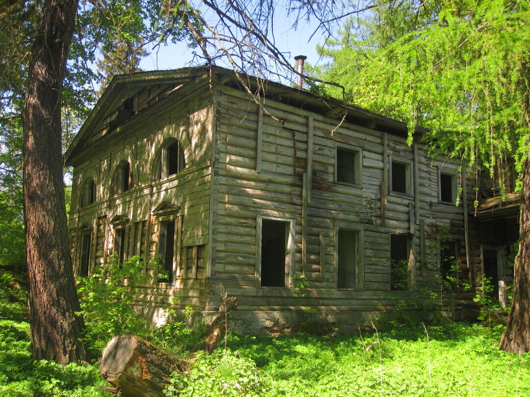
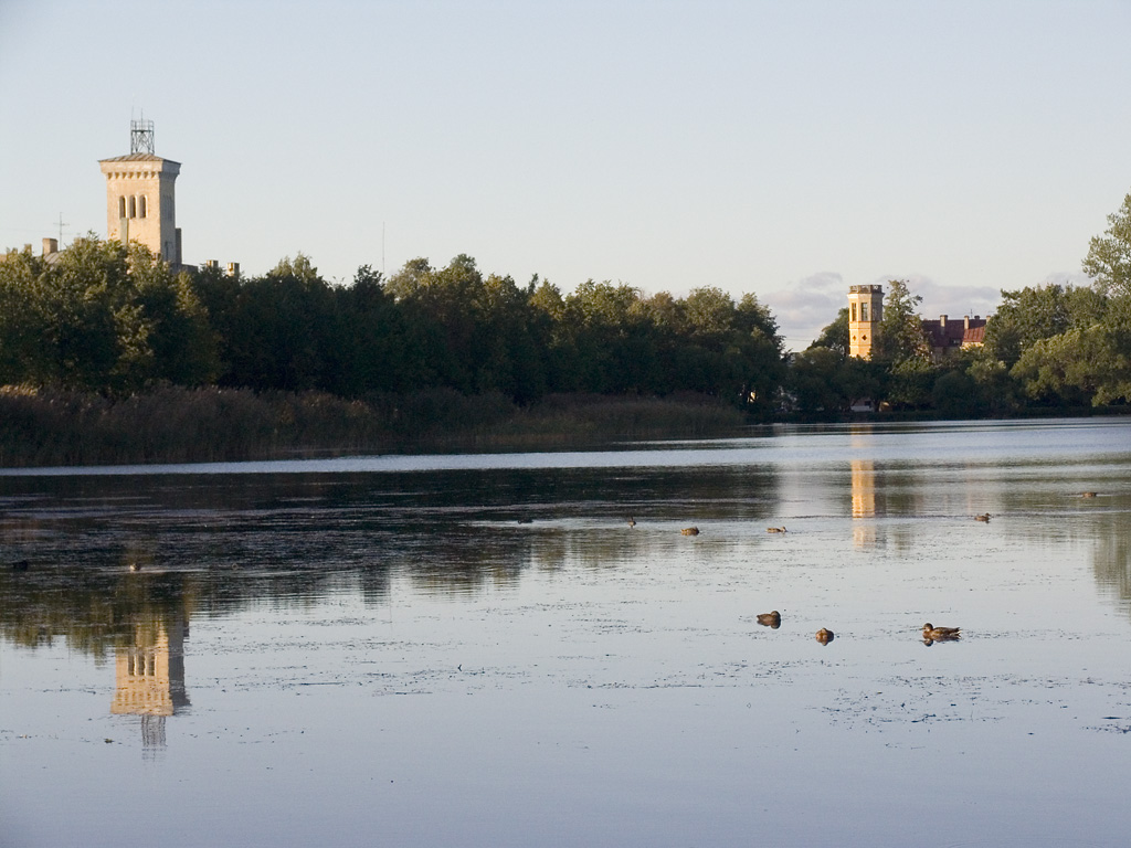
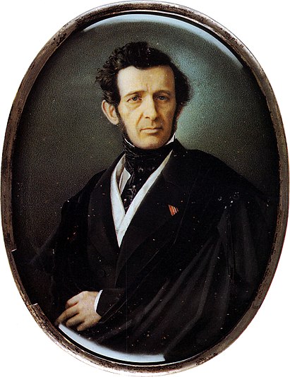
Andrey Ivanovich Shtakenshneider was born on February 22 [March 6], 1802, in the Shtakenshneider estate, Gatchina district, Saint Petersburg province. He died on August 8 [20], 1865, in Moscow. A great Russian architect who built imperial residences and grand ducal palaces in Saint Petersburg and its suburbs. A prominent representative of the first generation of eclectic architects in Russia. Professor of the 2nd degree at the Imperial Academy of Arts, actual state councilor.
Prison Islands

Prison Islands

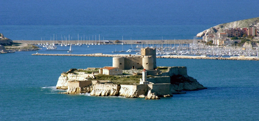
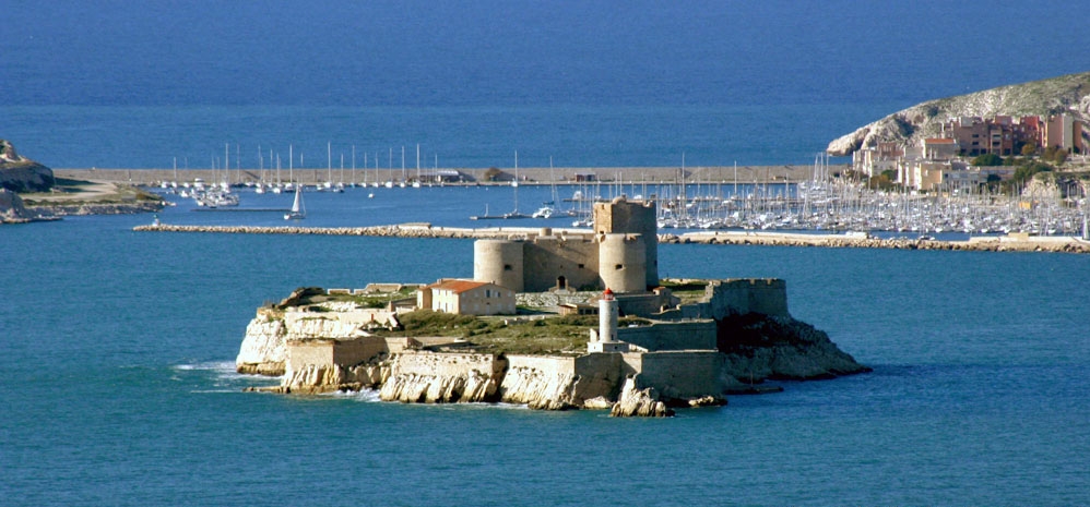
There are several islands in the world that serve or have served as prisons or places of confinement. The advantage of island prisons is their almost complete isolation from the outside world. Where are these "Châteaus d'If" located and who are their inhabitants? Below is a selection of the most famous island prisons in the world.
Imperial Parks: Sergievka, Sobstvennaya Dacha, and Ropsha

Imperial Parks: Sergievka, Sobstvennaya Dacha, and Ropsha

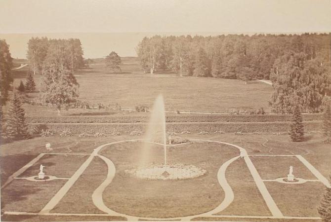
These parks are the perfect option for a secluded countryside walk. Their relative remoteness from Peterhof and Lomonosov allows you to stroll along shady alleys and by the ponds almost alone. The landscape parks, created in the first half of the 19th century on the site of a natural forest area, have partially preserved their original layout and the character of the vegetation.

Russia: UNESCO Sites or Sites Protected by UNESCO

Russia: UNESCO Sites or Sites Protected by UNESCO

The UNESCO World Heritage List includes 30 sites in the Russian Federation, which accounts for 2.6% of the total number (1154 as of 2021). Nineteen sites are included based on cultural criteria, with six of them recognized as masterpieces of human genius, and eleven sites are included based on natural criteria, with four of them recognized as natural phenomena of exceptional beauty and aesthetic importance. In 2017, Russia ranked 9th in the world in terms of the total number of World Heritage sites, and 4th in terms of the number of natural sites (after China, the USA, and Australia).
World: Prison Hotels

World: Prison Hotels

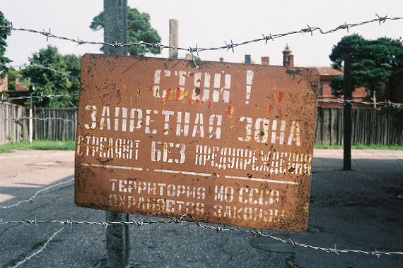
Prison hotel – this is a new type of hotel built in gloomy, barred abandoned prisons to justify the money spent on reconstruction and thus preserve buildings protected as historical monuments. This type of hotel is chosen by travelers seeking adventurous, themed hotels to experience firsthand what it’s like to sleep "behind bars." Some hotels additionally offer prison uniforms as pajamas, similar to those worn by inmates. Tourists can also stand trial or even spend the night on prison bunks. Sometimes it is possible to visit museum-style replicas of cells. To date, existing hotels of this type on four continents do not fit into any specific hotel category but cover various price segments.

Petersburg, suburbs: The Secrets of Pushkin

Petersburg, suburbs: The Secrets of Pushkin

The city of Pushkin is famous for the monument of landscape art and world architecture located on its territory — the Tsarskoye Selo Museum-Reserve, known for its rich history, beautiful palaces, magnificent decoration of the famous Amber Room, and the amazing Catherine and Alexander Parks. Pushkin was the place of the lyceum years of the famous Russian poet Alexander Sergeyevich Pushkin, as well as the school years of Anna Akhmatova and Gumilev. Every year in October, the city hosts a traditional literary and musical evening dedicated to the anniversary of the Imperial Tsarskoye Selo Lyceum.

Imperial Parks Mariental and Babolovsky

Imperial Parks Mariental and Babolovsky

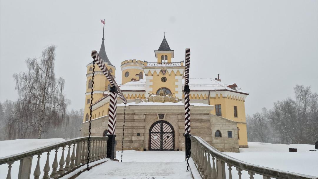
The "Mariental" Park is the second largest park in the city of Pavlovsk (Pushkinsky District of Saint Petersburg). It is located between Sadovaya Street, Krasnogo Kursanta Street, Mariinskaya Street, Elizavetinskaya Street, Hospital Street, and Prosveshcheniya Street. The park was laid out in the 1790s according to a design by architect C. Cameron. At the same time, the Mariental Palace (German: Marientahl — Maria's Valley) was built, named in honor of Maria Feodorovna, the wife of Russian Emperor Paul I. In 1798, a fortress called "BIP" was constructed on the site of the palace. Babolovsky Park is one of the five well-known parks in the city of Pushkin (along with Ekaterininsky, Alexandrovsky, Otdelny, Buffer Parks, and the once-existing Fermsky Park). The park is located between the southern part of the city of Pushkin and Aleksandrovskaya, northwest of Krasnoselskoe Highway in the city of Pushkin. The main attraction of the park is the Babolovsky Palace.

Romantic Ronda

Romantic Ronda

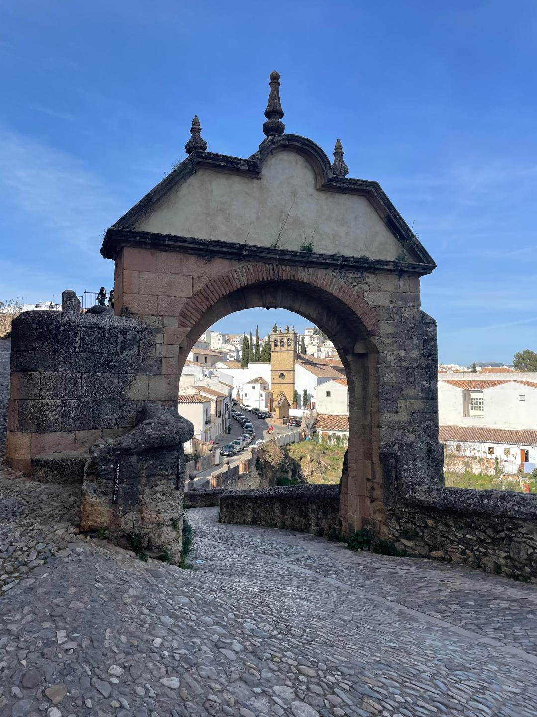
What do Cervantes, Rilke and Hemingway have in common? They all loved Ronda! Hemingway famously wrote that "Ronda is the place where to go, if you are planning to travel to Spain for a honeymoon or for being with a girlfriend. The whole city and its surroundings are a romantic set. Nice promenades, good wine, excellent food…"

World: Prison Islands, Active and Historical

World: Prison Islands, Active and Historical

There are several islands in the world that serve or have served as prisons or places of confinement. The advantage of prison islands is their almost complete isolation from the outside world. So where are these "Château d'Ifs" located, and who are their inmates? Below is a selection of the most famous prison islands in the world.
Karelia: Interesting and Unusual

Karelia: Interesting and Unusual

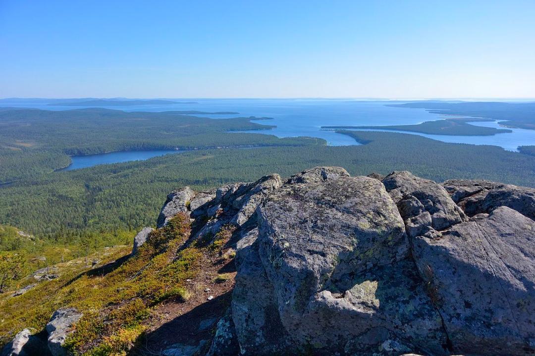
Almost the entire territory of modern Karelia was once inhabited by the tribe "Lop" (self-designation – “Saami”), between Lake Ladoga and Lake Onega lived the tribe "Ves" (Vepsians), and to the west and north of Lake Ladoga lived the "Korela" (modern name – “Karelians”). In the 10th-11th centuries, the southern part of Karelia came under the influence of the ancient Russian state, Slavic settlements began to appear, and Christianity was adopted. In the 17th century, Korela passed to Sweden and was returned to Russia only in 1721, after the defeat of the Swedes in the Great Northern War. The number of monasteries grew rapidly at that time, with the Solovetsky Monastery becoming particularly powerful. The Great Northern War (1700-1721) gave a strong impetus to the industrial development of Karelia. During this period, metallurgy actively developed, and several new factories were built. The largest of these gave rise to Petrovskaya Sloboda. By decree of Empress Catherine II, Petrovskaya Sloboda was renamed the city of Petrozavodsk, and from 1784 it became the center of the Olonets Governorate, whose first governor was the poet G. R. Derzhavin. In 1917-18, Soviet power was established in Karelia. In 1940, Karelia acquired a new status — the Karelo-Finnish SSR — and became the sixteenth union republic. Its territory expanded due to new districts that were annexed to the USSR after the war with Finland.

Peterhof and Surroundings

Peterhof and Surroundings

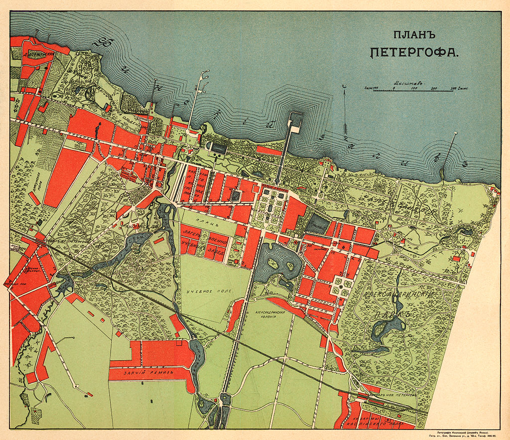
Peterhof, translated from German, means "Peter's Court." Having reclaimed these lands from the Swedes, Peter I ordered the founding of a city here. It began in the western part of modern Peterhof, where the "merchant" pier now stands. It was here that two chambers were built, where Peter stayed when he traveled by shore to Oranienbaum and further to Kotlin. Peter I greatly desired that his city and suburbs would differ little from the luxurious European capitals of that time.
Imperial Parks of Peterhof: Alexandria, Znamenka, and Mikhailovka

Imperial Parks of Peterhof: Alexandria, Znamenka, and Mikhailovka

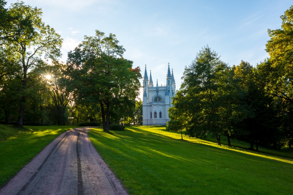
Date of formation: 1826 - 1832, Architects: A.A. Menelas, A.I. Shtakenshneider Garden master: P.I. Erler, Park area - 115 hectares The Alexandria Park is named after its first owner – Empress Alexandra Feodorovna, wife of Nicholas I. Sun, flowers, shady groves of old oaks, the "music of the water" of the stream, the expanses of meadows merging with the bay under the bottomless sky – all this is Alexandria, the family nest of four generations of the Romanov dynasty. Znamenka (formerly also known as the Znamenka Manor, Znamenka Dacha) — a former estate on the Peterhof Road, a grand ducal residence. To the west lies the "Alexandria" park, to the east — the "Mikhailovka" estate. Bounded by the Gulf of Finland to the north, and by the Peterhof Road to the south. It occupies an area of 74 hectares. Mikhailovka (also "Mikhailovskaya Dacha" and "Mikhailovskoye Estate") — a 19th-century palace and park ensemble on the Peterhof Road, which before the revolution belonged to the descendants of Grand Duke Mikhail Nikolaevich Romanov, son of Emperor Nicholas I.

Imperial Parks of Peterhof: Kolonistsky Park

Imperial Parks of Peterhof: Kolonistsky Park

Colonists' Park is a 29-hectare landscape park in Peterhof. Colonists' Park was created based on a design by architect A. I. Stackenschneider during the reign of Nicholas I. A special role in the creation of the park was played by the chief gardener of the Peterhof Palace Administration, P. I. Erler. The boundaries of Colonists' Park are: to the south — Erler Boulevard, to the east — Borodacheva Street, to the north — the embankment of Olgin Pond, and to the west — the Samsonievsky Pond Canal.

Bolgars: The Northern Mecca (In the Footsteps of the Golden Horde)

Bolgars: The Northern Mecca (In the Footsteps of the Golden Horde)

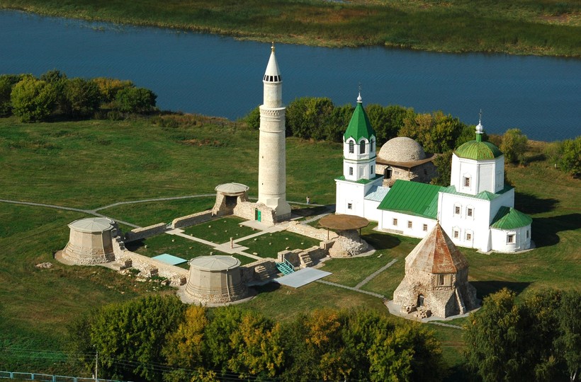
The city of Bolgar in Tatarstan, located on the banks of the Volga River, is a historic settlement of the Volga Tatars, the "Northern Mecca" of the Muslim world. Once, there was an ancient Bulgar fortress here, which in the 13th century transformed into a popular craft and trade hub connecting Rus with the East, and later became the capital of the medieval Golden Horde — Volga Bulgaria.

Pskov Region: Iconic Places

Pskov Region: Iconic Places

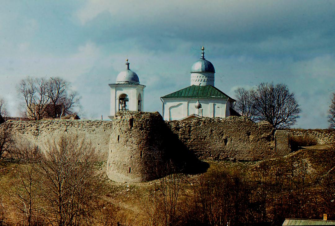
Under Vasili III, in 1510, the Pskov Republic was abolished, and its territory was annexed to the Grand Duchy of Moscow (the Russian state). The symbol of Pskov’s independence — the veche bell — was taken down and transported to Moscow. Pskov became a western outpost on the way to Moscow, and its suburbs Voronich, Ostrov, Opochka, Vrev, Vybor, Velie, and others became lines of defense meant to protect the borders of Russian lands. These were fortresses that bore the first blows of the enemy.
Great Writers: Vladimir Nabokov: "A Single Path — and Many Roads..."

Great Writers: Vladimir Nabokov: "A Single Path — and Many Roads..."

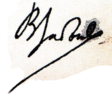
Vladimir Nabokov was born in St. Petersburg on April 22 (April 10 old style), but he celebrated his birthday on the 23rd. This confusion arose due to the discrepancy between the old and new style dates — at the beginning of the 20th century, the difference was not 12 but 13 days. Vladimir Nabokov liked to emphasize: “In the very last of my passports, the ‘date of birth’ is indicated as ‘April 23,’ which is also Shakespeare’s birthday.” About himself, Vladimir Nabokov said: “I am an American writer born in Russia, educated in England, where I studied French literature before moving to Germany for 15 years.” Throughout his life, he shocked and amazed those around him with his contradictory character, scandalous works, and unusual hobbies. He collected butterflies and was passionate about football, composed chess problems, and gave provocative lectures on world literature. Nabokov became famous worldwide for his book about nympholepsy, *Lolita*; it also brought him financial independence and cost him the Nobel Prize.
Imperial Parks: Gatchina

Imperial Parks: Gatchina

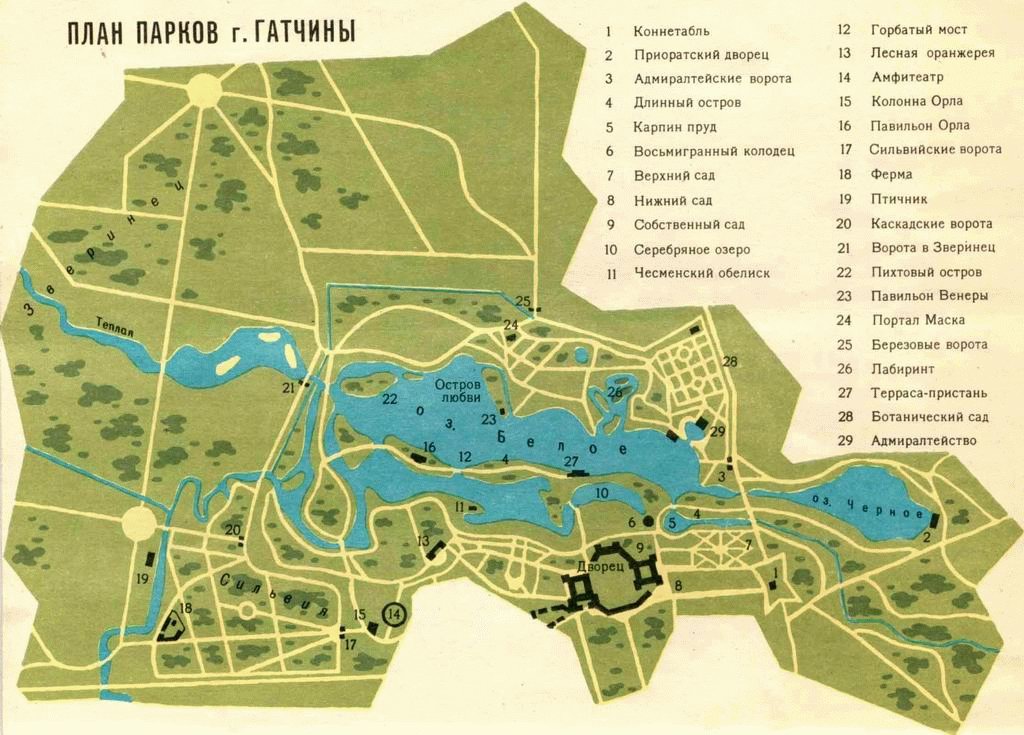
One of the main attractions of the city of Gatchina is the landscape park ensemble, the Palace Park, created at the end of the 18th century. It is the oldest of the Gatchina park complex, covering an area of 143 hectares. It is located in the central part of the city. It borders closely on urban developments to the west and east. To the south, the boundary separates the Palace Park from the Priory Park; to the north, it borders the Menagerie; to the northwest lies the regular Sylvia Park, whose territory used to be part of the Palace Park. The main structure of the park ensemble is the Grand Gatchina Palace, located in its southwestern part.
Imperial Parks of Tsarskoye Selo - Catherine Park

Imperial Parks of Tsarskoye Selo - Catherine Park

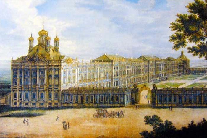
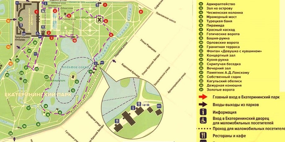
Yekaterininsky Park is a park that is part of the State Museum-Reserve "Tsarskoye Selo." It is located in the town of Pushkin near Saint Petersburg and is an architectural monument of the 18th–19th centuries. Together with Alexander Park, it forms an integral part of the Tsarskoye Selo Imperial Residence and is named after the Catherine Palace located within it. Yekaterininsky Park consists of two parts: the formal Old Garden and the landscape-style English Park. Sources: https://www.tzar.ru/objects/ekaterininskypark https://pushkin.spb.ru/encycl/parks/ekaterinenskii-park.html

Imperial Parks of Tsarskoye Selo: Alexander Park

Imperial Parks of Tsarskoye Selo: Alexander Park

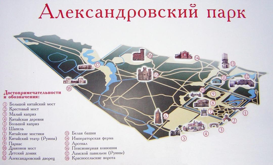
At the very beginning of the 18th century, on the site of Alexander Park, there was a square plot of forest enclosed by a stone wall, intended for imperial hunting. It was called the Menagerie, and Catherine I also enjoyed hunting here. Wild animals lived here – foxes, hares, wild boars. Later, during the reign of Elizabeth Petrovna, the park was landscaped and divided into four equal square sections, similar to formal French gardens. During the reign of Catherine the Great, new territories were added to the park. In 1792, architect Giuseppe Quarenghi began construction of a large palace in Tsarskoye Selo, later named the Alexander Palace. In the 1810s–1820s, the Menagerie, having lost its hunting purpose by that time, was transformed into an extensive landscape park. Here were located a small royal farm, pavilions for llamas and elephants, the building of the Retired Stables for horses that once served the royal family. Three large structures were also built in the landscape part of the park: Montbijou, intended to house a collection of weapons and military armor and called the Arsenal; an artificial Gothic-style ruin – the Chapel; and the White Tower. The greenhouses of the "Upper Garden" in the landscape part of Alexander Park are the only park greenhouses still existing on the site they occupied at the beginning of the 18th century, though they changed their appearance as a result of reconstructions in the early 19th century. The layout of the complex resembles the French fruit gardens of the Louis XIV era. At the beginning of the 20th century, the northeastern territory of Alexander Park, stretching from the Alexander Palace to the Egyptian Gates, was built up. Here the Fedorovsky Town emerged. Sources: https://www.tzar.ru/objects/alexandrovskypark https://pushkin.spb.ru/encycl/parks/aleksandrovskiy-park.html

Serbia: Life and Tragedy of the First Wave of Russian Emigration - The White Army, the Black Baron

Serbia: Life and Tragedy of the First Wave of Russian Emigration - The White Army, the Black Baron

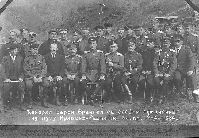
The main center of Russian emigration in Southern Europe became the capital of the young Kingdom of Yugoslavia – Belgrade. Here, during the period between the two world wars, the cultural life of Russian refugees was concentrated. In the early 1920s, a stream of Russian exiles flowed to the Balkans from southern Russia through Constantinople, with between 40,000 and 70,000 people arriving in Yugoslavia. There were several reasons for this mass phenomenon. Russians traditionally enjoyed the love of the people, whom they supported in the struggle for national liberation from centuries-old Turkish rule during the 19th century and later during the First World War – against new conquerors. At the head of the multinational Slavic state formed in 1918 stood the Serbian ruling dynasty of Karađorđević, related by kinship ties to the Romanov house. Assistance to Russian emigrants became an integral part of Yugoslavia’s domestic and foreign policy and was carried out under the slogan of repaying Russia’s historical debt. Yugoslavia, more than half of whose population was of the Orthodox faith (Serbs, Montenegrins, Macedonians), became the most important spiritual center of the Russian diaspora. In 1921, near Belgrade, in Sremski Karlovci, the Russian Orthodox Church Abroad was founded, headed by Metropolitan Anthony (Khrapovitsky) of Kiev and Galicia. Yugoslavia was also the only country that agreed to accept and accommodate parts of the White Army on its territory. The headquarters of the Tsarist army under General Wrangel was located in Belgrade. Besides the military, a modest part of the intelligentsia arrived in the country, as Russian educational documents were recognized here. There was an objective reason for this. Losses in the two Balkan Wars (1912 and 1913) and the First World War were so great that there was a severe shortage of specialists. The opportunity to find work and provide education for children made this country attractive for residence. According to statistics, 75% of Russians living in Yugoslavia in the 1920s–1930s had secondary and higher education. Moreover, the government allocated scholarships for Russian youth. In Serbia, Russians made up 10% of the creative intelligentsia. Russian emigrants taught in schools, gymnasiums, and universities, worked as doctors and engineers, and were involved in road construction. Belgrade became a major Russian publishing center, whose significance grew in the 1930s as Berlin and Prague curtailed their activities under the threat of fascism. The Russian emigration, as the bearer and guardian of a rich cultural tradition, possessed considerable creative potential, one manifestation of which was literary creativity. During the interwar twenty years, many famous Russian writers visited Belgrade, but none settled there for long. The literature of "Russian Belgrade" is notable for being created by youth who matured outside Russia, whose creative individuality awakened and developed far from their homeland, outside the sphere of their native language. Another feature of this literature is that the creative youth of Belgrade mainly expressed themselves in poetry and short genres. It was difficult for them to make their way, as reputable publications, concerned with commercial success, were reluctant to give unknown authors their pages. "Russian Belgrade" as a historical and cultural phenomenon lasted two decades. It possessed significant creative and cultural potential, which was not fully realized due to the historically short period of time. During and after the Second World War, some Russians moved further to Europe and America, while others assimilated. However, during these years, Russians made a substantial contribution to the culture of Yugoslavia.
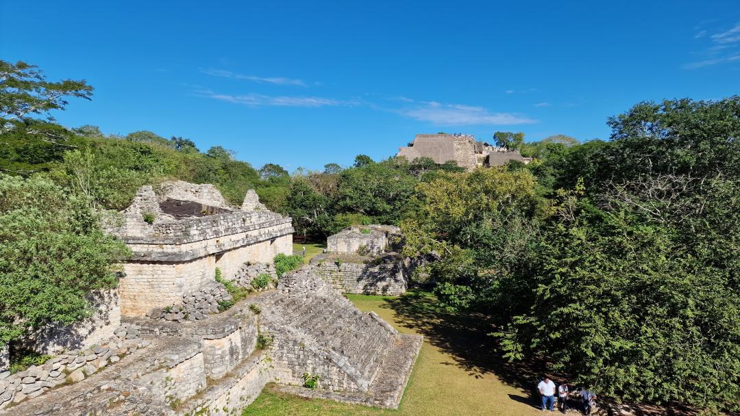
Maya Cities of Mexico - Chichen Itza

Maya Cities of Mexico - Chichen Itza

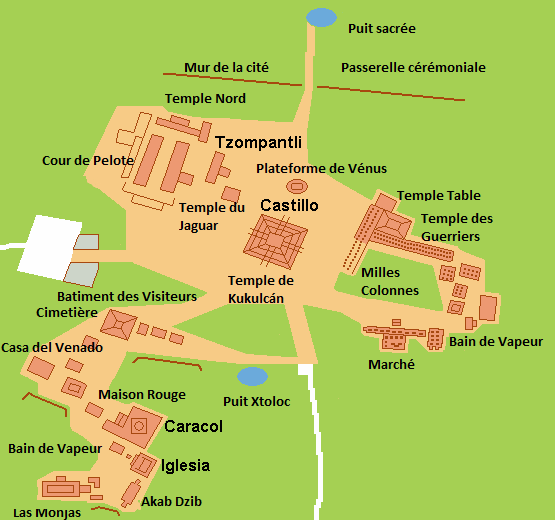
Chichen Itza, a ruined ancient Maya city covering an area of 4 square miles (10 square kilometers) in the south-central state of Yucatan, Mexico. It is believed to have been a religious, military, political, and commercial center, with a population of 35,000 at its peak. Settlers first appeared at this site in 550 AD, likely attracted by easy access to water through caves and sinkholes in the limestone formations known as cenotes. Most of the city's structures were completed in the early Postclassic period (around 900-1200 AD). In the late Postclassic period (around 1200-1540 AD), Chichen Itza was apparently defeated by the forces of the city of Mayapan and for a time united with Uxmal and Mayapan in a political confederation known as the League of Mayapan. Around 1450, the League and Mayapan’s political dominance collapsed. When the Spanish invaded the region in the 16th century, the Maya lived in many small towns, but large cities, including Chichen Itza, were largely abandoned. Long covered by jungle, Chichen Itza remained sacred to the Maya. Excavations began in the 19th century, and the site became one of Mexico’s major archaeological zones. A legendary tradition at Chichen Itza was the cult of the cenote, involving human sacrifices to the rain god Chaac, during which victims were thrown into the main city cenote (at the northernmost part of the ruins) along with gold and jade ornaments and other valuables. In 1904, Edward Herbert Thompson, an American who purchased the entire site, began dredging the cenote; his discovery of skeletons and sacrificial items confirmed the legend.
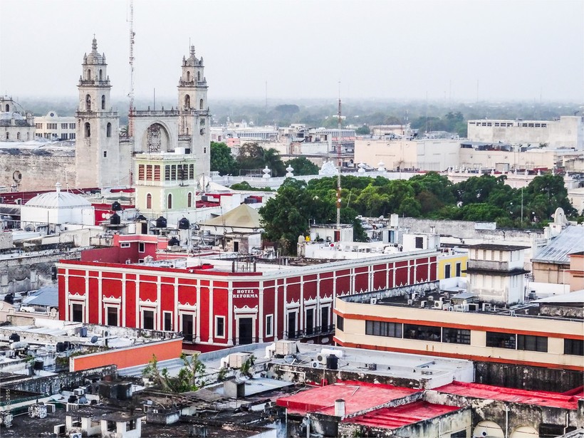
Colonial Cities of Mexico - Merida

Colonial Cities of Mexico - Merida

The city was founded on January 6, 1542, on the ruins of the ancient Maya city of T'ho. The stones from the ruins served as building material for the Spanish colonizers led by Francisco de Montejo and León. The ruins reminded the colonizers of the preserved Roman fortresses in the Spanish city of Mérida, and the new settlement was named in its honor. Mérida became the very first city in Yucatán built by Spanish colonizers, and the other cities were established following its example. It is an old city with its own traditions, featuring the architecture of Spanish colonists and Europeans, with narrow streets and shady parks.

UNESCO Cities of Mexico: San Miguel de Allende

UNESCO Cities of Mexico: San Miguel de Allende

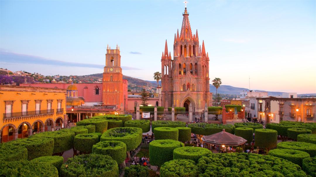
San Miguel de Allende is a colonial city in the state of Guanajuato in the Bajío mountains of central Mexico, approximately 270 km northwest of Mexico City. It is a Spanish colonial city with a population of 72,000 people (2020). It is a cultural heritage site protected by the Mexican government. In 2008, it was listed as a UNESCO World Heritage Site. Founded as "San Miguel el Grande" in 1542 by the Franciscan monk Juan de San Miguel, it became a center of the war for Mexico's independence from Spain. After the war, in 1826, San Miguel was granted city status and renamed San Miguel de Allende in honor of Ignacio Allende, a hero of the independence movement, the "first Mexican soldier," and a native of the city. Threatened with becoming a ghost town in the early 20th century, the city was declared a national monument in 1926. Construction in the historic city center was strictly limited, allowing the city to preserve its colorful local facades, which have served as the backdrop for many famous works of art and even modern films. In the 1950s, a number of artist colonies were established in San Miguel, including the famous Allende Institute, and many American former soldiers moved their families here after World War II, either as members of one of the colonies or to escape polio, which was rampant in many U.S. cities. This population, combined with wealthy Mexicans (especially actors and politicians) who rediscovered San Miguel as a retreat reminiscent of Malibu, away from Mexico City, created an eclectic mix of Mexican Old World charm, American hospitality, and a party atmosphere, making San Miguel a world-class place to live and vacation.

Magical Towns of Mexico (Pueblo Mágico) - Valladolid

Magical Towns of Mexico (Pueblo Mágico) - Valladolid

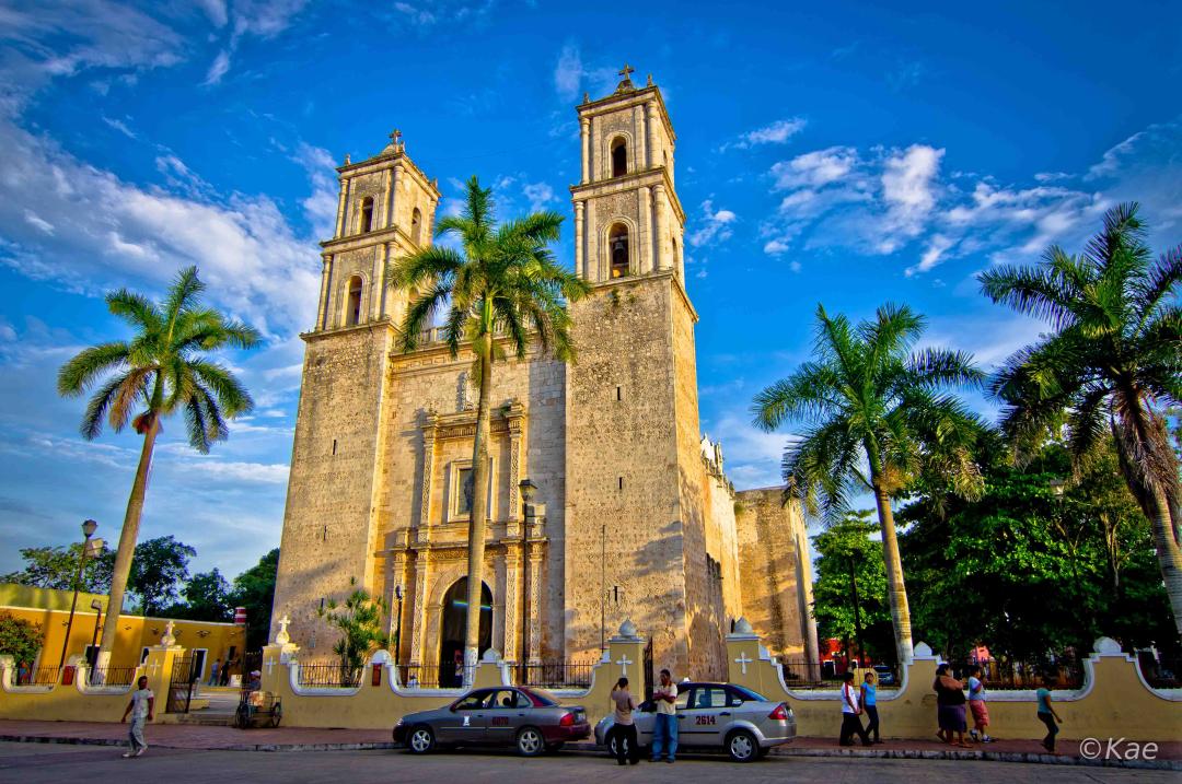
The city was named after the Spanish city of Valladolid, which was the capital at the time. It was founded on May 28, 1543, by Francisco de Montejo, nephew and namesake of the famous Spanish conquistador Francisco de Montejo, with the purpose of establishing Spanish settlers in an area controlled by one of the Maya tribes — the Cupul. The original location of the city was on the site of the settlement Chauac Há, belonging to the Maya Chikinchel tribe, near the coast. Early Spanish settlers complained about an excess of mosquitoes spreading yellow fever and petitioned to move the settlement further inland on the peninsula. On March 24, 1545, Valladolid was relocated to its current location and built on the site of the capital of the Maya Cupul tribe, called Zací, which in the Maya language means "white hawk." The ancient stone structures of the city were dismantled to build houses for the settlers in the Spanish colonial style. The following year, the Maya revolted, but their uprising was suppressed with the help of Spanish troops arriving from Mérida. Subsequently, Valladolid continued to be a center for the development of Spanish colonialism in the eastern part of the Yucatán Peninsula. Now, Valladolid, one of the oldest cities on the peninsula and currently one of the two Magical Towns of Yucatán, enchants in every sense of the word. Its paradoxically quiet yet lively streets are home to historic neighborhoods, houses, museums, cozy small hotels, markets, fountains, shops, ice cream and snack kiosks, parks, and many corners worth visiting. As if that were not enough, the privileged location of this charming town earned it the title "capital of the eastern Maya." Valladolid is situated right in the center, equidistant from the two largest cities on the Yucatán Peninsula, Mérida and Cancún, which are about 160 kilometers apart. Additionally, nearby are the main archaeological wonders of the region: Chichén Itzá, just 45 kilometers away; Tulum, 100 kilometers; Ek’ Balam, 30 kilometers; and Cobá, 35 kilometers.

Secrets of Palace Coups - Ioann III (VI) Antonovich

Secrets of Palace Coups - Ioann III (VI) Antonovich

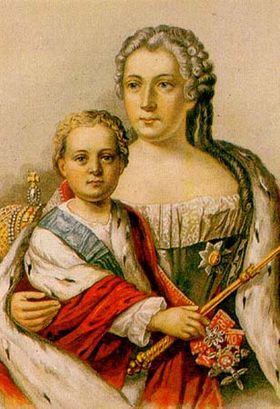
Ivan VI (Ioann Antonovich) (12 (23) August 1740 – 5 (16) July 1764) was a Russian emperor from the House of Welf who reigned from October 1740 to November 1741, and was the great-grandson of Ivan V. Formally, he ruled during the first year of his life under the regency first of Biron, and then of his own mother Anna Leopoldovna. The infant emperor was overthrown by Elizabeth Petrovna, spent his entire life imprisoned in jails and solitary cells, and was killed at the age of 24 during an attempted escape. In official contemporary sources, he is referred to as Ioann III, counting from the first Russian tsar Ivan the Terrible; in later historiography, the tradition was established to call him Ivan (Ioann) VI, counting from Ivan I Kalita.

St. Petersburg of Fyodor Dostoevsky

St. Petersburg of Fyodor Dostoevsky

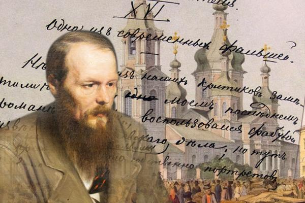
For Dostoevsky, Petersburg is "the most deliberate and abstract city in the world." Through the voices of his characters, Dostoevsky conveys his own attitude toward it: "...the extreme misfortune of living in Petersburg," "...this is a city of half-madmen... Rarely anywhere else can one find so many gloomy, harsh, and strange influences on the human soul as in Petersburg..." And yet Dostoevsky loved Petersburg very much. It is the city of his youth, his birth as a writer, his dizzying successes, tragic experiences, and losses. He needs it for his creativity: often Petersburg becomes the source of his inspiration. When leaving it, Dostoevsky always strives to return; upon returning, he feels burdened by it.

ABBA’s Stockholm

ABBA’s Stockholm

ABBA was - and still is - a truly unique phenomenon in music history. Their success has crossed all borders, while the band itself remained surprisingly local. Their lives and work have been inseparable from Sweden and its capital. Stockholm was constantly used as a backdrop for ABBA’s record covers, music videos and photo-shoots. This collection reveals some of the many places in the city that are connected to the stories of Agnetha, Björn, Benny and Anni-Frid (Frida). Must see for ABBA fans! Sources: https://www.cntraveller.com/gallery/abba-guide-to-sweden https://www.orbzii.com/guides-tips/ABBA-guide-to-Stockholm/ http://www.raffem.com/ABBARelatedPrivatandPlaces.htm https://www.soundonsound.com/music-business/atlantis-studios-stockholm Wikipedia Picture: Free to use under the Pixabay license

Maya Cities of Mexico: Coba

Maya Cities of Mexico: Coba

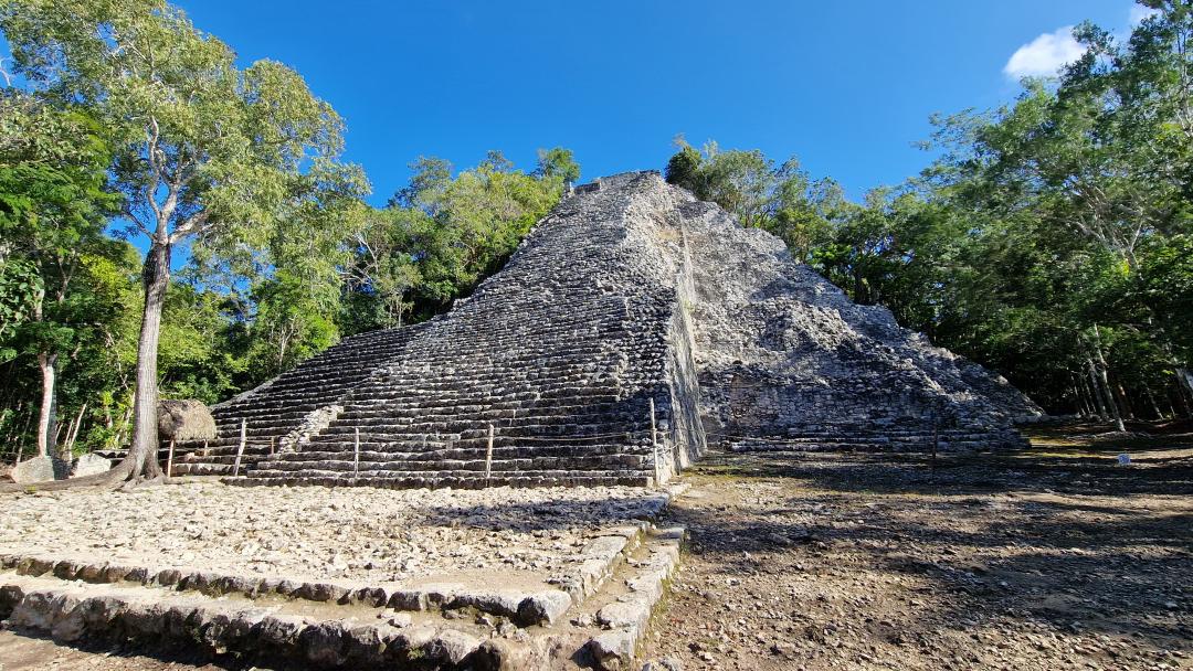
Koba is the oldest center of the Maya civilization, full of its secrets and mysteries, conveniently located 44 kilometers northwest of the coastal Maya city of Tulum. The Maya city of Koba is primarily famous for being situated at the intersection of the "sacbe" road network, which connected Maya kingdoms in the region. Among the city’s ruins, most of which are still hidden beneath the dense jungle canopy, many carved stelae have been discovered, narrating the history of the city and its rulers. The most famous monumental structure in Koba is the Nohoch Mul pyramid, standing 42 meters tall. Koba was founded between 50 BCE and 100 CE. All constructions from this period were made of wood, so archaeological finds include only remnants of clay pottery. After 100 CE, the city experienced rapid development, eventually becoming one of the most important political and religious centers of the Maya civilization in the northern Yucatán Peninsula. Between 200 and 600 CE, much of the Yucatán Peninsula was under Koba’s influence. The ruling dynasty controlled vast areas of cultivated land, managed the road network on the peninsula, and—most importantly for Maya cities—maintained control over freshwater supplies. Koba maintained close contacts with other major Maya cities such as Tikal in Guatemala and Calakmul in Mexico. The powerful Teotihuacan culture had a significant influence on Koba’s civilization. Koba was a major cultural and religious center of antiquity, holding enormous social and political significance. At its peak, the city covered an area of 50 square kilometers. The extensive network of ancient Maya roads, called sacbe, in Koba remains a mystery to this day. There are more than forty such roads, some stretching over a hundred kilometers. The rise of the Puuc culture cities and the founding of Chichen Itza weakened Koba’s influence in the region. For a century—from 900 to 1000 CE—Koba and Chichen Itza competed for hegemonic status in the area. After 1000 CE, Koba lost its political influence but retained its position as an important Maya religious center. Monumental construction continued until 1500. After that, nothing is known about the city’s history. Spanish conquerors who arrived in Koba in 1550 found the city abandoned. The rest remains buried under the lush jungle growth. The great city was abandoned, but its vast road network, tall structures, and large area show that it was one of the most important centers of the Maya civilization. At its height, it may have been home to around 50,000 people. Today, exploring its ruins and climbing one of the tallest pyramids in Yucatán leaves a vivid impression of touching antiquity.

Maya Cities of Mexico: Ek Balam

Maya Cities of Mexico: Ek Balam

The Maya founded a settlement in this place as early as the 3rd century BCE. Its area was 12 square kilometers. Later it became known as "Ek Balam," which translates to "Black Jaguar." The city was a well-fortified defensive center, as evidenced by the walls built in several rows. Today, more than 45 preserved architectural structures can be seen scattered throughout the ancient city's territory. It is believed that the name Ek Balam was given to the city in honor of one of its great kings named Ek Balam or Kok K'el Balam. According to the Maya creation legend, the Black Jaguar was the Ruler of the Underworld, a symbol of the night sun and darkness. The most noble Maya kings were considered his descendants. Overall, information about the civilization that once existed in Ek Balam is quite scarce. There are later texts suggesting that it was once part of a kingdom called Talol, founded by a man named Koch Kal Balam from the east, and later controlled by the aristocratic Kupul family. However, this is the only text in which Ek Balam is mentioned at all.
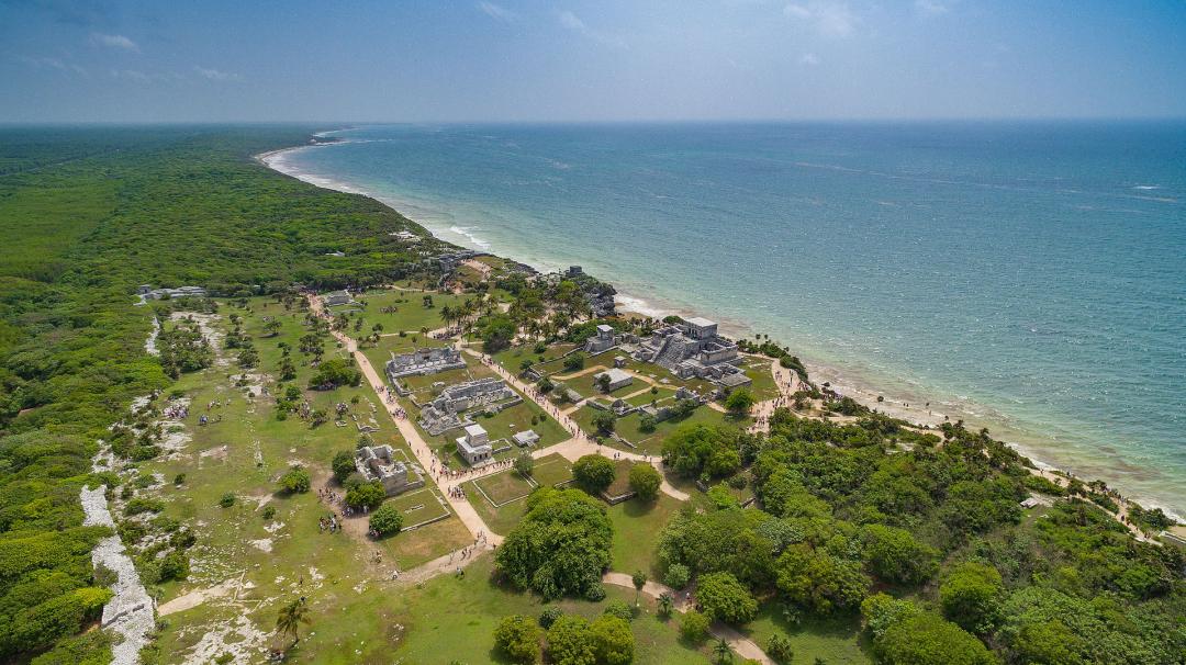
Mayan Cities of Mexico: Tulum

Mayan Cities of Mexico: Tulum

The greatest attraction of Tulum is the combination of majestic ruins with the stunning shades of the Caribbean Sea. This incredible Maya port city is small but impressive, located on a small cliff 15 meters above sea level, bordered by the turquoise-blue waters of the Caribbean Sea. Among the ruins of Tulum is one of the most beautiful beaches of the Riviera Maya. Originally called Zama, meaning dawn or sunrise in the Maya language, it was an important crossroads for trade by land and sea. The buildings currently visible in Tulum almost entirely belong to the last pre-Spanish period of Maya occupation of the peninsula: the Late Postclassic period from 1200 to 1550 AD. However, the presence and analysis of some structures using carbon-14 clearly date to earlier periods, such as Stela 1 and Structure 59, which contain some stylistic elements of the Classic period, indicating that the settlement may have originated in the Early Classic period, between 400 and 600 AD. Little is known about the first settlers in this area; however, based on archaeological evidence from ceramics, the first settlement can be dated to around 300 AD.
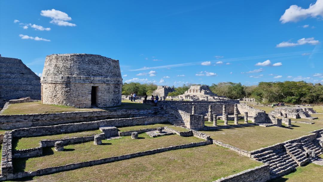
Maya Cities of Mexico: Mayapán

Maya Cities of Mexico: Mayapán

Mayapán is an ancient Maya city in the Mexican state of Yucatán in Central America, located 40 km southeast of Mérida. The full ancient names of the city, Ichpaa Mayapan and Tankah Mayapan, are bilingual Maya-Nahuatl constructions (literally "Inside the fortress of Mayapán" and "In the center of the city of Mayapán"). The etymology "Maya banner," found in Diego de Landa, is incorrect; in reality, Mayapan (literally "In the [place] of the Maya") is a common Nahuatl toponym ending in -pan.
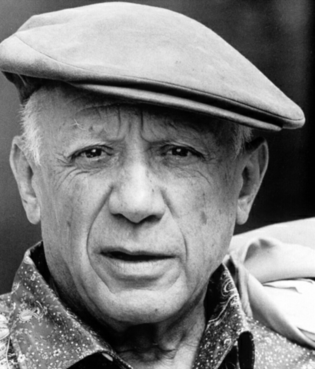
Picasso walk in Malaga

Picasso walk in Malaga

Malaga is the city where Pablo Picasso was born and spent his early childhood. The atmosphere and daily life of those years inspired some of the recurring themes in his paintings, such as flamenco, pigeons and bulls. Take this walk along the streets of Malaga to see the places connected to the life and work of the great Spanish artist! Sources: https://www.spain.info/es/, https://visita.malaga.eu, https://www.visitcostadelsol.com/, Wikipedia, https://www.museopicassomalaga.org/ Photo: Pablo Picasso 1962, Public Domain, http://www.magicasruinas.com.ar/revistero/internacional/pintura-pablo-picasso.htm

Maya Cities of Mexico: Coba (Kabah)

Maya Cities of Mexico: Coba (Kabah)

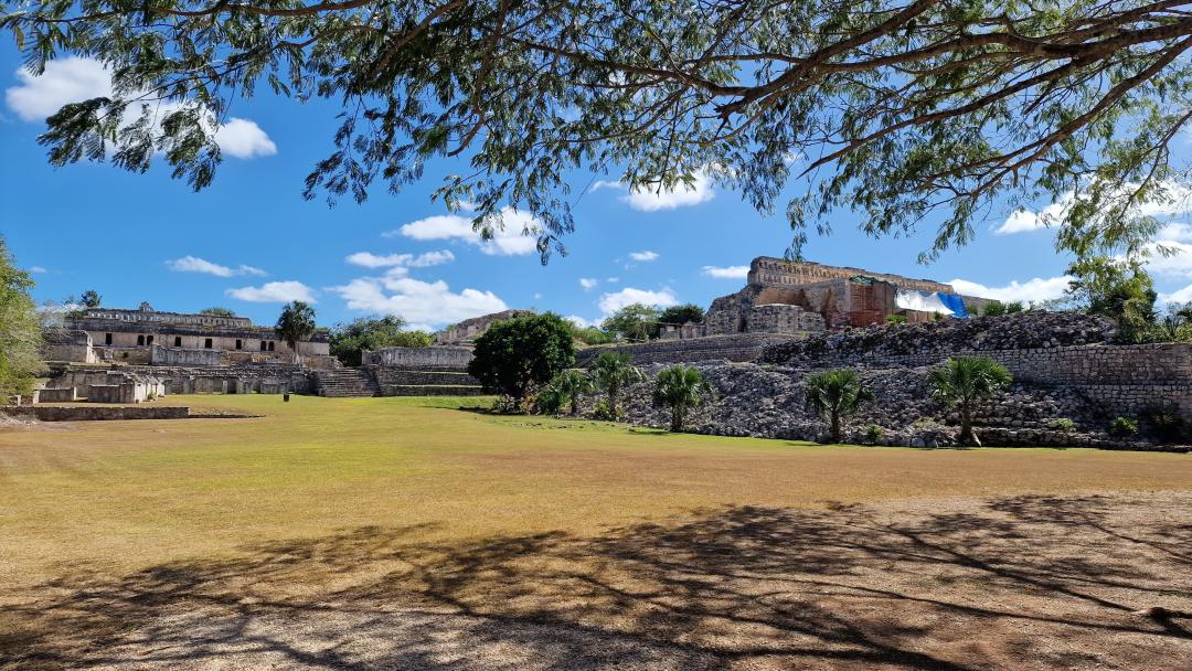
Kabah is an archaeological site of the Maya civilization located in the southeastern part of the Mexican state of Yucatán. It lies south of Uxmal and is connected to this city by a huge 18-kilometer paved pedestrian road, 5 meters wide, with monumental arches at each end. Kabah is the second largest ruins in the Puuc region after Uxmal. The name "Kabah" or "Kabaah" is believed to mean "strong hand" in the archaic Maya language. This is a pre-Columbian name of the area, mentioned in Maya chronicles. Another name is Kabahaucan, or "royal snake in the hand."
Magical Towns of Mexico (Pueblo Mágico) - Izamal

Magical Towns of Mexico (Pueblo Mágico) - Izamal

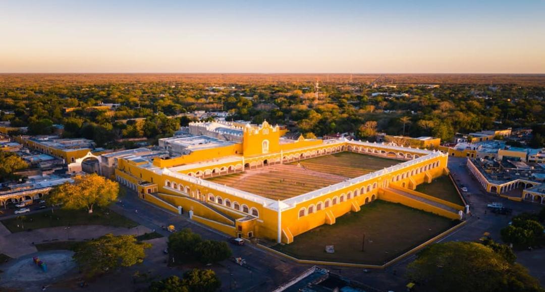
Izamal – a city included in the list of magical cities of Mexico (Pueblo Magico), located in the very heart of the state of Yucatán. Izamal is filled with legends and tales; they pass like shadows and whispers through all the streets of this unusual place. A huge monastery rises right in the center, its walls built from the stones of the Pyramid of the Sun. To this day, the local residents worship the sun, which is why all the houses in the city are painted bright yellow. Izamal is also known as the City of Three Cultures due to the fusion of Maya, Spanish, and modern influences. This small town with its exquisite architecture and cobblestone streets. Its name comes from the name of the Maya priest Itzamna or Zamna, which means “splashes falling from the sky,” one of the names of the Maya god of wisdom, who was considered the teacher and mentor of the ancient inhabitants of this land. Wandering among the mysterious structures, it feels like being on the set of a historical film, before you an impossible combination for the Catholic world – cathedrals and pagan pyramids. This is the city of Bishop Diego de Landa, who did everything to destroy the Maya culture and everything to preserve it. This city is unique not only because five real Maya pyramids proudly stand on its streets. It is extraordinary because it is one of the oldest continuously inhabited cities in America. It was founded by the first Maya at the dawn of their civilization, and people have lived here continuously since those ancient times. Almost all other cities on the continent were abandoned long before the arrival of the Spanish conquerors, but not Izamal. The city was founded between 750–200 BCE, meaning it is about 2,500 years old. It is roughly the same age as Rome.
Maya Cities of Mexico: Uxmal

Maya Cities of Mexico: Uxmal

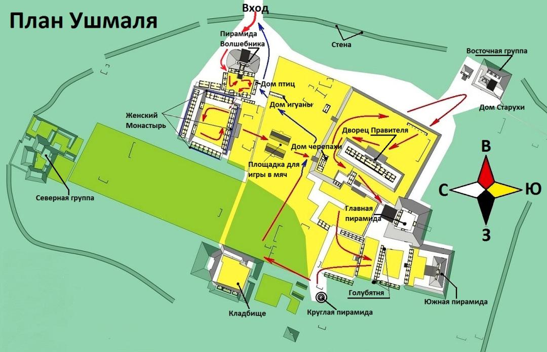
When the sun sets over the jungles of the Yucatán, its fading light falls on the western staircase of the Pyramid of the Magician, just as it has for over a millennium. In pre-Hispanic times, during Maya religious festivals, a priest or ruler could ascend this staircase to pass through the gates into the sacred temple. Watching from the plaza below, commoners saw the leader emerging from this richly decorated doorway as a manifestation of the sun itself. Imagine you were born in the Classic Maya period around the year 900 on the Mexican Yucatán Peninsula. If you were lucky, you might have had the chance to travel to Uxmal. As you entered the city, you would be greeted by a lively, bustling city with a population of about twenty-five thousand people and many more thousands in the surrounding areas. Approaching the city center, giant stone structures would block out the sun as you drew near, towering even above the tallest trees, shattering the limits of what you thought possible. Intricately decorated buildings would convince you that the rulers and priests were truly anointed by the gods.

Constructivism: Originating from the USSR

Constructivism: Originating from the USSR

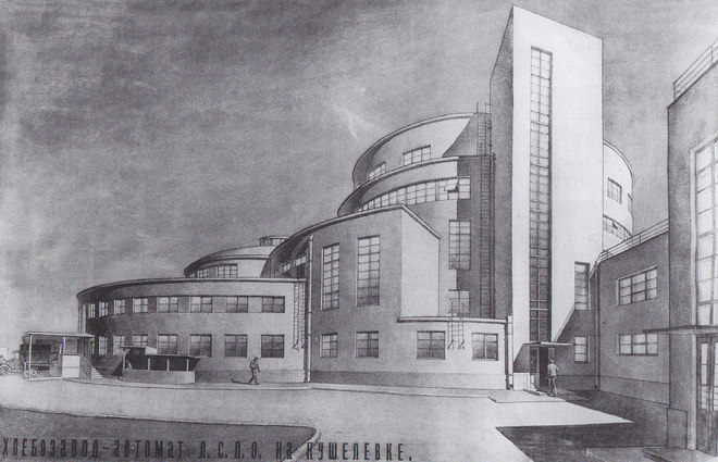
Although Russia and the USSR cannot be called the originators and founders of architectural movements, there is one distinctly pronounced style that manifested most widely during the Soviet era. Of course, this is Constructivism. Constructivism is a new direction in visual arts, architecture, photography, and decorative-applied arts that emerged in the early 1920s in the USSR. This movement is one of the branches of the new avant-garde proletarian art. Quoting Mayakovsky: “For the first time, not from France, but from Russia came the new word in art – Constructivism.” The atmosphere of the 1920s created fertile ground for bold experimentation. The average age of Soviet architects was about 30 years. Constructivism was also developing in Europe, but the Soviet version of the style is interesting because it was ideological, meant to symbolize the new life of the proletariat. Freed from the shackles of the bourgeoisie, the working class now lives in bright apartments, bathes in spacious public baths, spends evenings engaged in amateur activities, or at worst, watches a film in a huge cinema. Although buildings in this style were actively constructed in other working-class outskirts of Petersburg – Nevskaya Zastava, Vyborg Side, on Vasilievsky Island – Narvskaya Zastava nevertheless became the showcase of Leningrad Constructivism.

Russia: Industrial Heritage

Russia: Industrial Heritage

A movement to preserve the traces of the departing industrial era is developing worldwide. Production, alongside religion, philosophy, trade, and social history, is one of the foundations of life. The study and preservation of evidence from the industrial era is a new field within the protection of historical and cultural heritage. There are plenty of reasons to address issues related to the study and preservation of industrial architectural monuments. A vast number of unique technological sites and industrial enterprises, factories are shutting down and being repurposed—how to preserve this heritage?

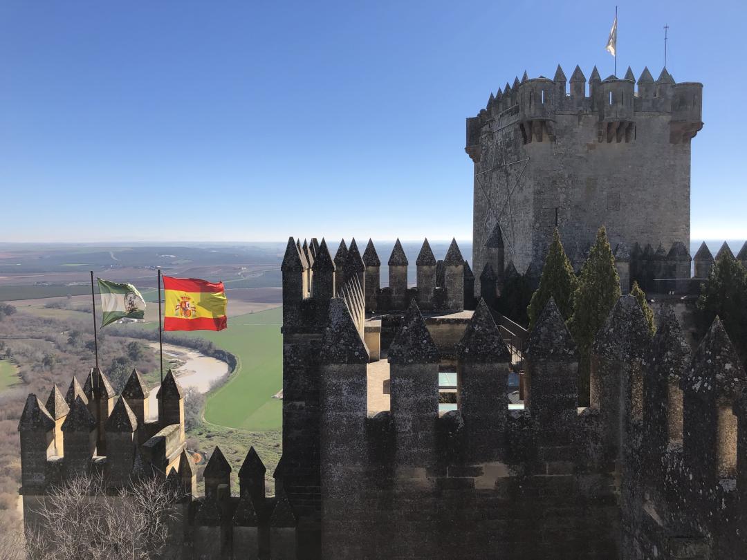
Curiosities of Andalusia

Curiosities of Andalusia

Andalusia has a lot to offer to the curious. Granada’s Alhambra and Mezquita de Cordoba are on top of most travellers’ lists. Look deeper and find some less known places and curious stories behind them!
Kronstadt: History, Legends, and Attractions

Kronstadt: History, Legends, and Attractions

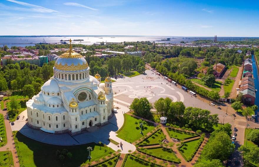
On October 4, 1724, on the way to Kotlin Island, Peter I "made a drawing of the Kotlin fortress," and after lunch on the island, he "outlined the site of the fortress with small trenches." On October 6, a strong wind blew, and the tide flooded the site of the new fortress's foundation. On October 7, despite the rain, the laying ceremony took place: first, there was a prayer service with the blessing of water, during which the fortress was named Kronstadt. After the prayer service, His Excellency himself laid three sods, then Her Majesty the Empress laid three sods. After that, everyone else laid one sod each, and when all were laid, His Excellency cut a corner off, as if to make a bulwark, and cannon fire was fired from Kronshlot; then soldiers and sailors began carrying and laying sod. When they laid it lengthwise to the designated place and eight sods wide, a cellar was laid there by the soldiers and sailors, and the distinguished gentlemen were offered a glass of good Burgundy. On November 3, 1724, Vice Admiral P. I. Sivers was appointed the chief commander of Kronstadt. Under his command, construction of the new fortress began. The fortress plan envisaged the creation of bastions connected by curtains. On the south side of the island, the fortress walls closed onto the walls of the harbors under construction. The western front of the fortress consisted of six bastions named after the regiments that built them: Preobrazhensky, Semyonovsky, Ingermanland, Lefortovsky, Butyrsky, Morskoy, and a moat crossing the entire island and separated from the bay by dams.

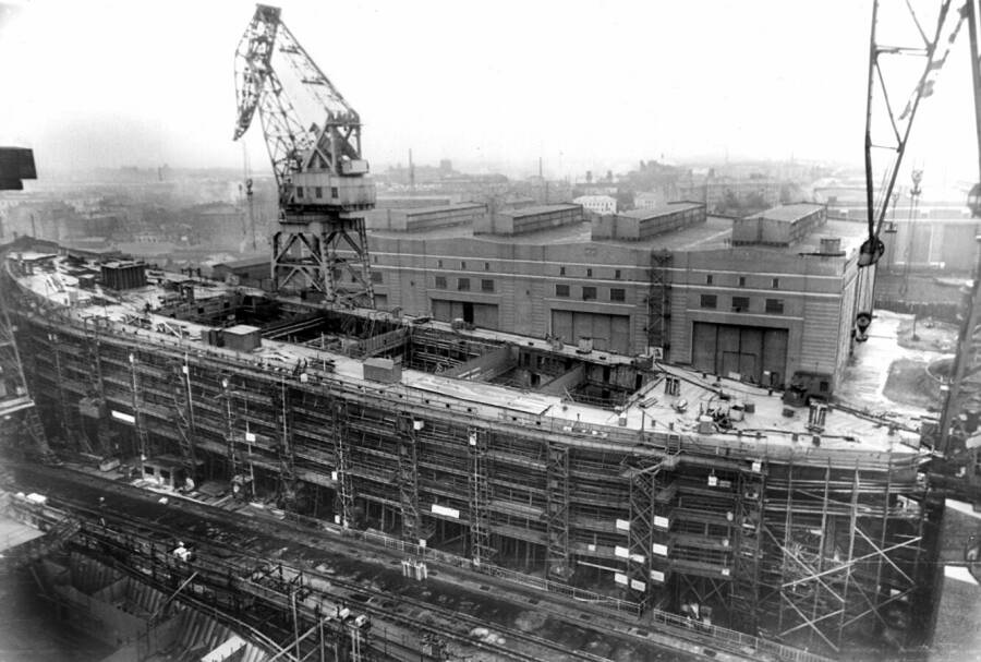
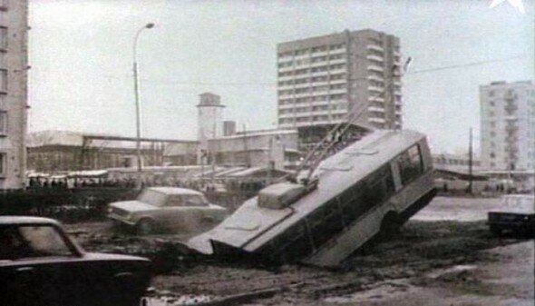
Russia: Accidents and Technogenic Disasters

Russia: Accidents and Technogenic Disasters

Accidents and hazardous natural phenomena, disasters, natural or other calamities that have resulted in human casualties, harm to health or the environment, significant material losses, and disruption of living conditions. These are emergency events of a technological nature, caused by structural, production, technological, or operational reasons, or due to accidental external impacts, involving damage, malfunction, or destruction of technical devices or structures, as well as major industrial or transportation accidents.

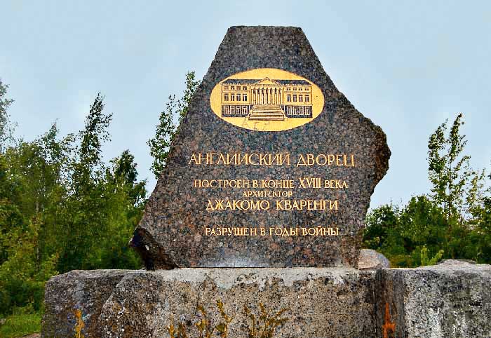
Russia: Lost Monuments

Russia: Lost Monuments

In place of many architectural monuments, only fragments remain that will never regain their former appearance. Which historical buildings will we never be able to see as they once were, and what stands in their place now?
St. Petersburg of Alexander Blok

St. Petersburg of Alexander Blok

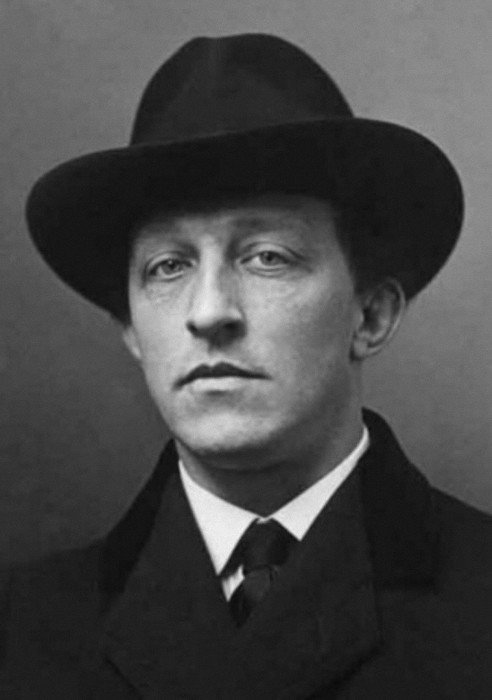
Alexandra Blok was called a genius of Silver Age poetry and a guiding star for aspiring writers. The poet was a favorite among women: gray-eyed, with beautifully curved lips, thick hair, and an expression frozen in thoughtfulness, he could captivate anyone if he wished. However, his calling lay elsewhere. We remember what Alexander Blok was like and take a walk through his addresses in Petersburg.
Industrial Cyprus

Industrial Cyprus

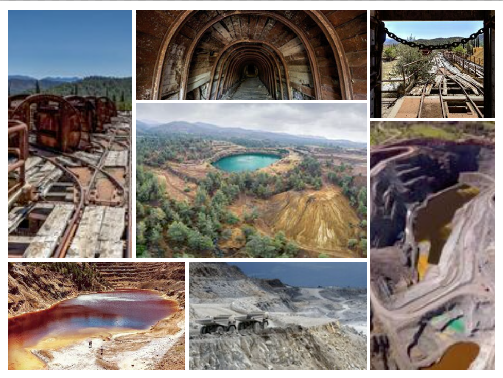
The name, Cyprus, derives from the ancient Greek word for the precious copper deposits that were already being mined and traded as early as 3000 BC.The ancient Cypriots were not only experienced miners but also skillful metallurgists. Since then the mining industry of Cyprus was active in the production of minerals of copper, iron pyrite, gold, chromites as well as asbestos fibers. Since 1979 the mining industry of Cyprus is in recession because of the exhaustion of the known large and rich copper and iron pyrite ore bodies and the increase of the production cost without proportional increase in the international sale prices of metals. Today there are about 25 abandoned sulphite mines around the Troodos Mountain. Some of the mines are partly restored for purposes of access, prevention of the acidic drainages and reduction of the visual disturbance.

Visby medieval wall walk

Visby medieval wall walk

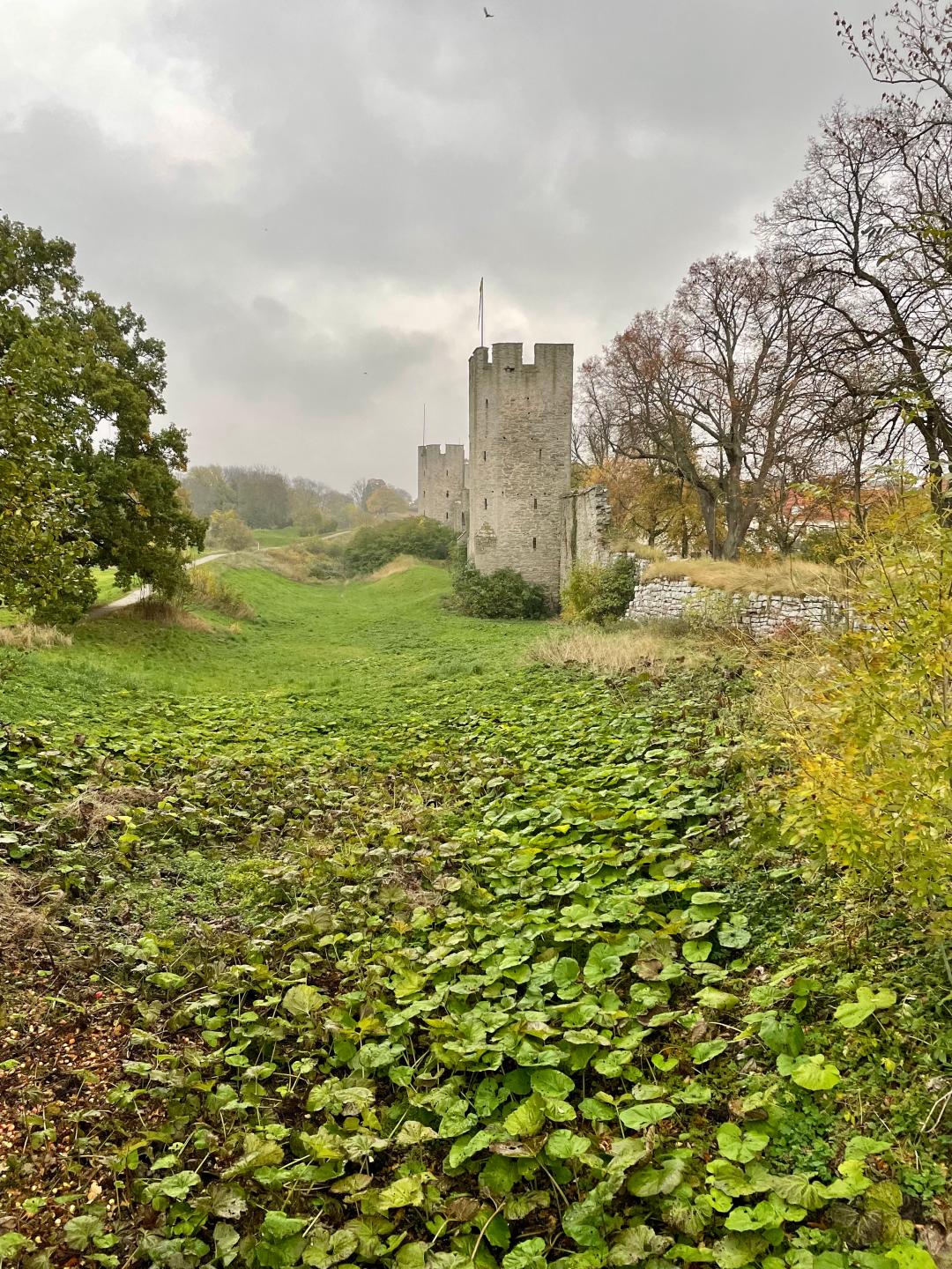
Take a walk back in time along the strongest, most extensive, and best preserved medieval city wall in Scandinavia - Visby City Defense Wall. Approximately 3.44 km of its original 3.6 km still stands. Of the 29 large and 22 smaller towers, 27 large and 9 small remain. This is the most complete guide with 40 stops which will tell you much more than the guidebooks and information boards. The best way is to follow the wall from the outside. We suggest starting from the medieval harbor area and the Sea Wall and walking clockwise. But you can start at any other point. Just bear in mind that there is no wall between the Sail Tower and the Large Beach Gate and you will need to find your way between these two points through the town streets. But do not worry, this can be a pleasant adventure on its own. Sources: Wikipedia, Region Gotland information boards, Riksantikvarieämbetet och kampanjen Rädda Visby Ringmur, https://www.mittvisby.se/